
Mount Sheba to Cowboy Camp: 13.5 km, +300 m, -1150 m, 8 h 50 m
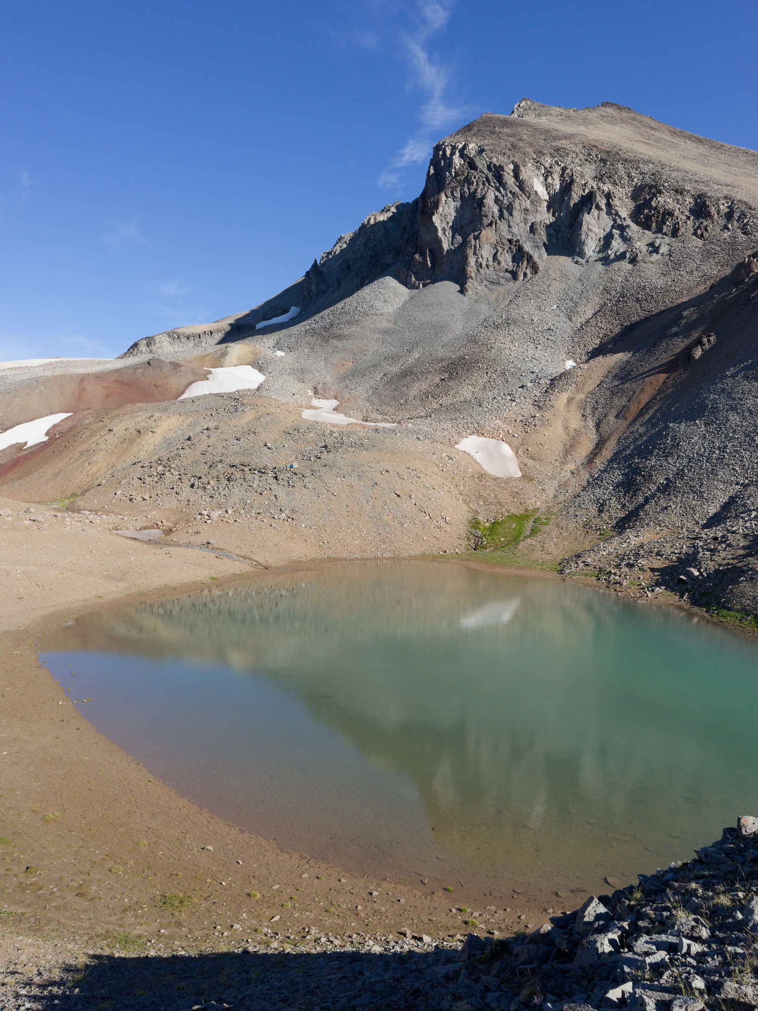
That was a cold night, and certainly cold enough to deter me from venturing out to watch the sunrise. I’m sure it was beautiful judging by the sunny skies that greeted us as we dragged ourselves out into the morning. There was frost on the fly and ice in our water bladders and we were thankful for the warm sunshine. I spent a few minutes exploring the rocky outcrop next to our tents, which offered a nice view of Mount Sheba reflected in the tarn.

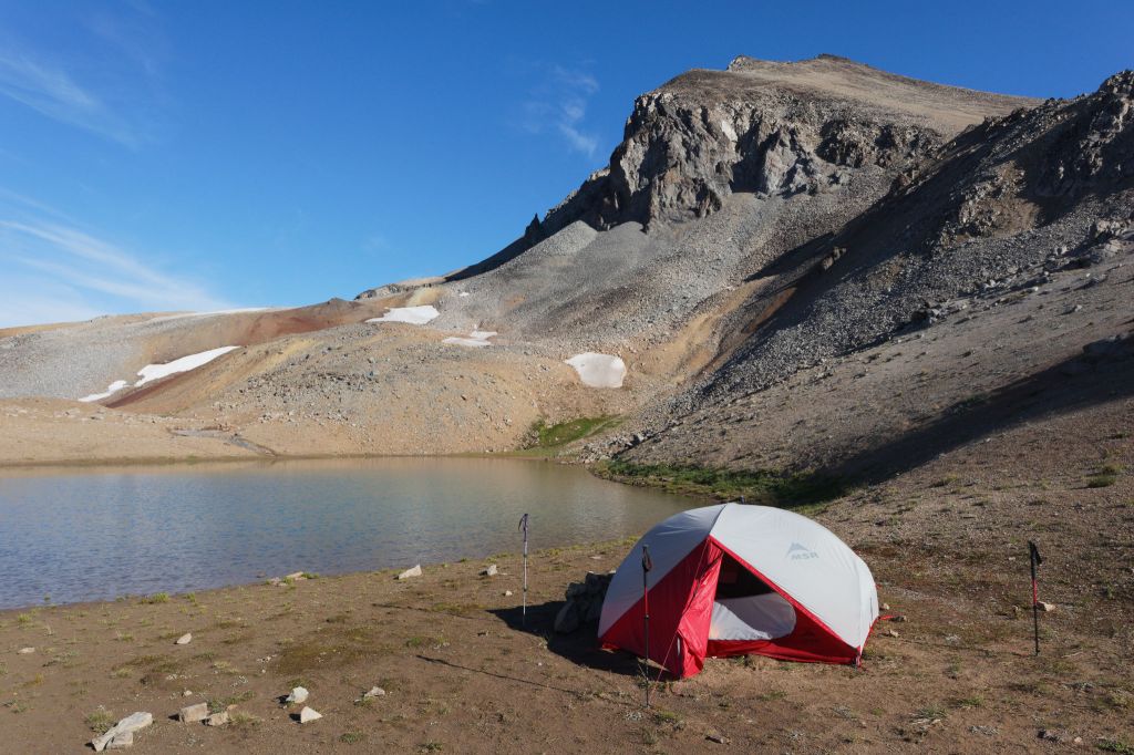

We retrieved our food bags (which had been hung from some protruding rocks) and walked along the edge of the tarn to our dining room from last night, watching a pika scamper over the rocks away from us and hearing a couple more squeak out their morning greetings. Breakfast and terrible coffee were welcome and we savoured our time in the morning sun.
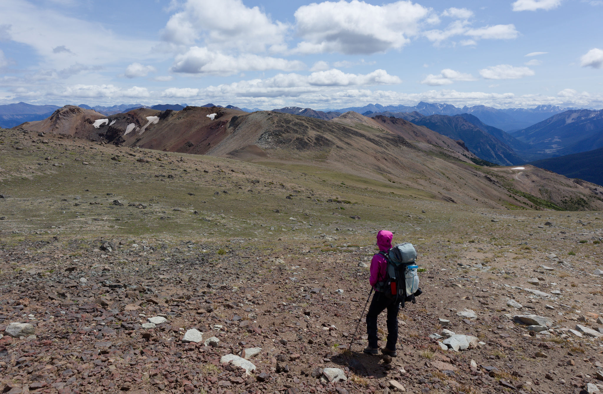
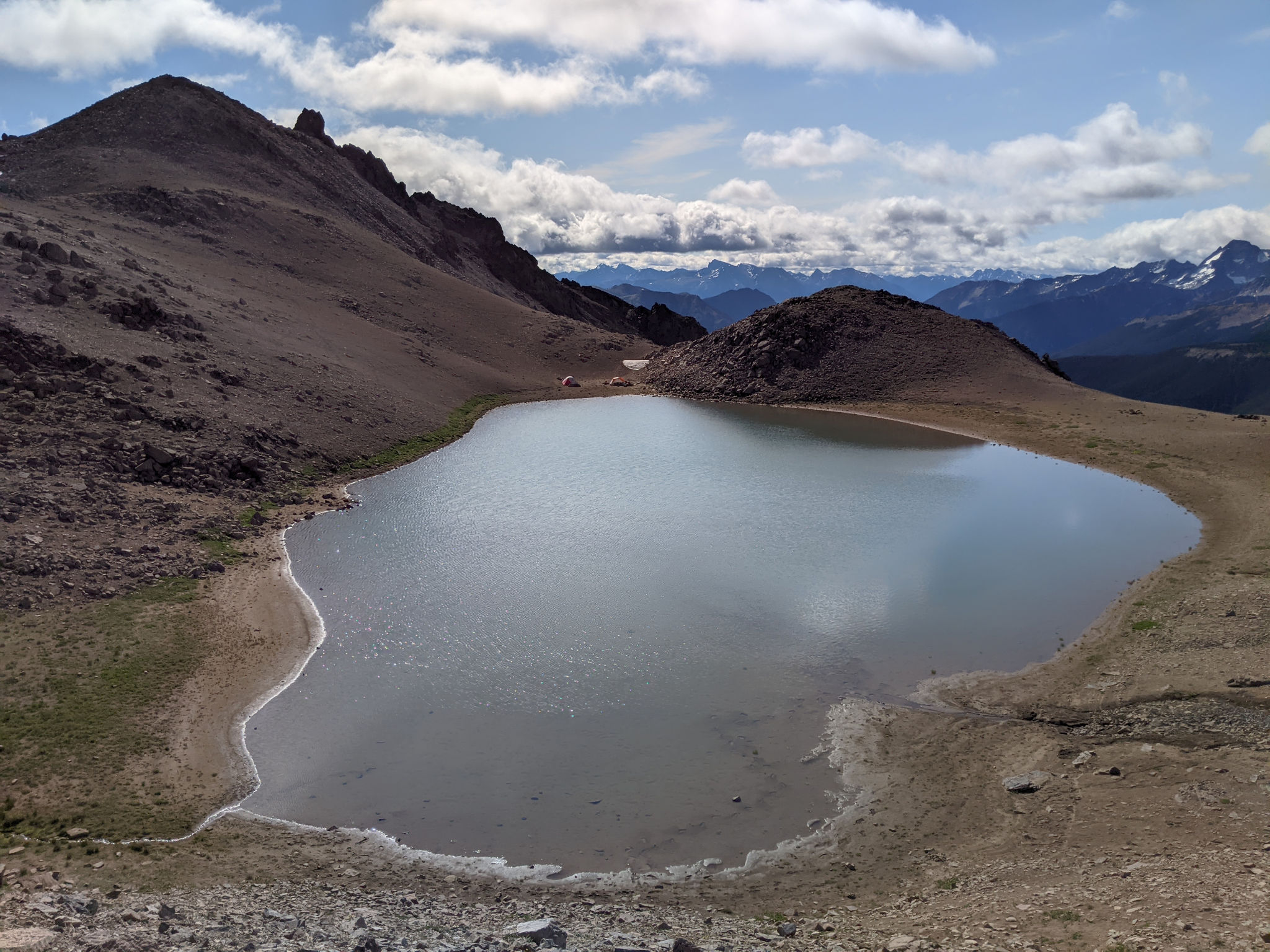
After breakfast we followed Stephen up to his camp spot with its superb view over the tarn. Next time, we’ll camp here if we can. We didn’t seem to be in too much of a hurry to leave and it wasn’t until 11 am that we shouldered our packs and began the day’s adventure. It was a short but stiff climb retracing our steps from yesterday up to the shoulder above the tarn where we stopped for a moment to look over what had been our home for one wonderful night. Reluctantly, we turned our backs and looked with excitement at what lay ahead – another broad, open ridge with uninterrupted views and the promise of more superb hiking.


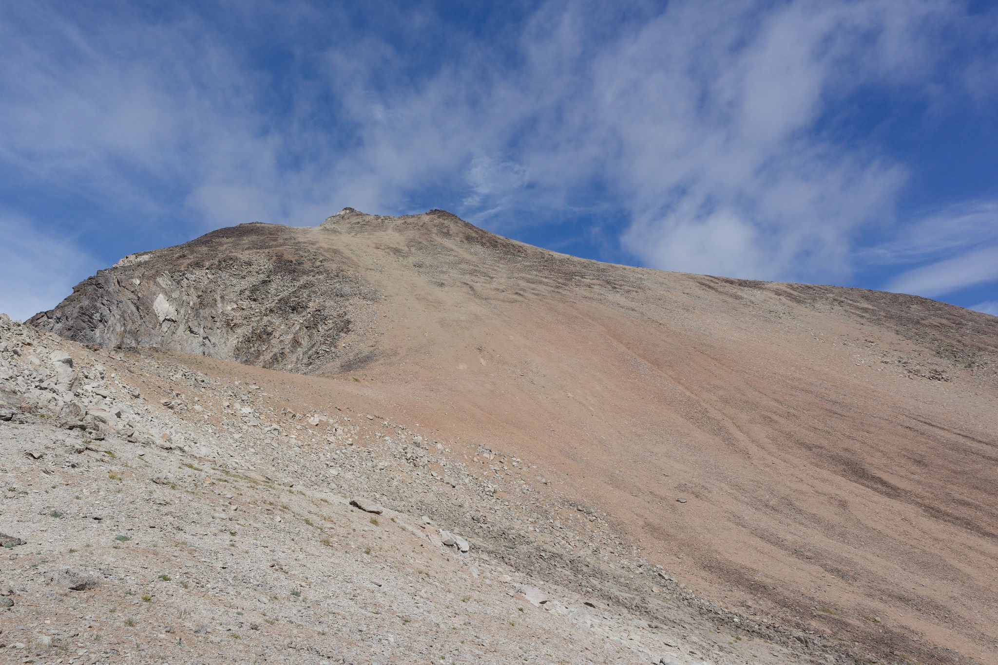
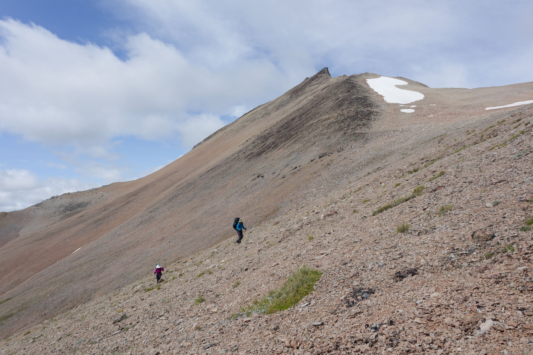
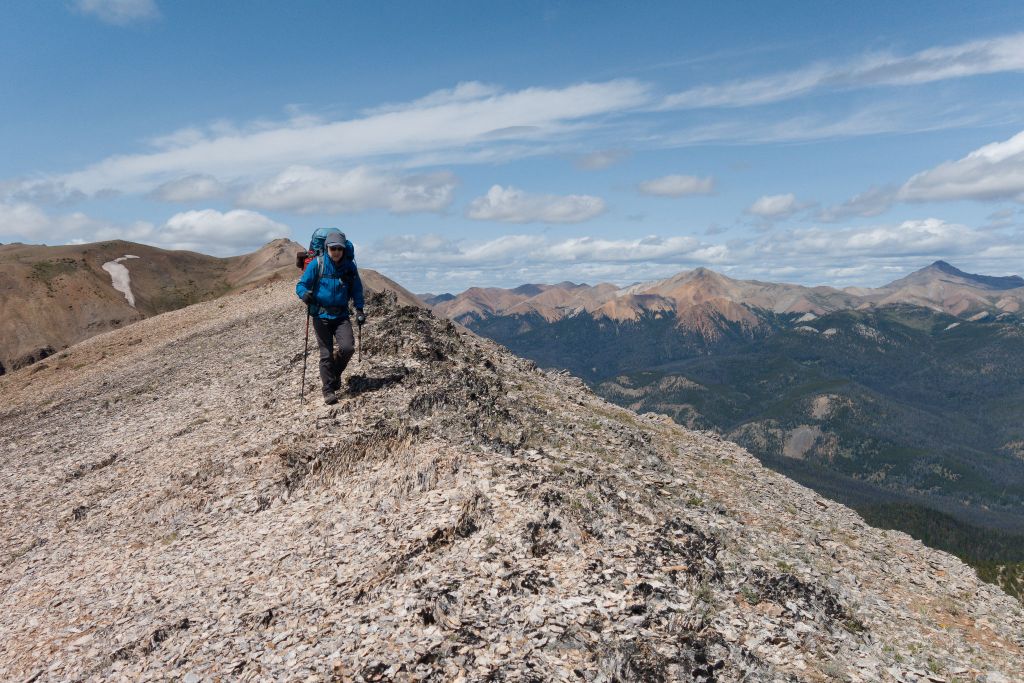
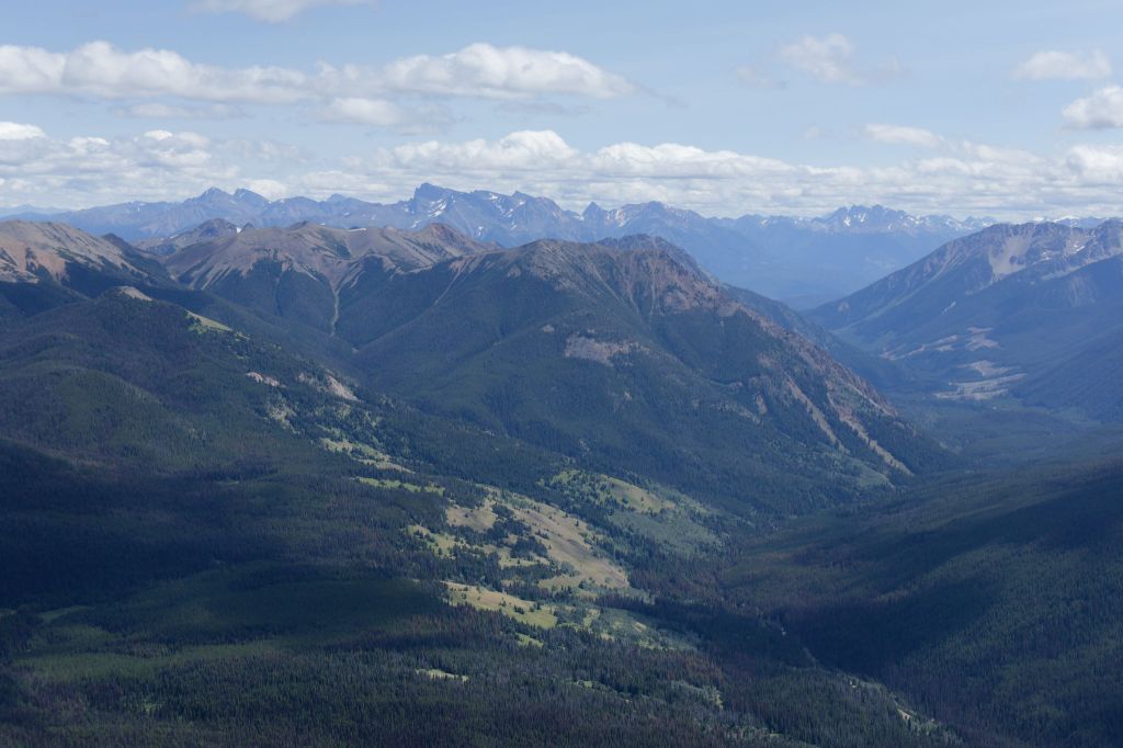
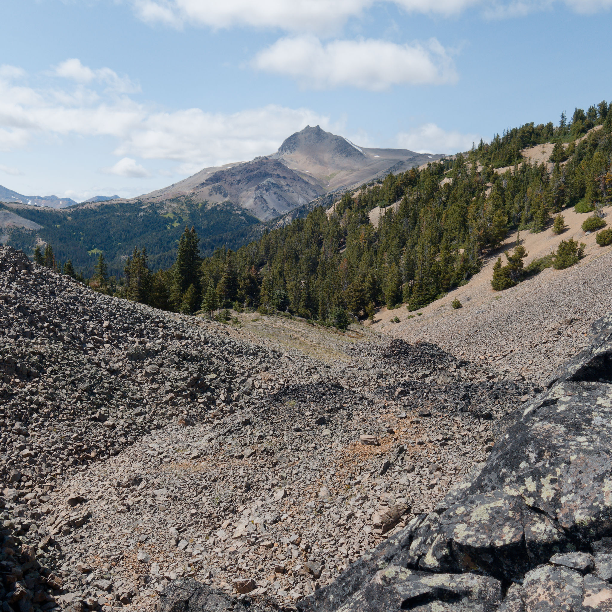
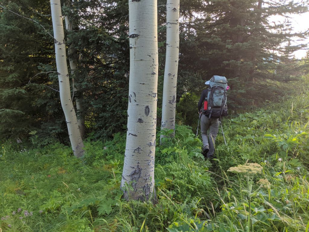
But first, we had to re-cross the scree and talus that we had not enjoyed last night. In the light of day, we could now make out a faint trail stretching out before us over the rocks, although it descended and climbed again which we weren’t keen on doing. Instead, we followed the contour of the land (yes, over those same annoying rocks) as much as possible, then ascended to the high point of the ridge. We were glad to make it onto firmer and more level ground, though with fresher legs this morning the rocks didn’t seem quite so bad. Looking back at Mount Sheba, we were struck once again how intimidating it looks, its wedge-like profile soaring up from the ground, and we marvelled at the fact that we had stood on its summits and hiked straight down the south-facing slope.


Despite its barren appearance, the broad ridge was festooned with life – tiny flowers barely daring to bloom more than a few centimetres from the ground, green mats of vegetation, and tufts of grasses. But it was no wonder that nothing grew tall here: the wind was ferocious, threatening to knock us off our feet and steal our words as we tried to express our wonder at being in this landscape. Like yesterday, the views were phenomenal – I’m running out of words here, send a thesaurus! – and the going was easy, following no path but our own along the dips and bumps on the ridge.


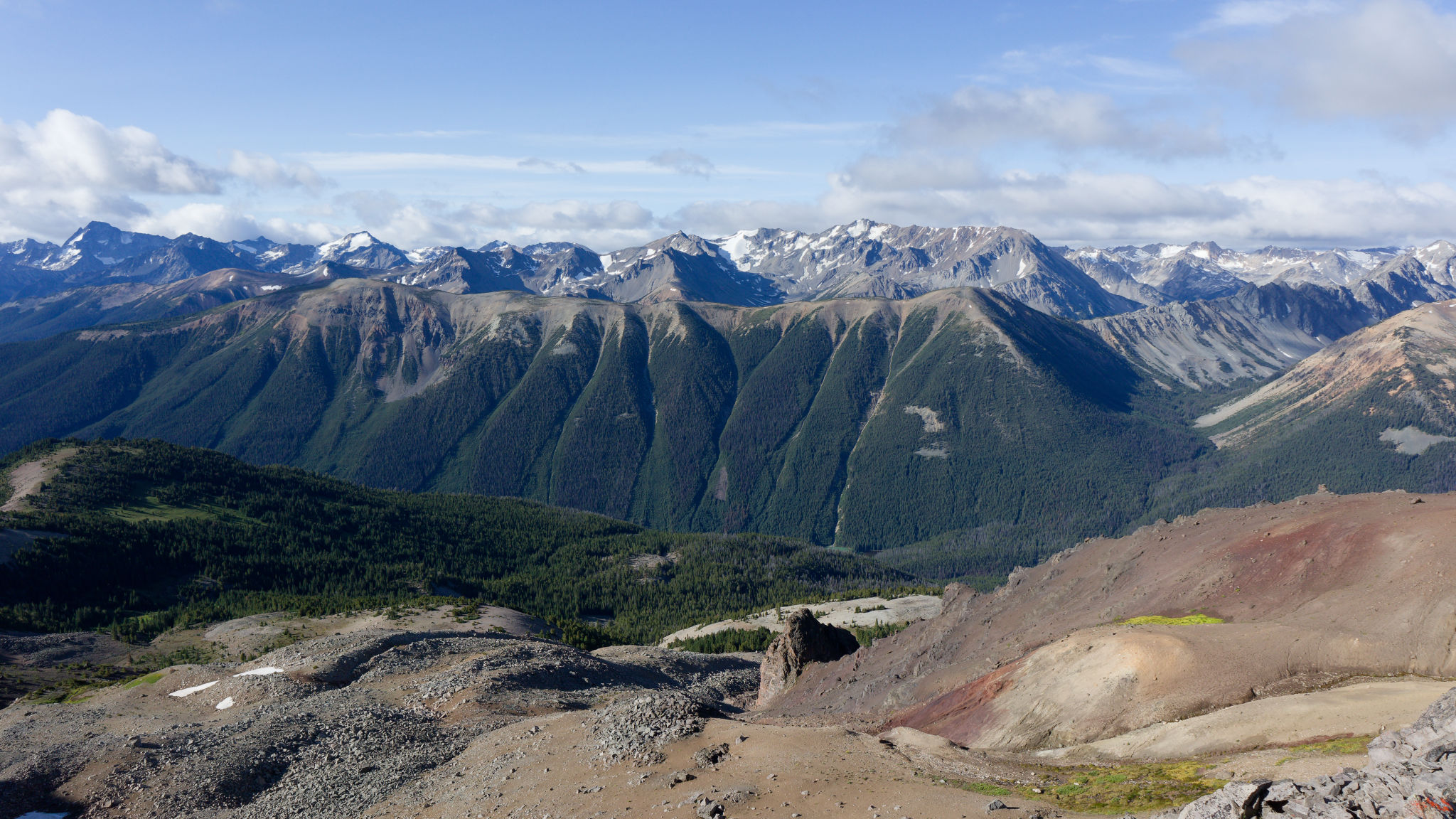
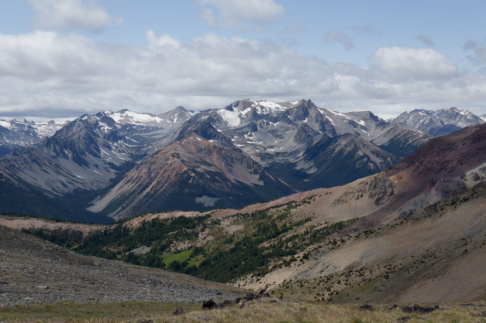
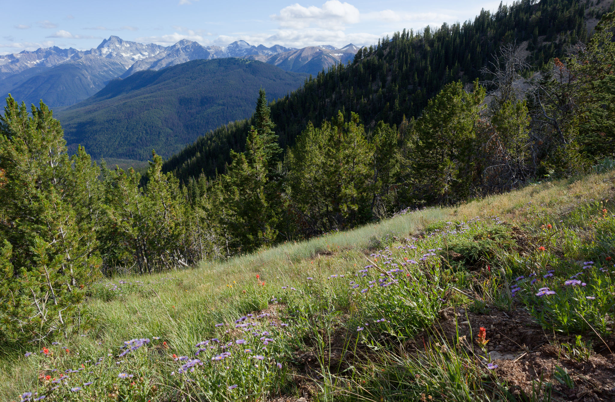
We sought refuge off the north side of the ridge to escape the wind for a few minutes while we devoured a snack, sitting on various pointy rocks to take in the panoramic view of the colourful peaks above Tyaughton Creek. Moving on, we stayed as close to this edge as possible to enjoy the views near and far of mountain peaks and fascinating multi-coloured outcrops of jagged rock. It was worth it, despite the wind. We descended slightly to traverse the flank of a bigger bump on a surprisingly well-defined trail, after which we picked up the ridge line again. It’s hard to express just how great the hiking was. The open landscape just invited us onwards and I could’ve spent hours – days, even – exploring every inch of the ridge, following every little spur to take in slightly different views.
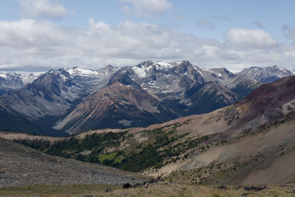


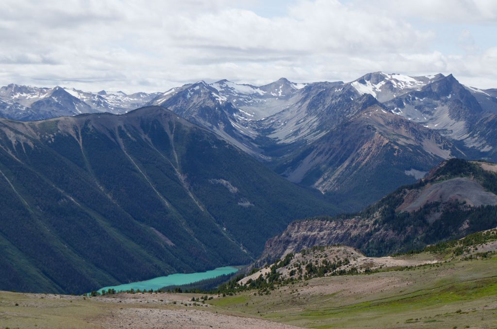
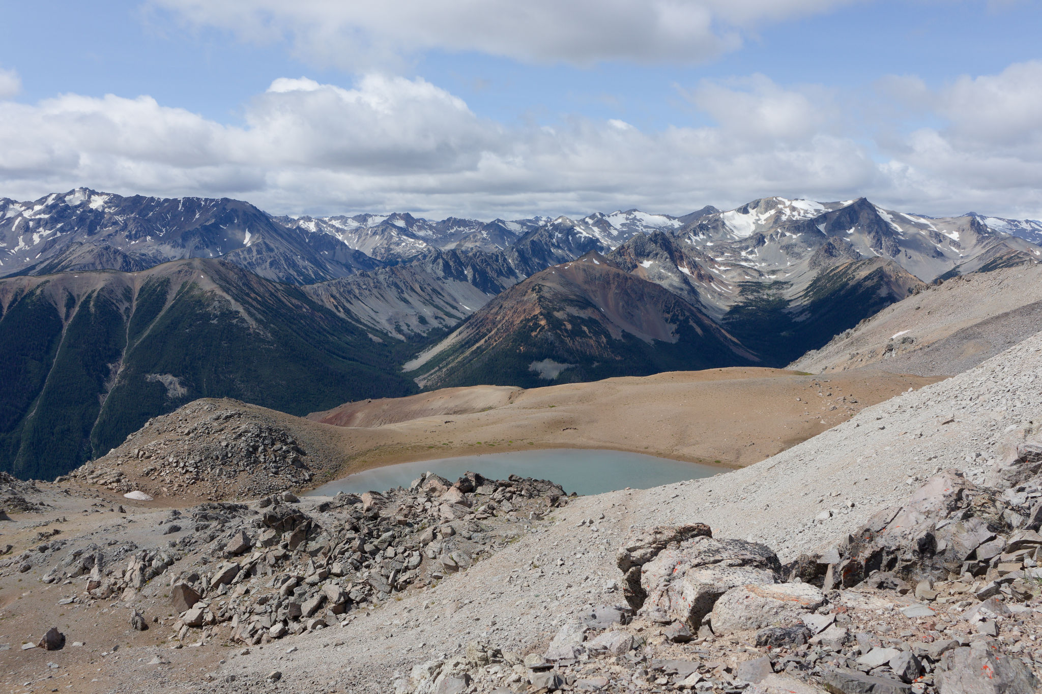
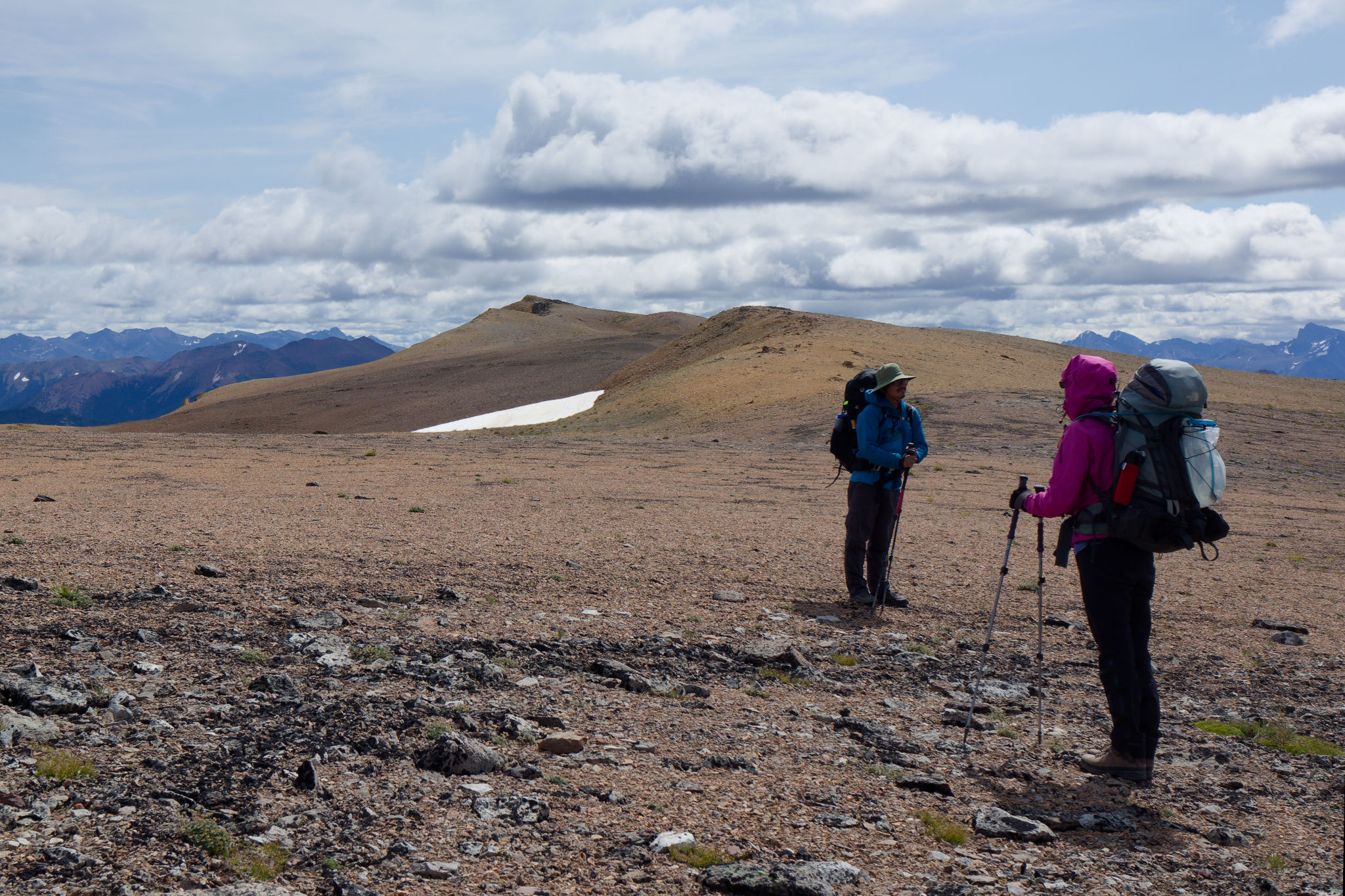
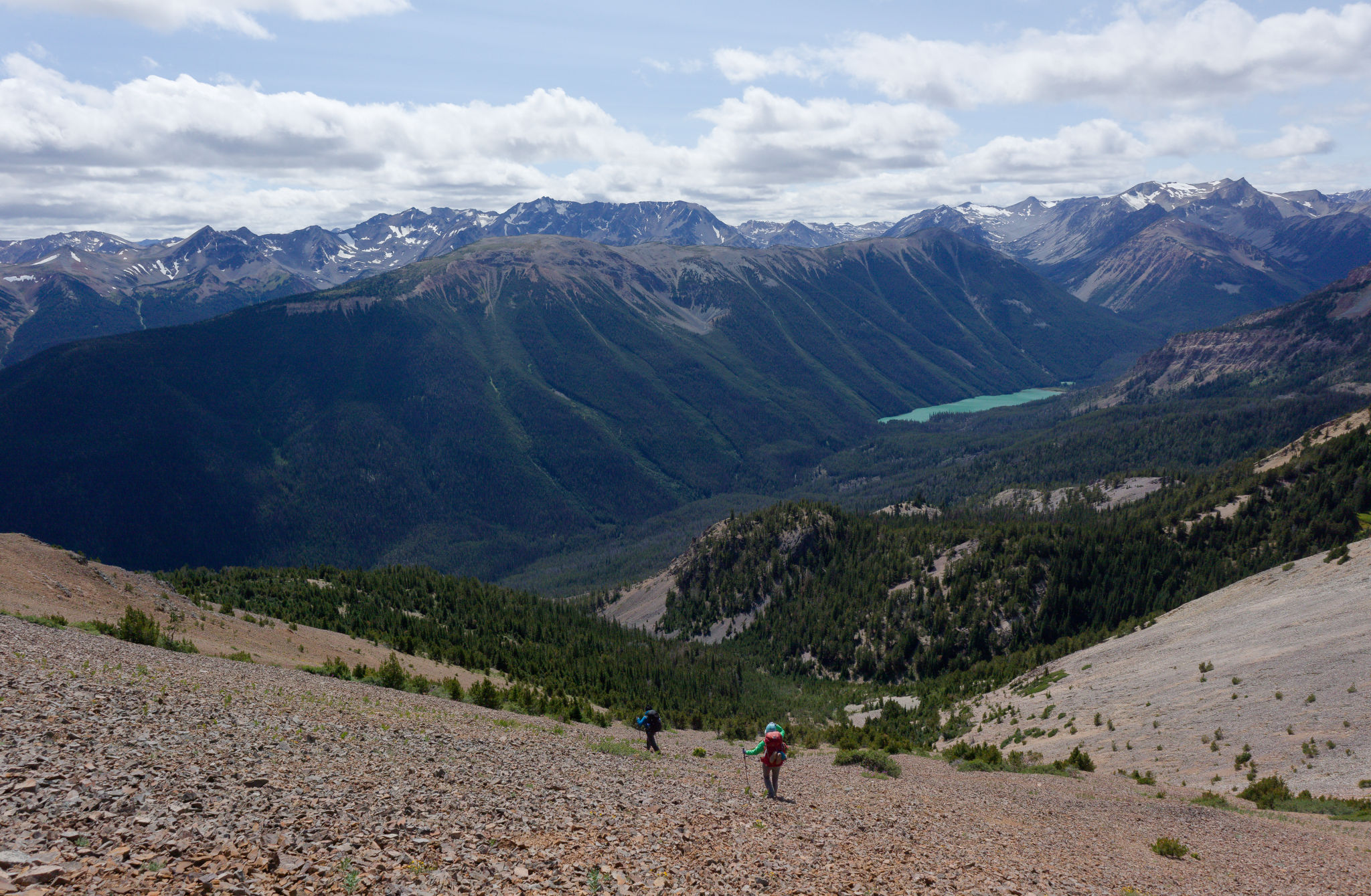
A dip in the landscape hid a small pond still edged with snow, and offered just enough shelter from the wind to entice us to sit and have lunch. The pond was an oasis of flowers with patches of dryas in bloom, lots of small-flowered penstemon, stonecrop, moss campion, and others. Fed and rested, we moved on back in the wind and followed the ridge ever eastwards. Behind us, Mount Sheba was starting to look distant. Ahead of us we could see an obvious trail leading up to a bump of pale rocks, and we knew our next decision point lay up there. For now we just enjoyed hiking the open ridge. Hummingbird Lake came into view, glowing turquoise in the sun.
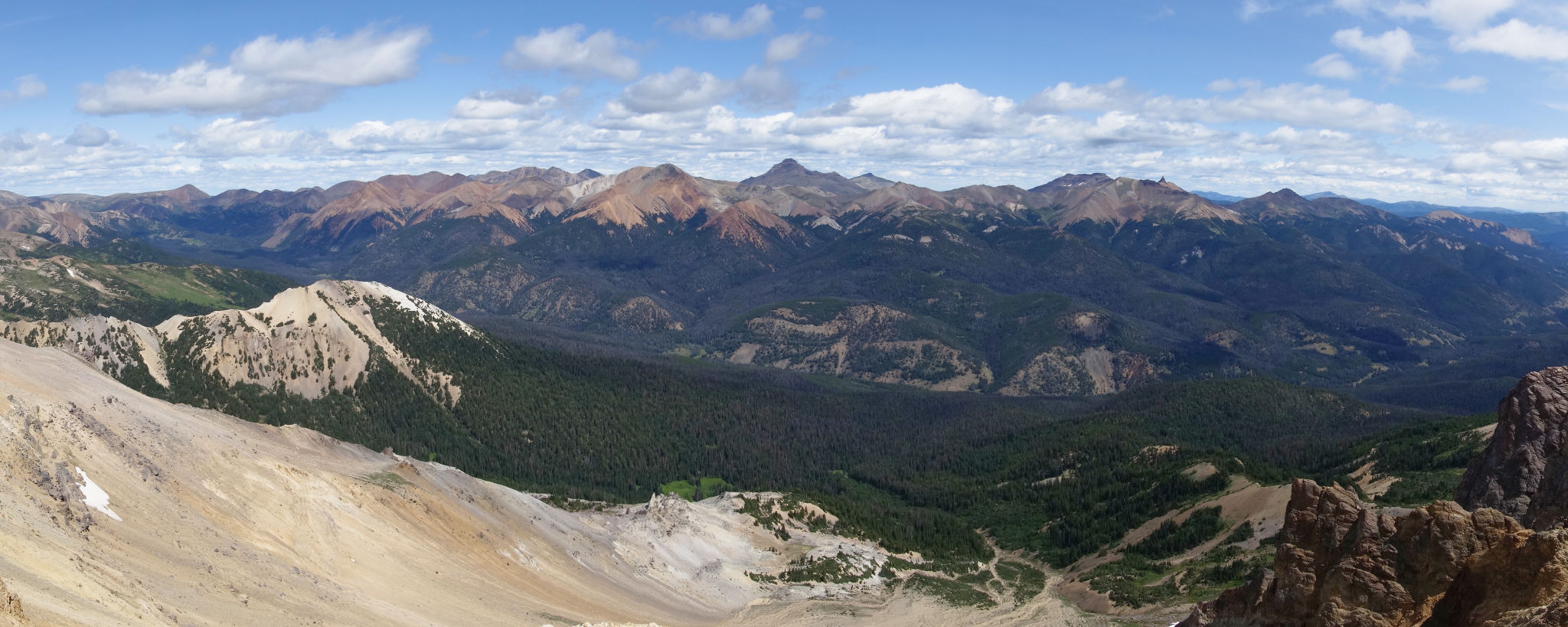
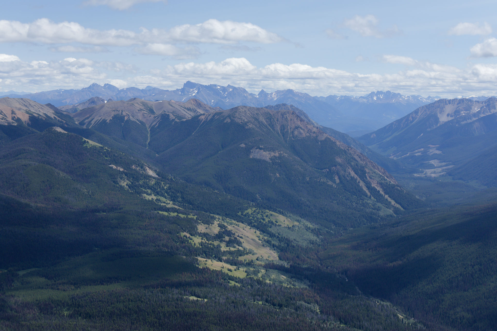
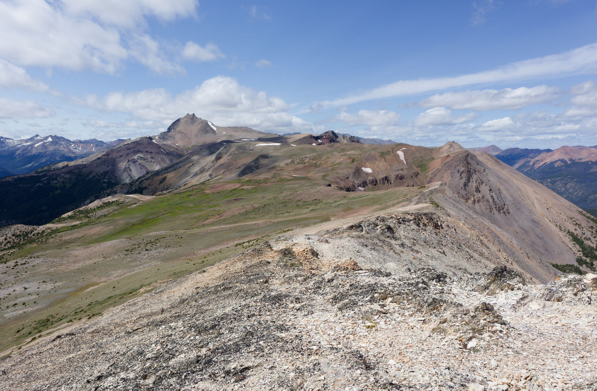
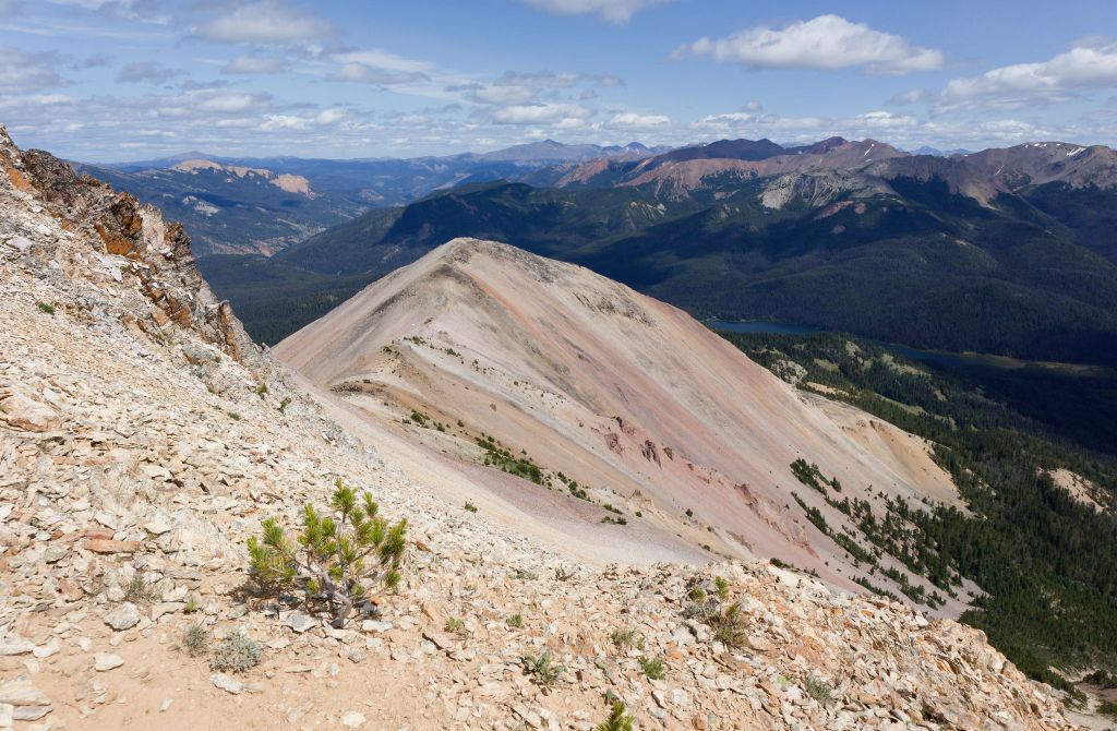
We summited the bump and took in the views around us. Of course, Mount Sheba and the broad open ridge we had just walked lay to the west, Hummingbird Lake down in the Gun Creek valley, and many unnamed and unnameable mountains beyond. North were the Tyaughton Creek peaks – Castle, Cardtable, Fortress, Cunningham, Relay. Ahead of us we could see down to Spruce Lake, dark among the trees, with the Windy Pass area – our destination for tomorrow – looking a long way off. A peak we called Stegosaurus Mountain (on account of its jagged spine) rose above Spruce Lake. Closer to us, the peak we were on split into two narrow ridges of contrasting colour – black and orange to our right and paler grey to our left. We had to descend and get around the end of either one.

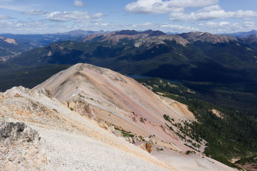

We pulled out the map and discussed our options for the rest of the day. We could either take a route around to the north of the grey ridge or go south towards the orange and black. I don’t remember how we decided but we soon found ourselves heading south to the orange ridge, reaching the low point and faced with an intimidating descent straight down the mountainside on loose scree. We boot-plunged our way down, occasionally crossing trails that we thought might be “the” trail marked oh-so clearly on the map, but quickly realizing they were most likely goat tracks. Stephen spotted the actual trail further down the slope and we continued with our scree surfing – which was tricky with overnight packs – down to meet it.
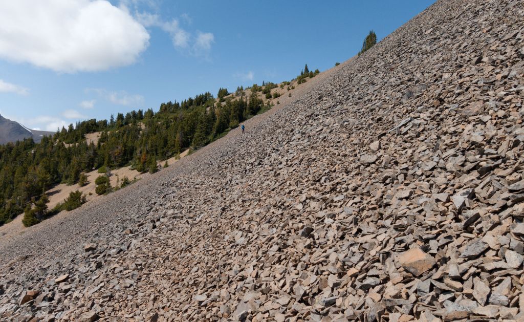

That was more like it – a clear beaten path in the rocks made for much easier walking. Looking back along it, we could see where it came from and wondered how we would have seen it had we tried to follow this route directly. One of the many mysteries that is hiking in the South Chilcotin Mountains! We were just glad to be on the trail and suspected it might have been easier on us to backtrack to find it, rather than take this – our third! – scree elevator.
The path led us downhill into a grove of aromatic white bark pines where we sought shade from the now very hot sun. Those pines smelled so good, so sweet in the hot still air. It was hard to believe we were being nearly bowled over by the wind higher up, and now we actually yearned for some sort of breeze to cool us off. As ever, we had to keep moving and we continued our descent over scree and hard-packed dirt through short switchbacks to help lessen the gradient. A little at least. The dirt was awful to hike on as it was invariably on the steepest parts of the trail and the threat of slipping and falling was ever present. Thankfully it wasn’t too long before the trail levelled off as an interesting rock formation came into view.

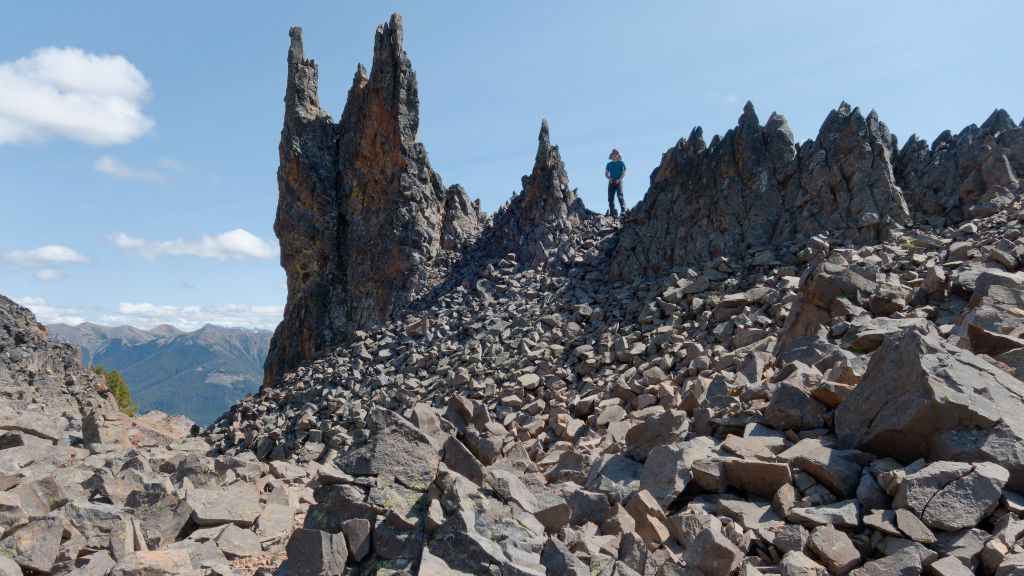
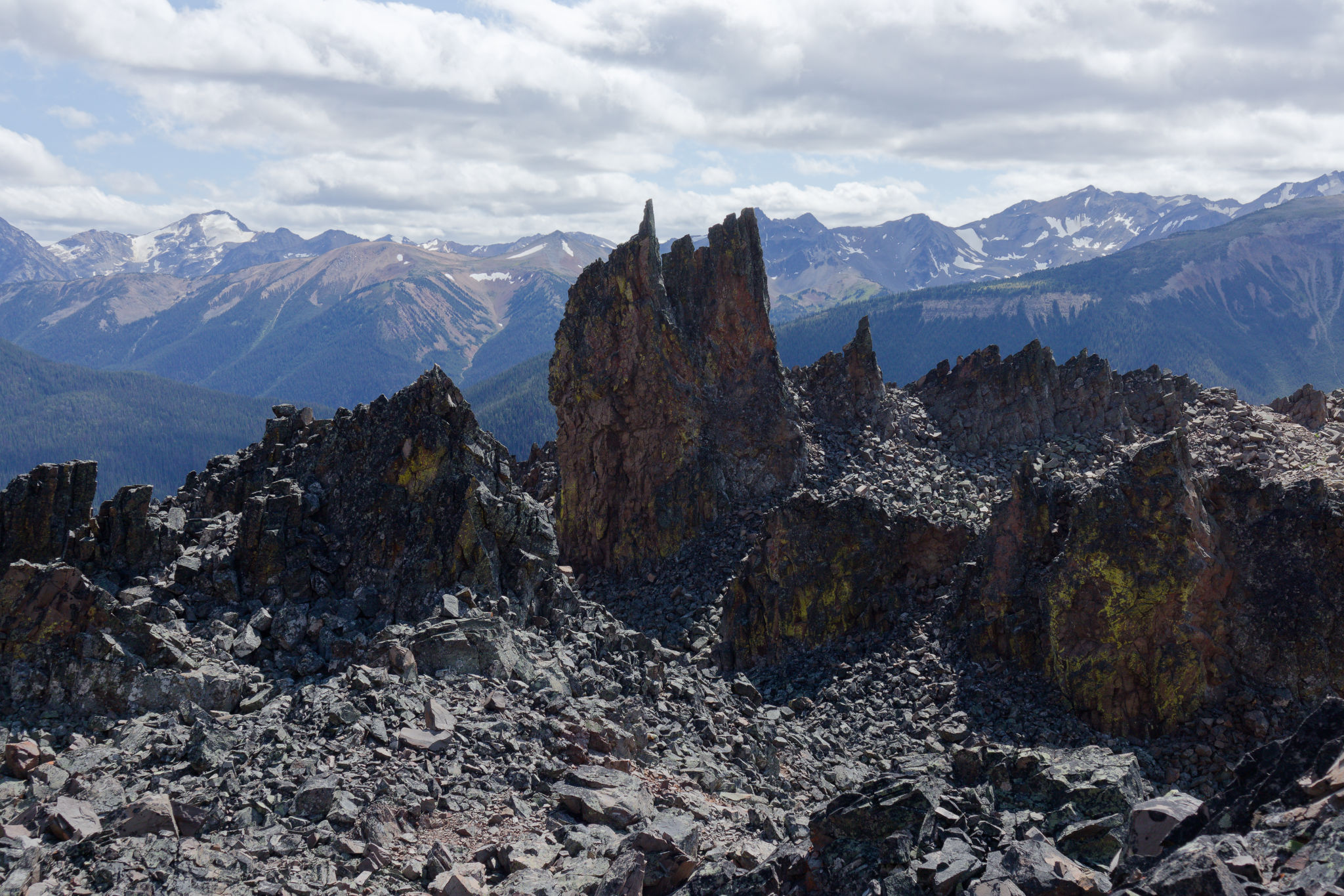
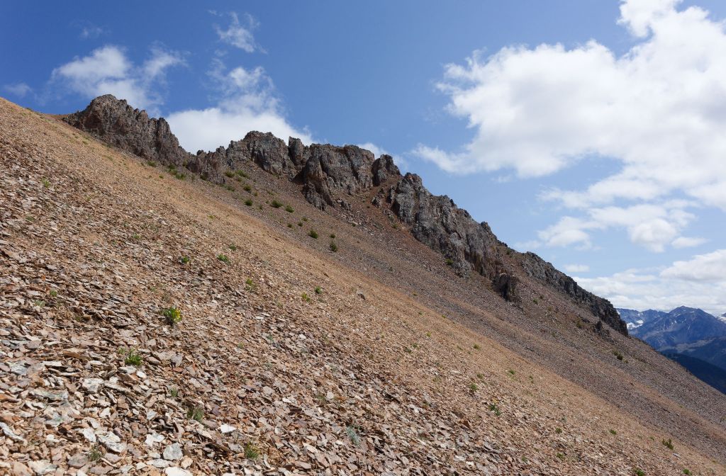
Little Mordor. I had read this description in the book at some point but hadn’t really thought about what it might mean. But here before us lay an outcrop of dark rock with twin spires that – from the right angle – looked like a miniature version of Sauron’s tower, Barad-dûr. On a more atmospheric day I could imagine the eye of Sauron gazing out from here, but on a beautiful warm sunny afternoon in the middle of summer, well, it all seemed so unlikely! We dropped our packs – with pleasure – and took the time to investigate and explore the rocks. It was really fun, and good for our souls, to get up close and enjoy some time not hiking.
The warm – almost too warm – sun had lifted our spirits and we continued merrily on only to be stopped in our tracks by an enormous washout where a large chunk of the slope had slid away. Ah, so this is what the hunters were talking about – they had mentioned a washout but of course hadn’t said (or known) where it was. Well, we’d found it alright and it was completely impassable – there was no safe way to cross this deeply eroded gully. We weren’t sure what to do and – to be honest – we didn’t feel like losing elevation only to have to regain it on the other side. Our instinct was to venture high up and over the top of the washout. This was, shall we say, an interesting experience, and not one I’m in a hurry to repeat. A few cairns enticed us steeply upwards onto challenging scree that we had to descend on the other side to rejoin the trail. Colleen’s amazing sure-footedness on this ground came into its own as she led us safely down, even carrying Maria’s pack for a while to allow her to focus on keeping upright on this difficult terrain.
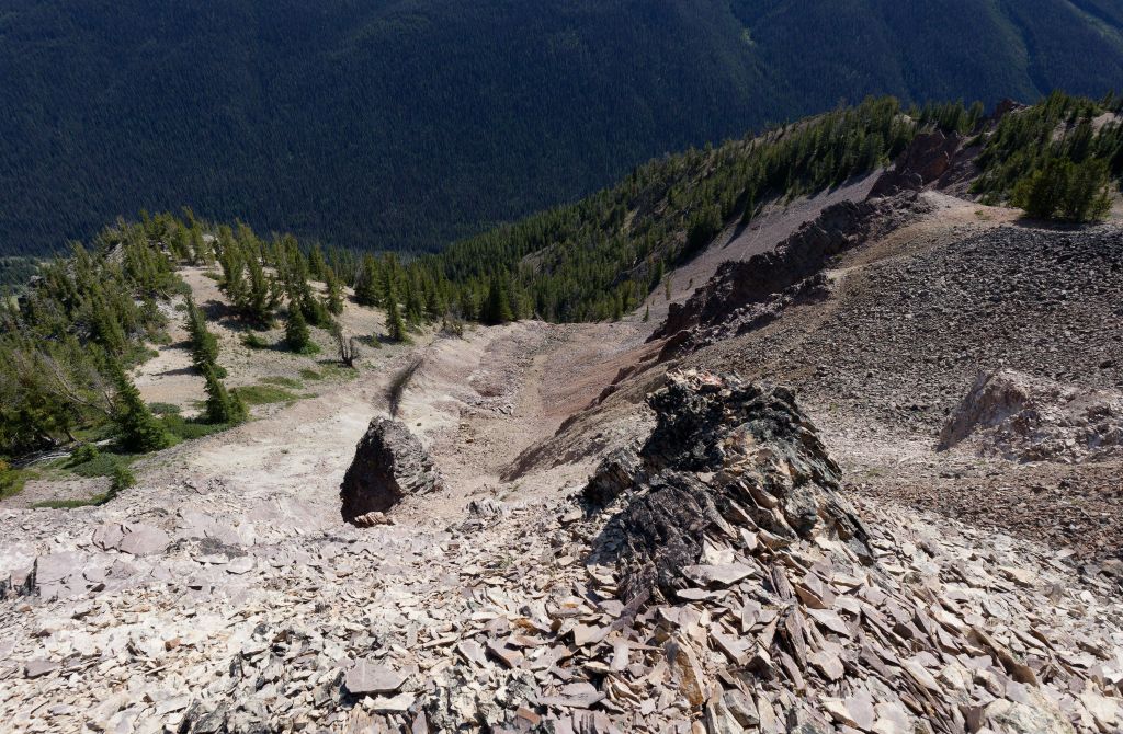

If the time in Little Mordor had re-energized us, crossing the washout had absorbed all of that extra energy and we found ourselves feeling a little more worn out once we started hiking again. Once we were back home I checked the Trail Ventures website and sure enough they listed this washout/landslide (from 2018!) as something to avoid, and recommended doing the thing we didn’t want to do – descend to a place where the gully could be crossed safely. Now we know, I guess, and I was surprised able to see a trail far below us in one of my photographs.
We were very relieved to be back on the trail and continued through patches of forest and open scree slopes, over a couple of shoulders that included a few short energy-sapping climbs. At the end of one of these climbs, we picked our way through some avalanche debris – a mix of uprooted and slanted trees – before the trail petered out among the pines. We paused for a snack break and to check our location before moving on, taking our navigational cues from blazes on trees, strategically trimmed branches, and an occasional footbed to keep us on track. The shade and breeze were most welcome, keeping us cool and allowing us to manage our dwindling energy levels. It was a pleasure to be among the tress as the sun-warmed spruce and fir smelled so good! Low-lying juniper brushed against my ankles and somehow I noticed Oregon stonecrop growing in abundance on the rocky soil.
Our luck eventually ran out, probably due to some combination of inattention and missing the increasingly subtle trail cues, and we found ourselves marooned on a steep slope among open pine forest with no obvious path to guide us forwards. We scouted around to no avail but I found some boot prints that were not ours and followed them upwards to the shoulder of a ridge that had a view of the terrain ahead. Comparing this view with the map told us that we were in the right spot, but where was the trail that was so clearly indicated on the map? We spread out the map on the ground and used the GPS to locate us and determine which direction we needed to head – a task made all the more difficult this late in the day. It was nearly 5:30 pm and we’d been on the move for six-and-a-half hours, with over two more hours of hiking ahead of us. The previous four days of hiking had definitely taken their toll and we were tired.
Thankfully, it wasn’t long before we reached a consensus on how to proceed and we continued on, soon intersecting a clear trail that appeared from our left and leading in the exact direction we needed to go. How had we missed this? With relief, we stepped out on the welcome easy path, following it around the head of a rocky drainage basin to the base of the pale ridge that we’d seen from above some three hours earlier, and coming to a marked trail intersection. This point marked where the northerly route around the end of the ridge joined our route and we turned right (we almost turned left…) to begin descending – past a sign warning on unmaintained trails in the direction we’d just come from – on the loose gritty, surface.

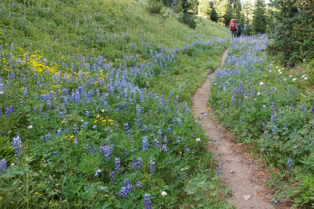

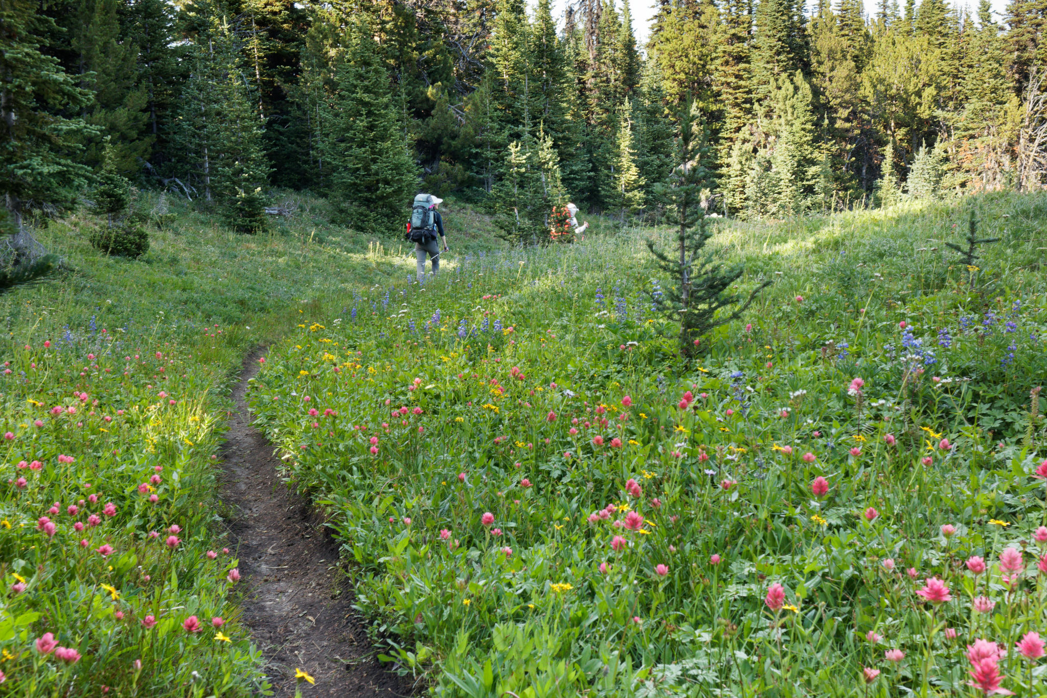
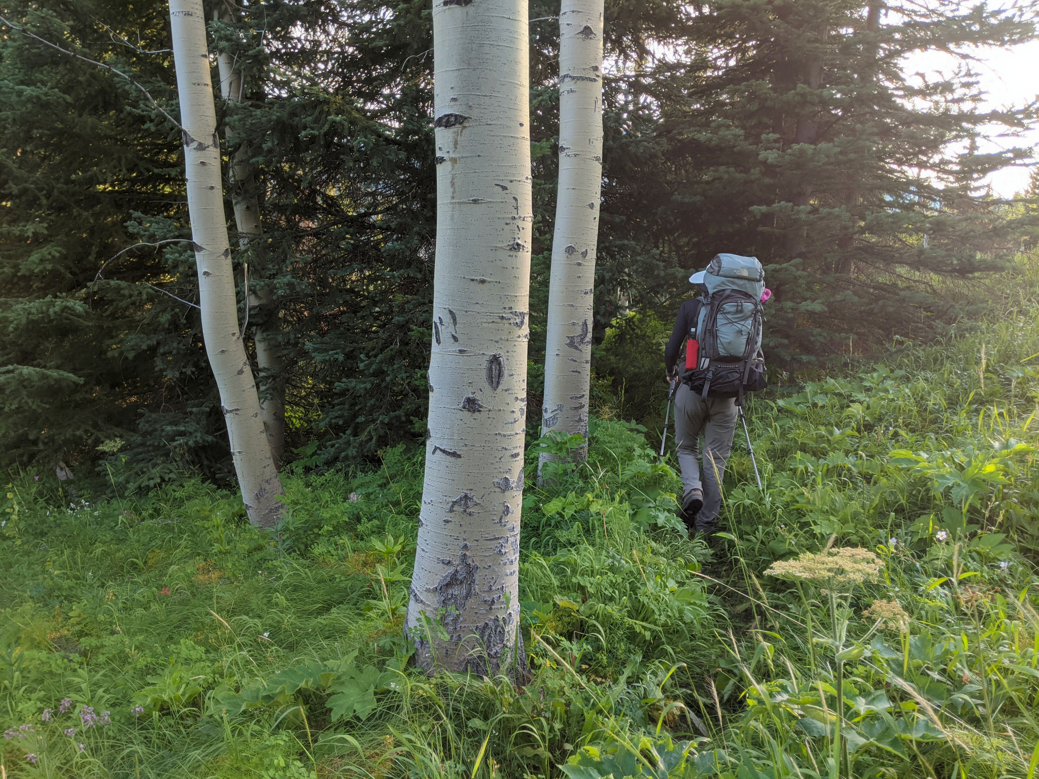
The trail wasn’t great to hike on to begin with but the trees were aromatic and it wasn’t long before we levelled off among beautiful meadows full of lupine, arnica, and paintbrush. The lupines smelled heavenly! Despite having several kilometres to go, we could now relax in the knowledge that the rest of the route was on a quality trail (it said so on the map, so it must be true!), and the hiking became enjoyable again. Time and distance passed slowly but the hiking was good and the meadows were gorgeous, some with expansive views down to the Gun Creek valley. I kept my eyes open for a side-trail that would short-cut a corner on our planned trail – the OH Connector – but never saw it. I was beginning to worry that we’d missed our turn altogether but then we noticed a narrow, unmarked trail turning sharply right and doubling back on ourselves. A quick check of the map and GPS told us this was our intended path and we turned off to follow it through a patch of forest before emerging on dry sandy meadows full of balsam root. This slope must have been stunning a month or so ago with the bright yellow flowers covering the slopes. Now it was a carpet of faded sage-green leaves.
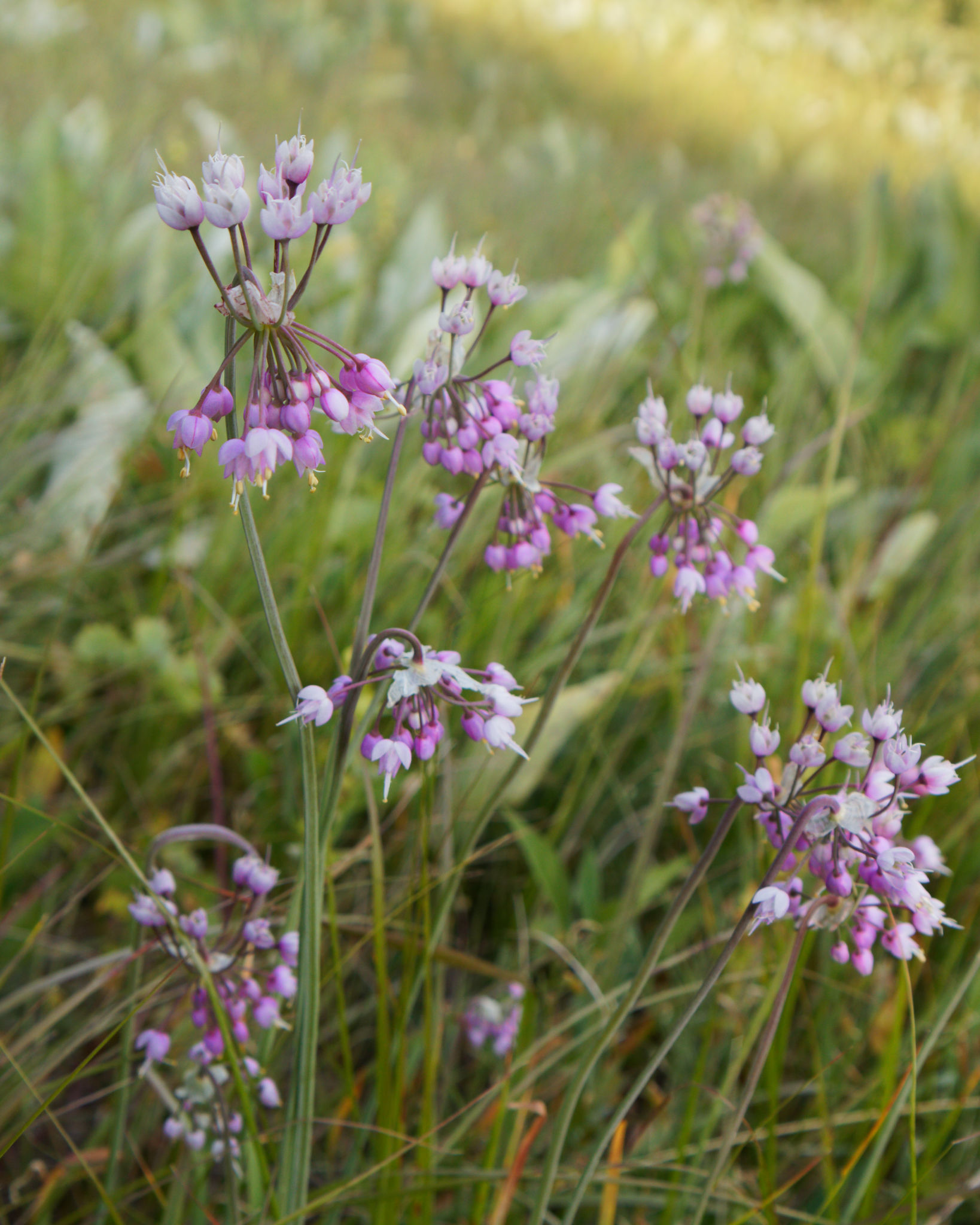
We passed through more forest – where the trail even climbed again for a while – before descending over big open meadows full of flowers, even if the main show was mostly over. I spied western meadow rue, the seed pods of glacier lilies, paintbrush, cow parsley, nodding onion, and more. The nodding onion seemed to the thriving with some beautiful rich patches of the pale lilac flowers.


To our surprise, the trail occasionally disappeared on us through the meadows – much like it had on our Paradise Creek trip the previous year – and it took a little bit of effort to find it again. At other times the trail was worn into a knee-deep (or deeper) canyon, the meadow grasses and flowers threatening to cover it up, hiding our feet from sight to add extra difficulty. If there’s one thing about hiking in the South Chilcotin Mountains, it’s that you should never take trails for granted as they can disappear or their character can change abruptly in only a few steps.
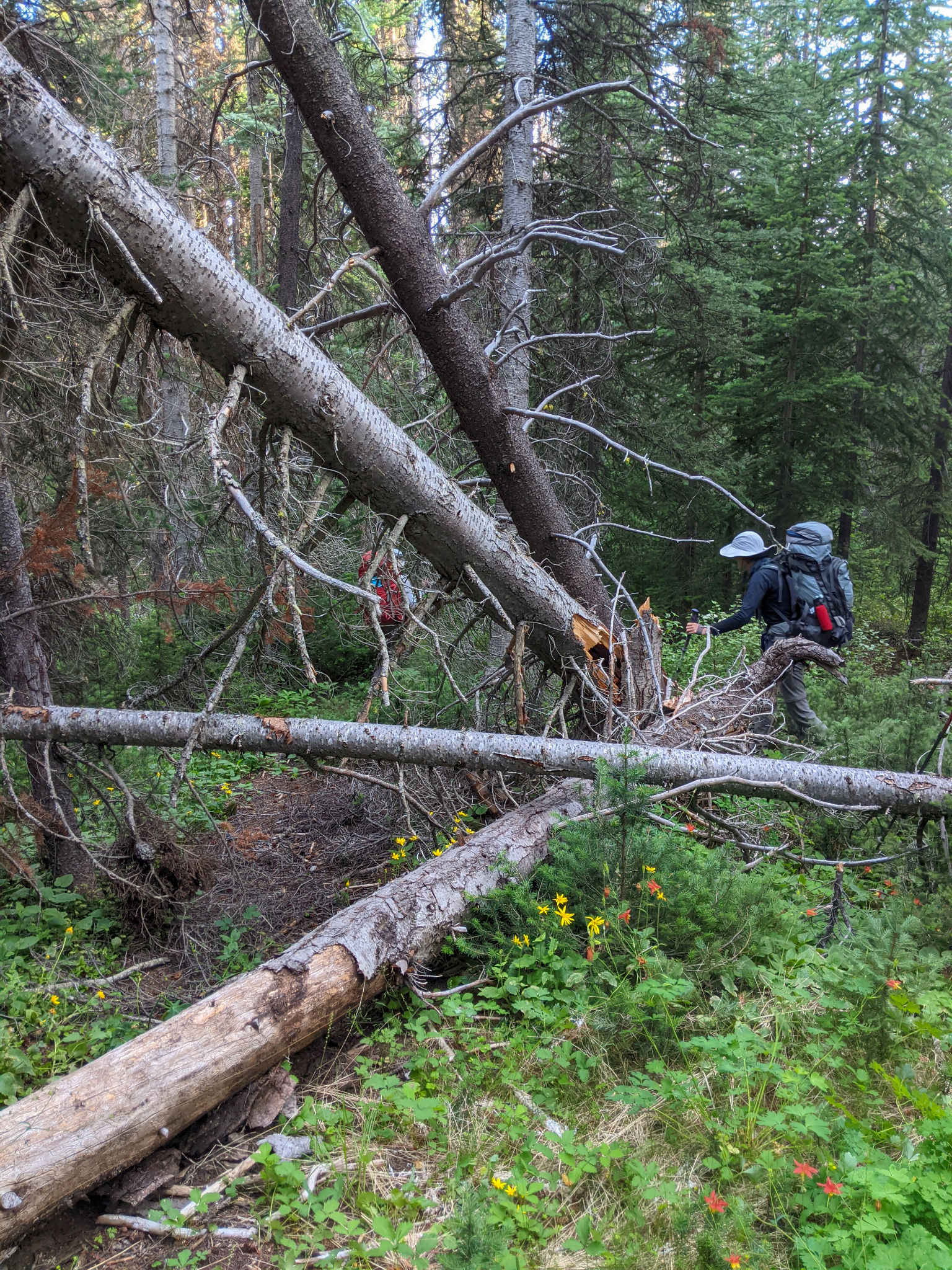
After descending awhile, we entered dense, dark forest where at least the trail became more obvious again. Lest you think the going was now easy, our way was full of fallen trees that were sometimes tricky to negotiate. It was clear that our $50 trail fees were not being spent here. A few forest flowers were hanging on here and there, Columbia lilies adding a welcome splash of colour in the darkening forest. We crossed a number of small creeks which were the first sources of water since our lunchtime pond over 5 hours earlier, and leant some welcome humidity to the air.
We emerged onto another large open meadow, with enough flowers still blooming for Stephen to comment on the rapturous displays. A rest break was in order so we dropped our packs and topped up our energy levels, taking a few minutes to admire and appreciate where we were. I couldn’t resist looking at the map and it was with some relief we found that we were only about 1.5 km from our camp. Suddenly we could envision an end to the day and our destination finally felt close, which lifted our sagging spirits.
With renewed energy, we continued on into more forest, now coming alongside a creek for a while before turning eastwards. Of course, this was nature’s cue to begin hiding the trail from us, with luxurious patches of grass and cow parsley (sprinkled with jagged, fallen trees) to sharpen our senses and navigational skills. I was getting tired of this finding the trail, losing the trail seesaw. One minute we had a clear and obvious footbed, the next there was none and we relied on picking a route that seemed like it was going in the right direction.


Movement ahead of us caught our attention and we were relieved to see it was a lone mule deer, barely 20 metres away, looking as surprised to see us as we were to see it. We stopped to let it choose its exit path, only for it walk past us most casually at a surprisingly close distance. That was a nice encounter! But now all semblance of a trail had vanished among the trees and grass, and we took a leap of faith disguised as dead reckoning to aim for the Upper Grasslands Trail that we were due to join any minute.
Yes! There it was! We were so relieved to find this trail – marked as a major trail on the map – so that we didn’t have to waste any more energy on navigation. As we checked the map to ensure we were indeed where we thought we were, I noticed one little clue – the final 100 metres or so of the OH Connector was marked not with a nice trail dash but with a dot indicating it had deteriorated to a route. Had we noticed that before, we might not have been so surprised that the trail vanished on us.
We turned right to continue descending gently through open grassy meadows, the trail surprisingly (unsurprisingly?) faint or overgrown at times with more downed trees to work over or around. It was so overgrown in places that it hid the wildlife, a grouse exploding from the green with such a noise that startled the life out of Stephen in front. It always takes a moment or two for your heart rate to come back down after that! Down we went, spotting another deer at the edge of some trees across the meadows and passing some flattened grass where something had bedded down at some point recently.
A signpost greeted us as we joined the Mid Grasslands trail where we noticed some old stockade fencing. We turned right, crossed a burbling creek and arrived at the Cowboy Camp, our destination at last! It was 7:50 pm, nearly 9 hours after setting off. Nine hours to cover nearly 13.5 difficult kilometres, and losing a total of over 1100 m of elevation. There’s no doubt we were lulled into a false sense of security by the easy hiking up on the high ridge and ever since then it felt like we’d had to fight for every kilometre of ground.
The Cowboy Camp was well-named, clearly set up for people on horses with a bar to tie them (and a ton of old horse poop) right next to a kitchen area with a makeshift table and some benches around a well-used fire pit. We weren’t quite sure where to put our tents – it certainly wasn’t possible to stick to the usual rule in grizzly country for camping 100 m away from where you ate. With reluctance we settled on the fading flower meadows, about 30-50 metres from the dining area, justifying our choice on the basis that the flowers had already set seed for the year and that we weren’t likely to cause too much damage. (Having said that, it’s surprising how quickly paths get beaten into the meadow as we walked back and forth to our tents.)
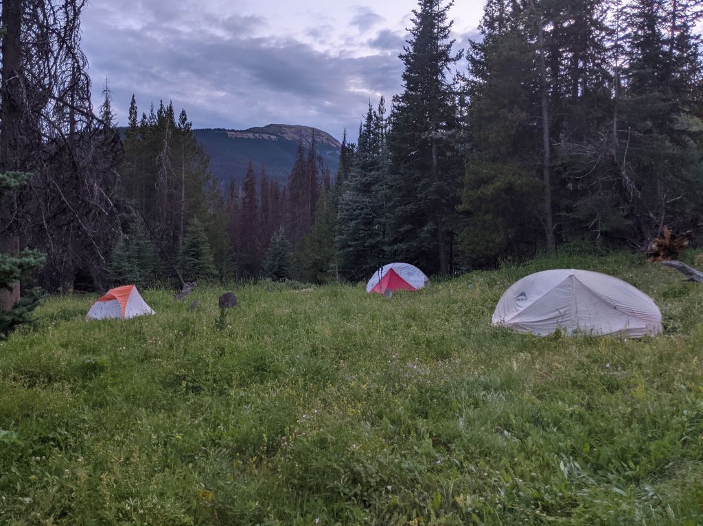
We were so happy to be able to take off our packs for the last time and establish our home for the night, even if it wasn’t up in the alpine or next to a beautiful lake. What it did have going for it was warmth: it was noticeably warmer than any of our previous camping spots – as might be expected now that we were down at 1500 m (compared with over 2300 m for our past 3 nights) – and much less windy too. On top of that, it was much less buggy than expected and we were the only ones here. Maria filtered water while I went in search of an outhouse – to no avail but I did find an old collapsed cabin with some much better tent camping next to it. If we camp in this area again I think this would be a better choice. I followed the trail a bit further, crossing the creek again and rejoining the Mid Grasslands trail further downstream.
Having explored a little, I returned to our camp where we boiled water for our dinner, finished setting up our tents, and sorted out the food bags. They were finally feeling lighter! We enjoyed our dinner around the “campfire” and reflected on the day. It had been (another?) challenging day but still so rewarding. We felt fortunate to be able to explore this place, and, in retrospect, I found myself appreciating the difficulties we had faced and overcome. I wouldn’t say it was Type II fun – it wasn’t quite that bad – but it demonstrated that you simply cannot take anything for granted in the mountains.
The day drew to an end, darkness falling quickly after sunset, and we cleared up and found places to hang our food bags (not high enough for bears, but hopefully enough for squirrels and other rodents) by the light of our headlamps. It was 10 pm and we caught sight of the full moon rising through the trees. That was our cue to crawl into our tents for the night where we were soon comfortable.
Maria and I chatted awhile, discussing the long and tiring day, and commenting that it’s clear the mountain bikers are selective in the trails they want to maintain. Once again we were surprised by how faint (and intermittent) the trails can be and we both agreed that this area needs more backpackers so that their needs are equally well met. But – selfishly – not too many. After all, it felt remarkable that we were the only ones here. In fact that was bliss. No, that’s not right – the soothing sound of the creek was bliss. Or was it the warmth of our sleeping bags? Whatever. It was bliss.
Finally, at the end of another spectacular, challenging day of hiking, it was time for sleep. After all, we have another long day ahead of us with two passes to climb tomorrow! Whose idea was that again? Oh right….