
Taylor Basin to Tyaughton Lake: 15 km, +395 m, -1455 m, 7 h 48 m
See that number, -1455 m? Yeah, that’s a lot of downhill….
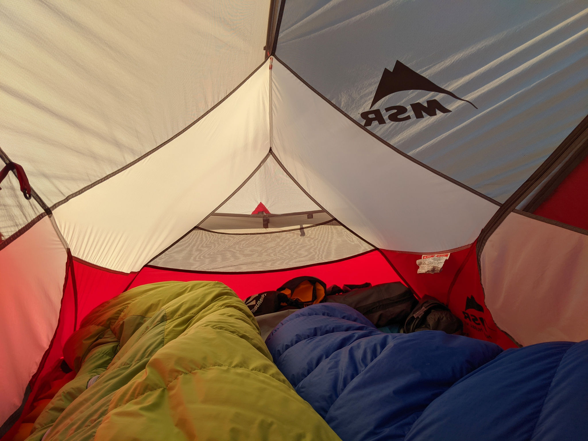
Our last night on the trail was wonderfully quiet, though that didn’t mean I slept any better and I woke often to see how far the moon had moved across the tent. On the plus side, the view of the stars and moonlit landscape was a beautiful sight and I could’ve got up and sat awhile to enjoy that scene. Sleep came eventually and I was roused by the sun peeking over the horizon around 5:30 am; one of the perks of our east-facing camping spot, even for this non-morning person. I was content to lie in my sleeping bag for another hour before easing myself out into the day.
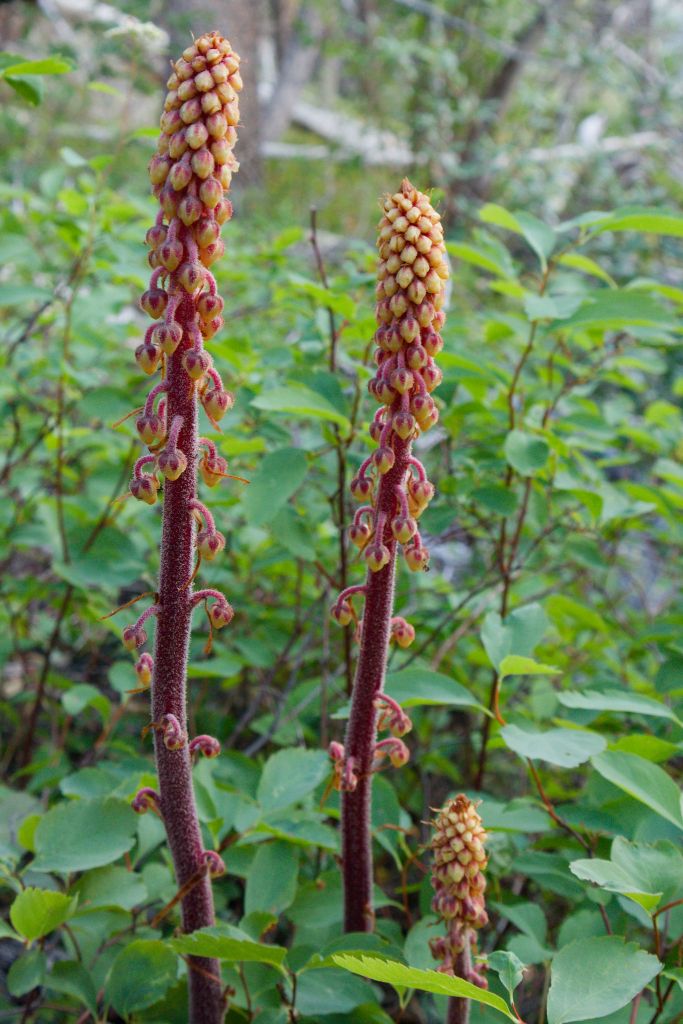
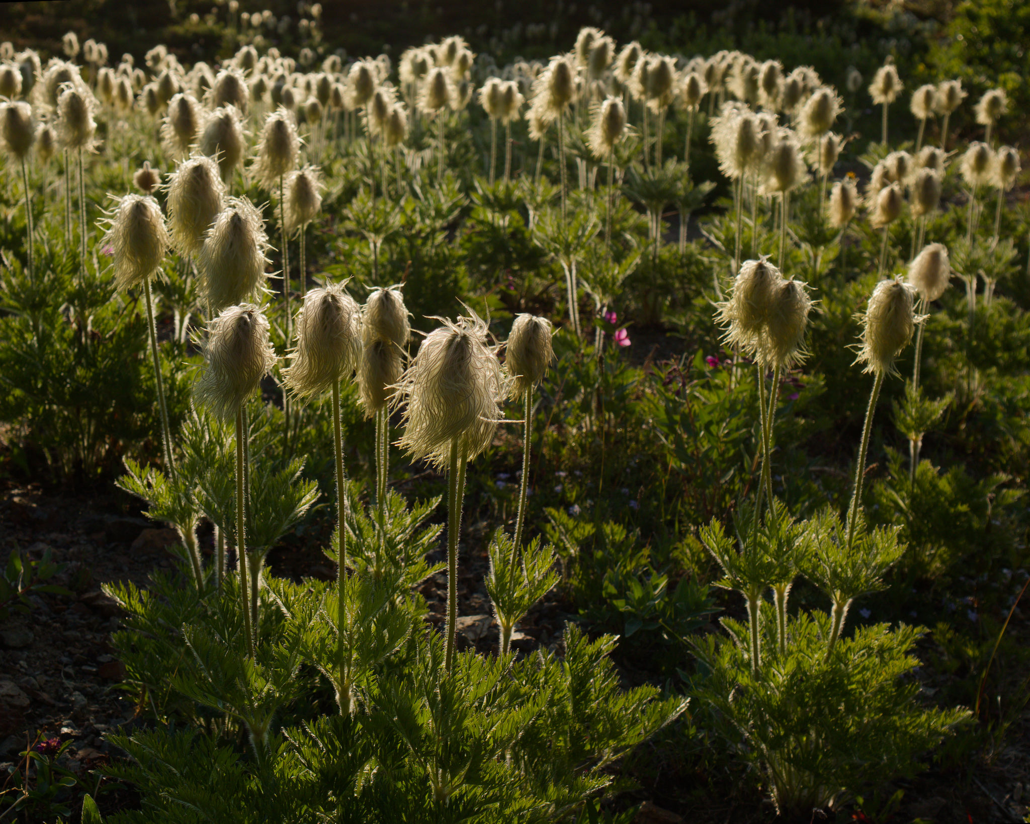
I wandered around in the peace of the early morning taking photos of backlit fireweed and moptops, the tranquility disturbed only by my footfall on gravel and the squawking of a pair of Clark’s nutcrackers. These are the moments I love most in the backcountry, some time to feel part of the landscape, and to simply be. I returned to the tent to begin packing up, the inside already hot in the sunshine, before retrieving our food bags and boiling water for breakfast.

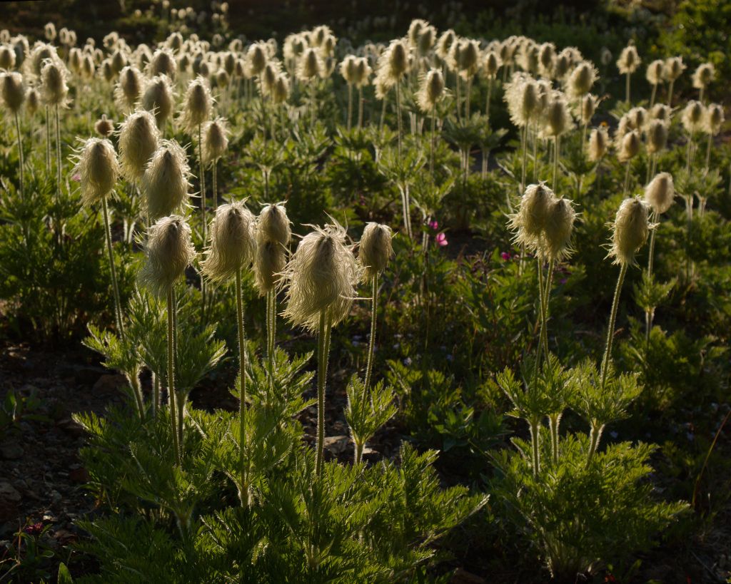

There’s always that tinge of sadness on the last morning of an extended period of time in backcountry, especially on such a fine morning, and we took the time to savour our surroundings, embedded as we were in a sea of fluffy moptops. Each of our camp sites on this trip had been difficult to leave behind, but this one might have been the most difficult. But leave we must and a little after 10 am we hauled on our backpacks and began the day’s adventure.
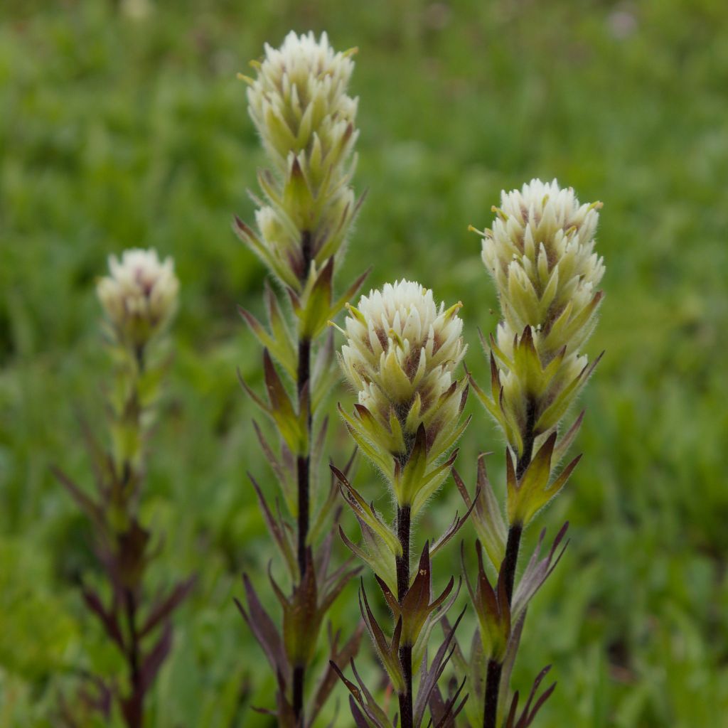
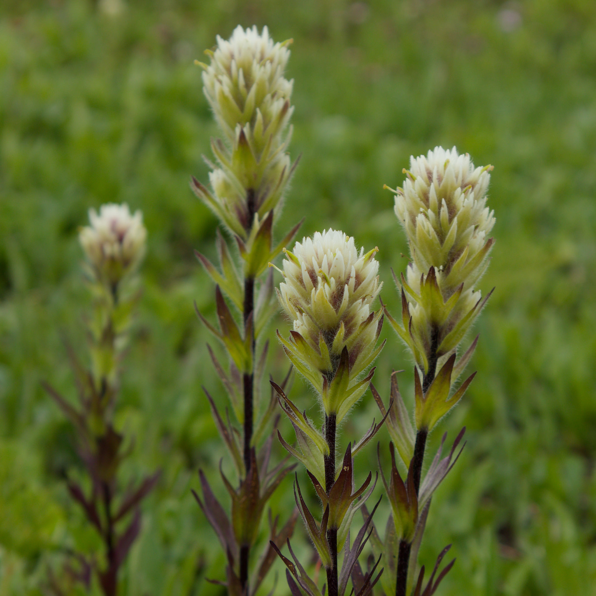
We crossed the grey ridge we’d explored last night and descended into the next bowl where the trail from Taylor Cabin met our path. Colleen hadn’t seen the cabin before and wanted to check it out, so we dropped our packs again – in the same spot where we’d sheltered from the thunderstorm in 2018 – and relaxed while she went to visit it. I took the camera on a walk around the mossy green meadows, finding some fine white paintbrush and bog orchids to admire. Colleen returned and reported that the cabin wasn’t worth the detour; I don’t think any of us was surprised by her reaction and we were quite happy to have spent the time sitting around in the alpine.


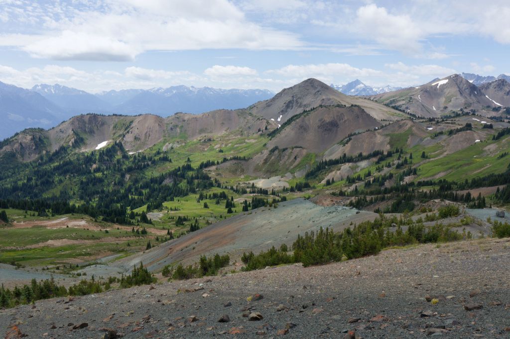
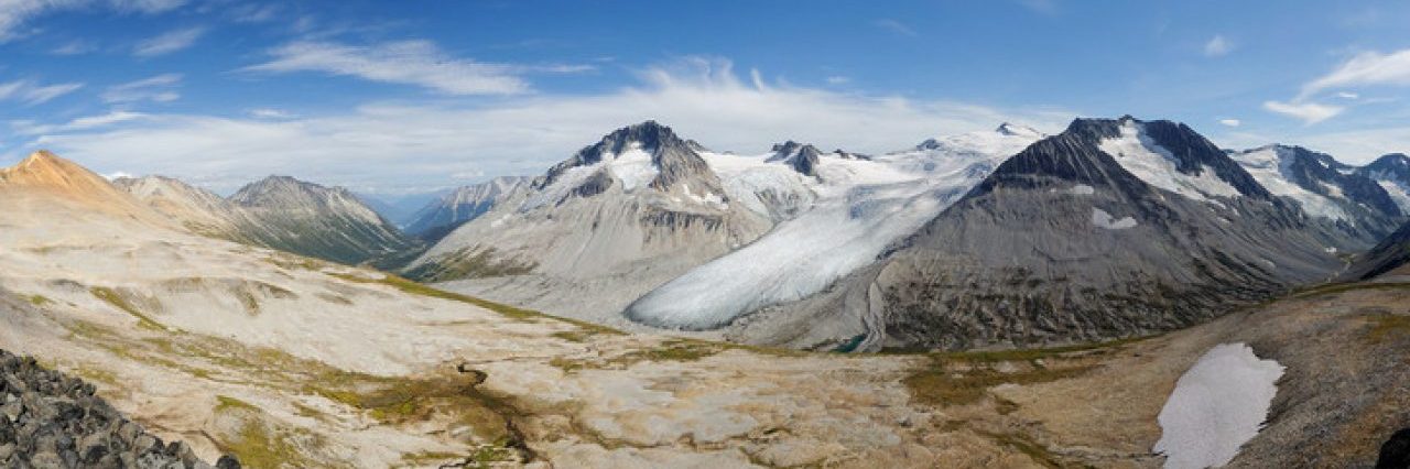
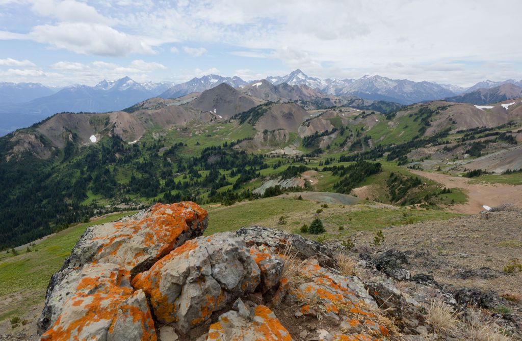
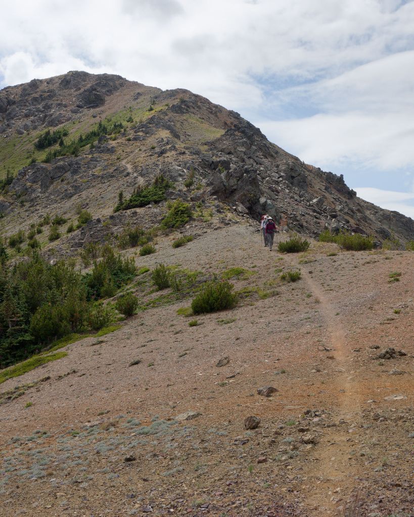
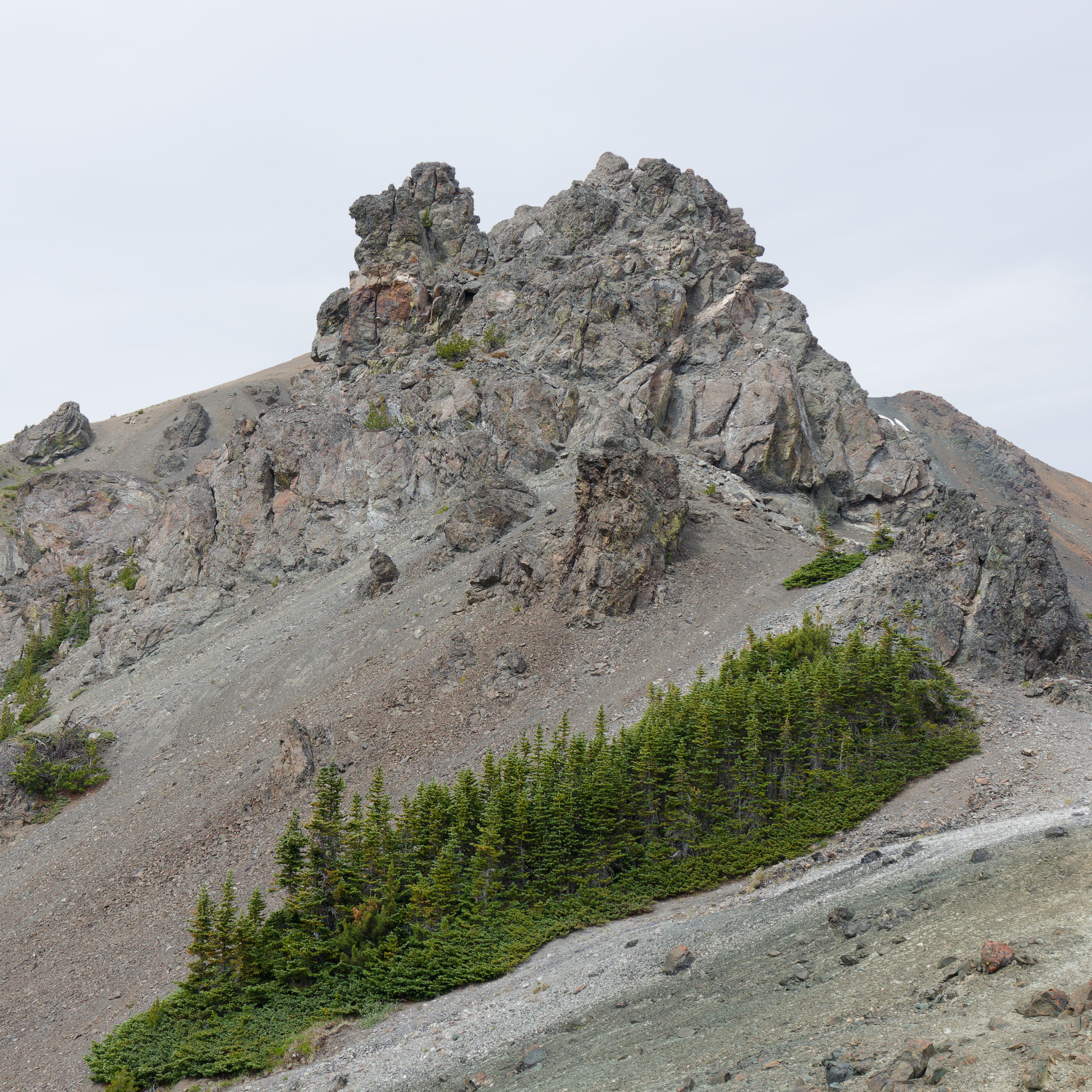
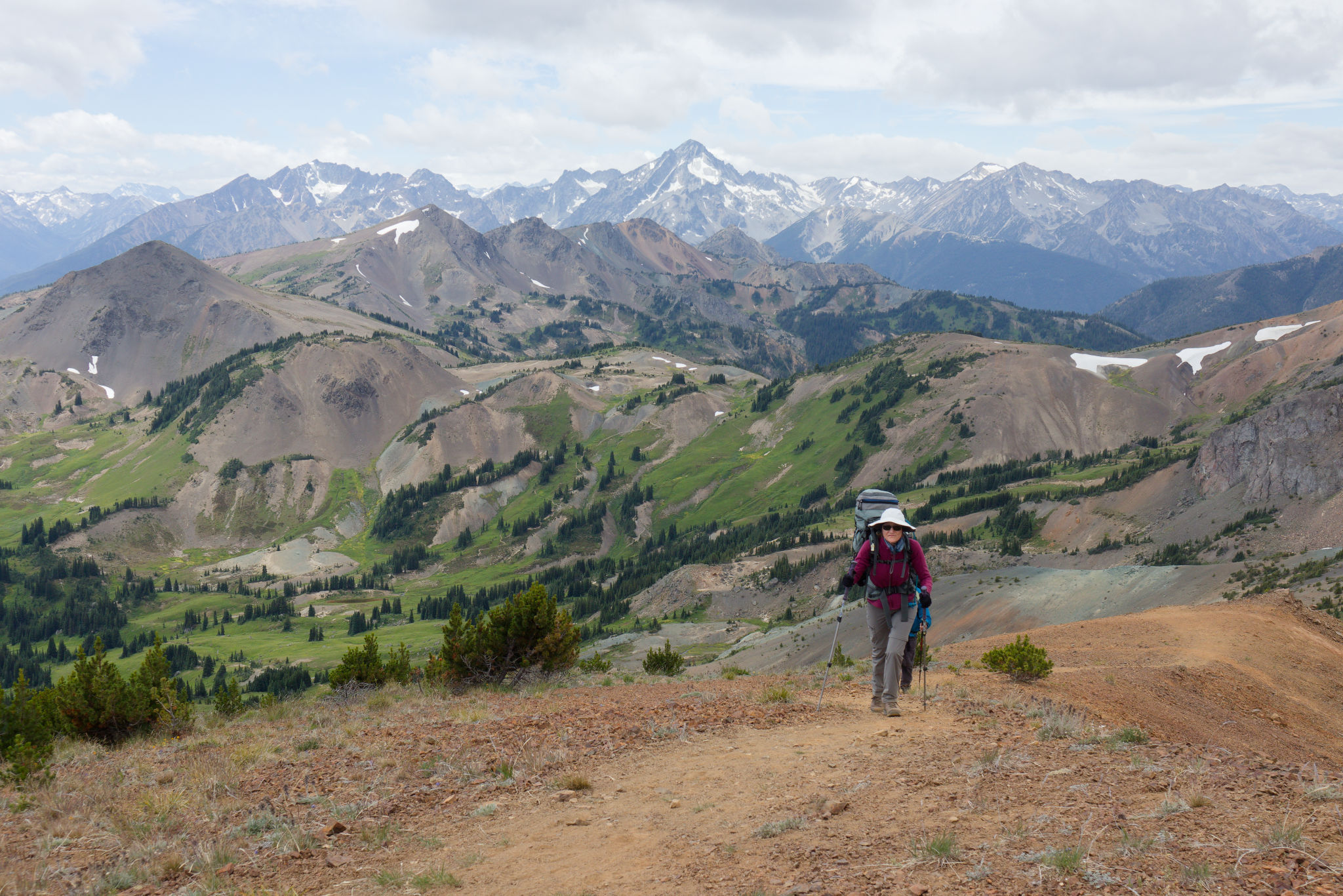
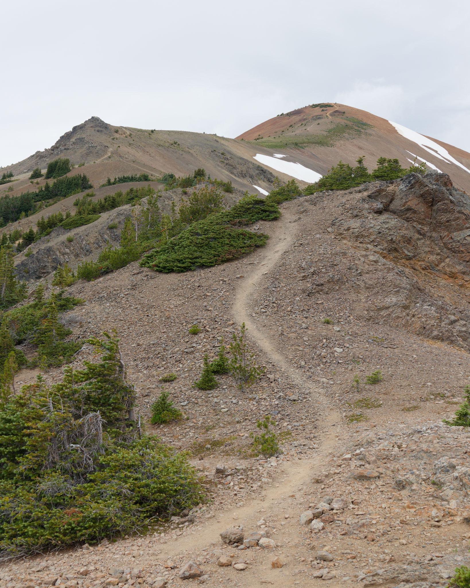
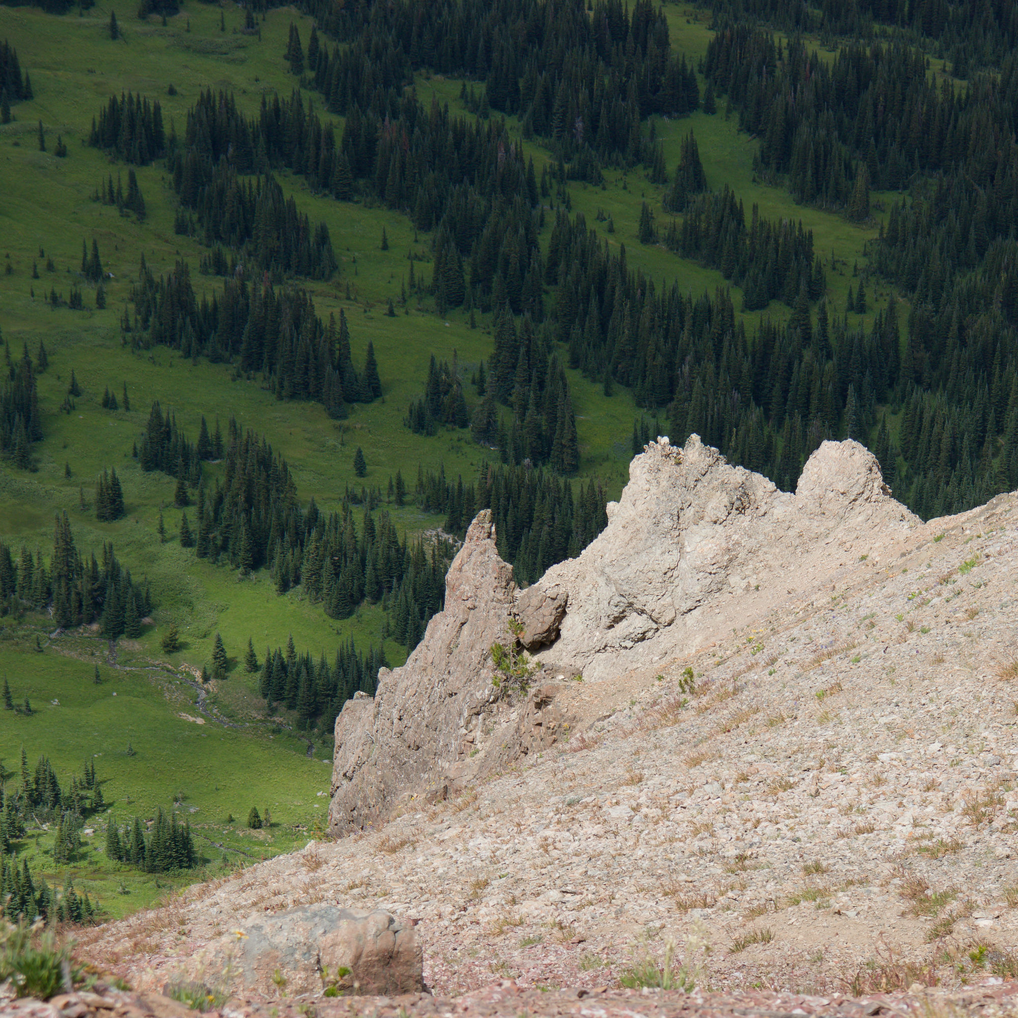
The bright blue skies of the early morning had given way to high clouds as we crested Camel Pass. Not that we cared: the views were still expansive. After admiring the eponymous rock formation, we turned left up the ruddy slope to follow the ridge line steeply up to one bump then another, occasionally looking back at the camel at the pass and admiring the spectacular view down into the Pearson Creek drainage. Looking at my feet as I climbed, I thought I spotted canine prints in the dirt – probably someone’s dog but my imagination preferred the idea they were from a wolf.

We summited the high point on the ridge, a spot we had reached in 2018, and took in the magnificent view all around. In 2018 I called this one of the best views I’d ever seen and I felt similarly now. It’s a truly stunning spot to take in the colourful hikeable ridges and meadows of the South Chilcotin mountains. A few low pines grew out of the otherwise barren landscape, and tiny low mountain lupine hugged the ground, each a striking contrasting colour against the ochre rocks.
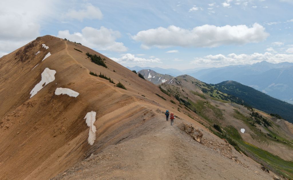
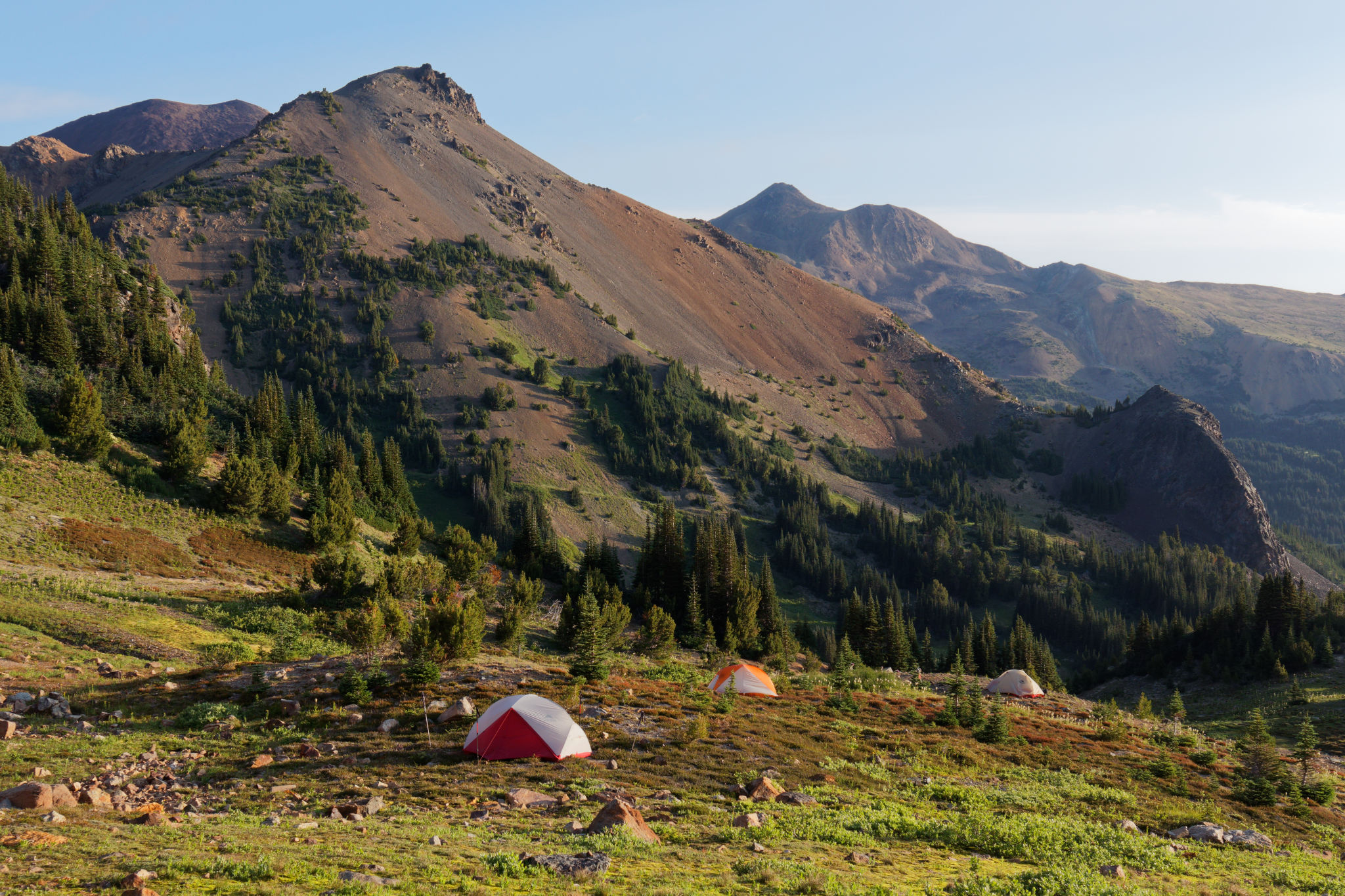
Our next steps trod new ground for us as we descended on a smooth trail worn into the dirt by the passage of many mountain bikers. We had planned to hike this route in 2018 but were foiled by the weather and we were excited to see what it had in store for us. It was steep and loose in places but thoroughly enjoyable ridge walking with incredible views to either side. We could see our breakfast spot from the morning we left North Cinnabar basin, a spot we’d soon walk close to. Pearson Creek valley was bathed in gorgeous light as the sun broke through the clouds, and we could make out a pair of tents in the meadow far below us.


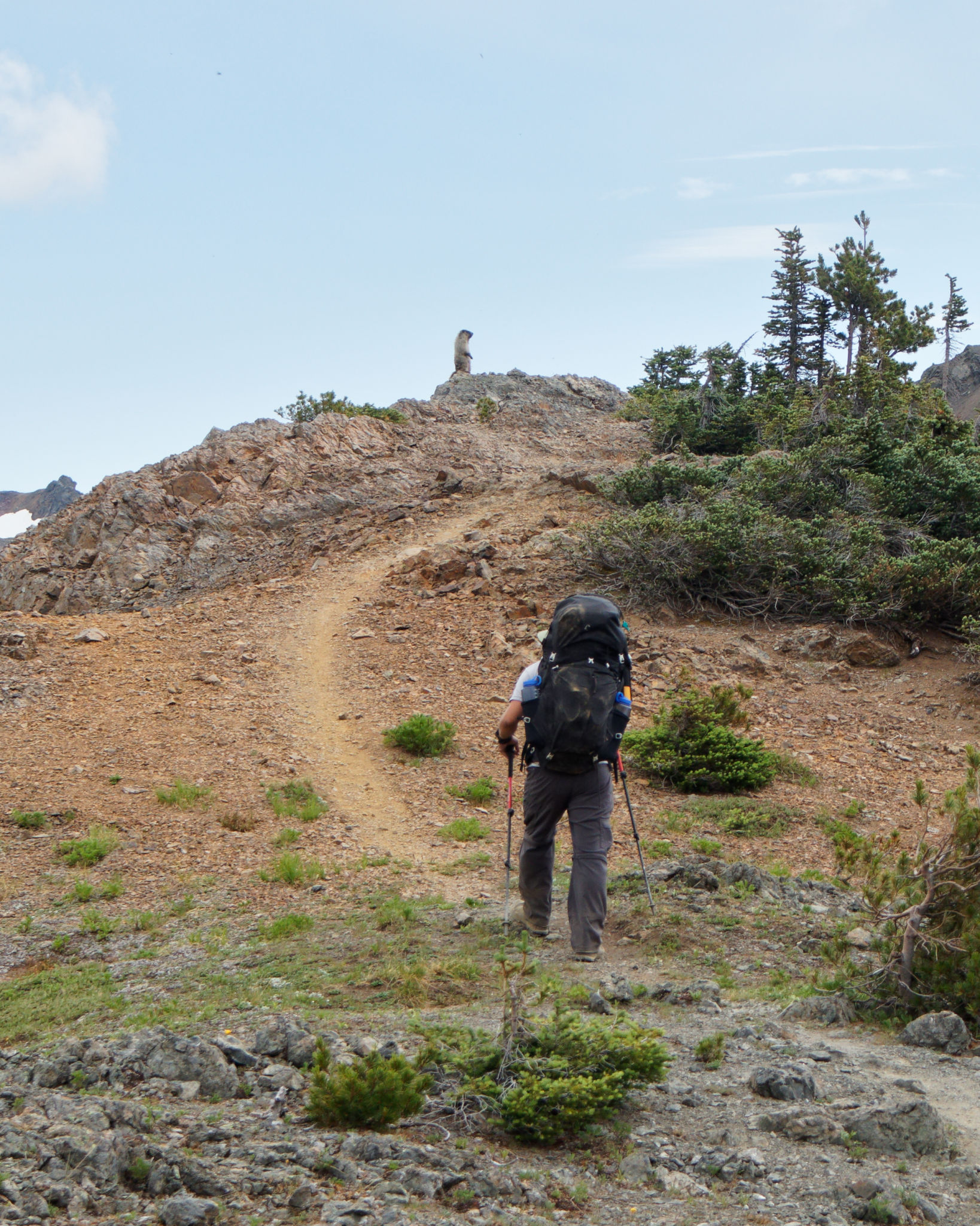
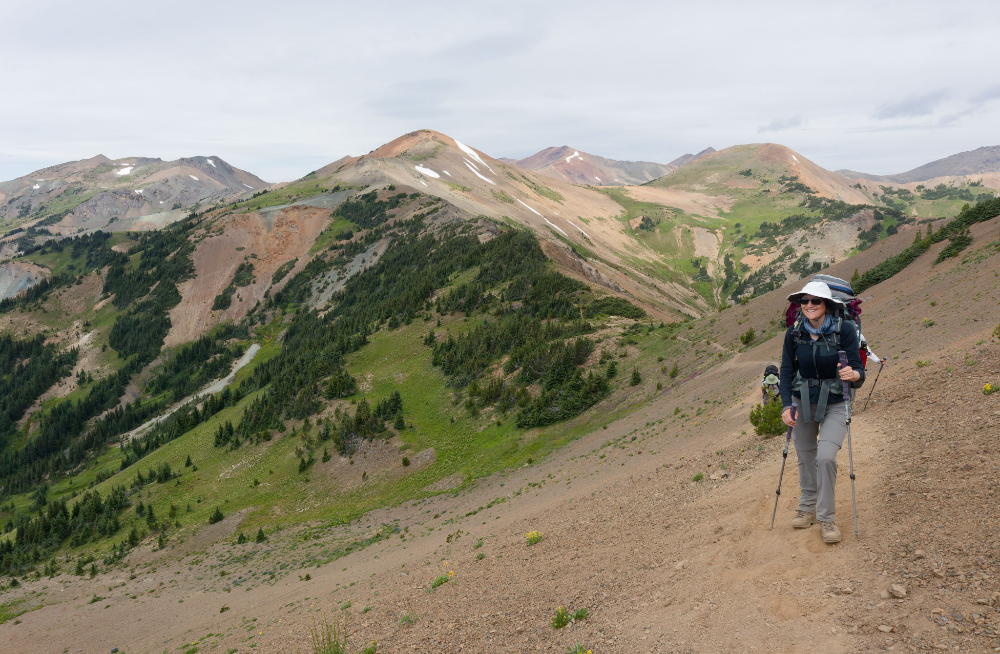
We came to a rocky outcrop occupied by an alert marmot while we heard others whistling nearby. A raven circled the meadows below us – the first one we’d seen this trip. The ridge line led us up and down over a number of small bumps until we came to the base of a somewhat larger bump. A steep trail led up and over while another traversed its flank, rising more gradually – an option that was infinitely more appealing at the end of this long trip. We followed the narrow trail across the slope, picking up the ridge-line again and pausing momentarily to allow a few mountain bikers to pass.
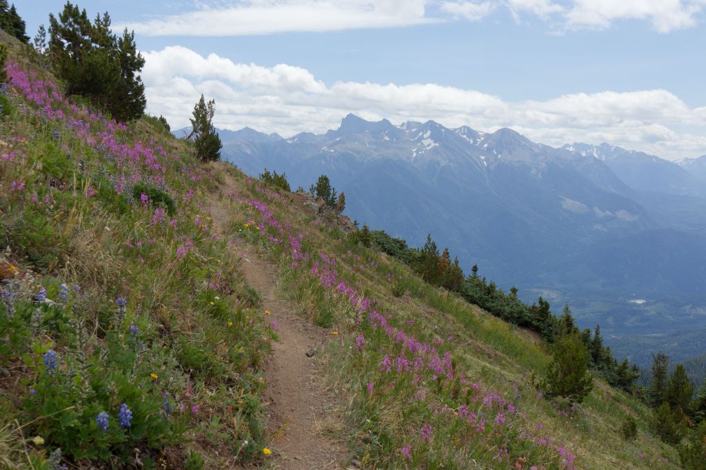
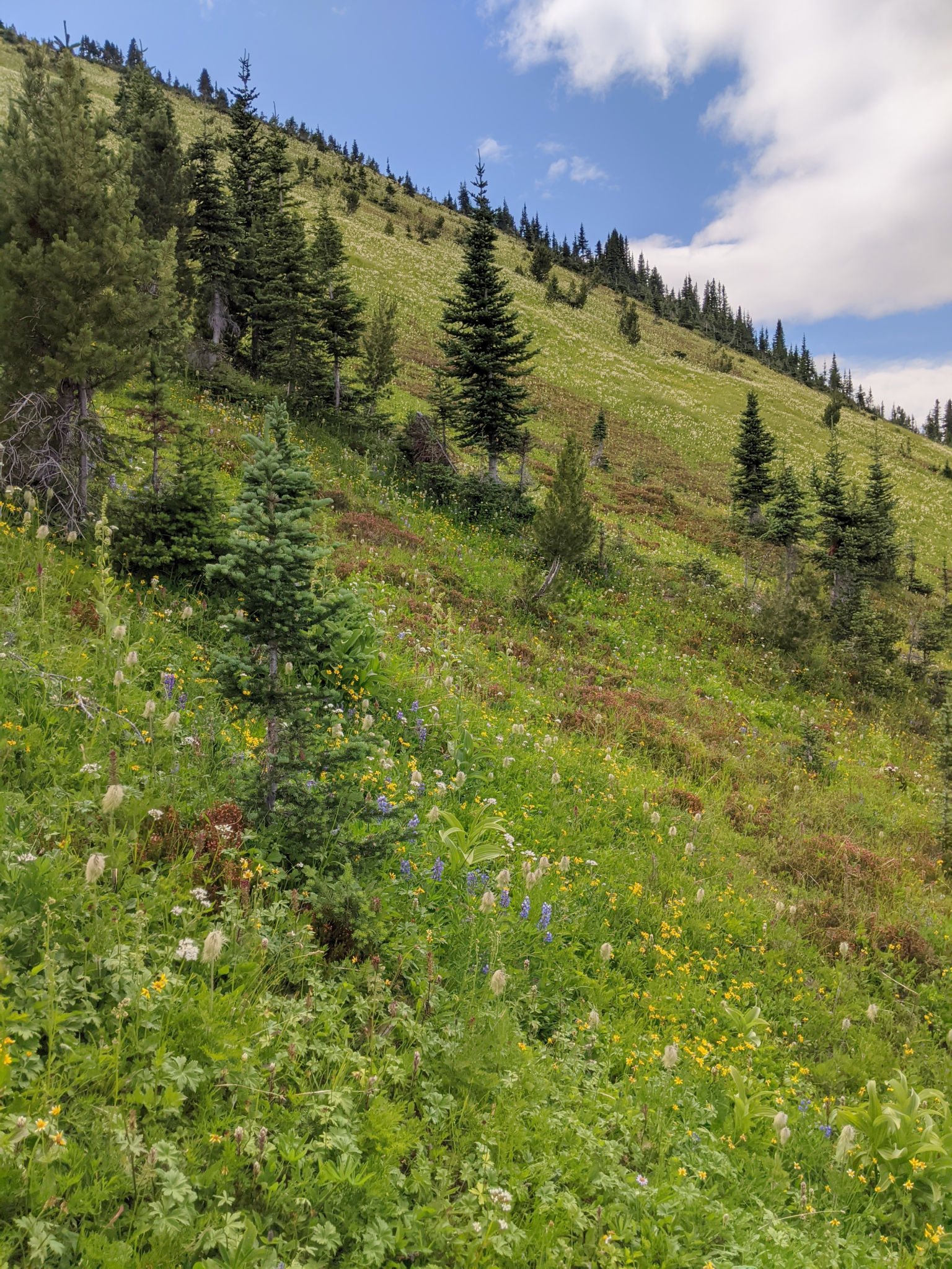
The route had a few more small bumps in store, their slopes covered in flowers such as lupine, paintbrush, and fireweed. Of course the views were spectacular – looking back we could still see Mount Sheba about 18 km away. Another group of mountain bikers caught up with us as we started another short climb and we paused again to let them pass. Like yesterday, they were a large group of a dozen or more, spread out along the ridge and took quite a few minutes to pass. I don’t understand the appeal of being in such a large group.

We reached the top of the next bump and decided it would make a fine spot for lunch. We sat with our feet dangling over rocks at the edge of the ridge, admiring the dappled sunshine in the oh-so-green meadow below. Even from this distance we could make out extensive patches of blue lupines, yellow arnica, and white valerian carpeting the meadow. I scanned for signs of furry movement but – as ever – saw nothing. Another movement did catch my eye and I looked up to see a bald eagle fly past not much higher than we were. I say fly but really it just soared on the air, not flapping its wings even once. I followed it as far as I could before it crossed into the next valley and disappeared.
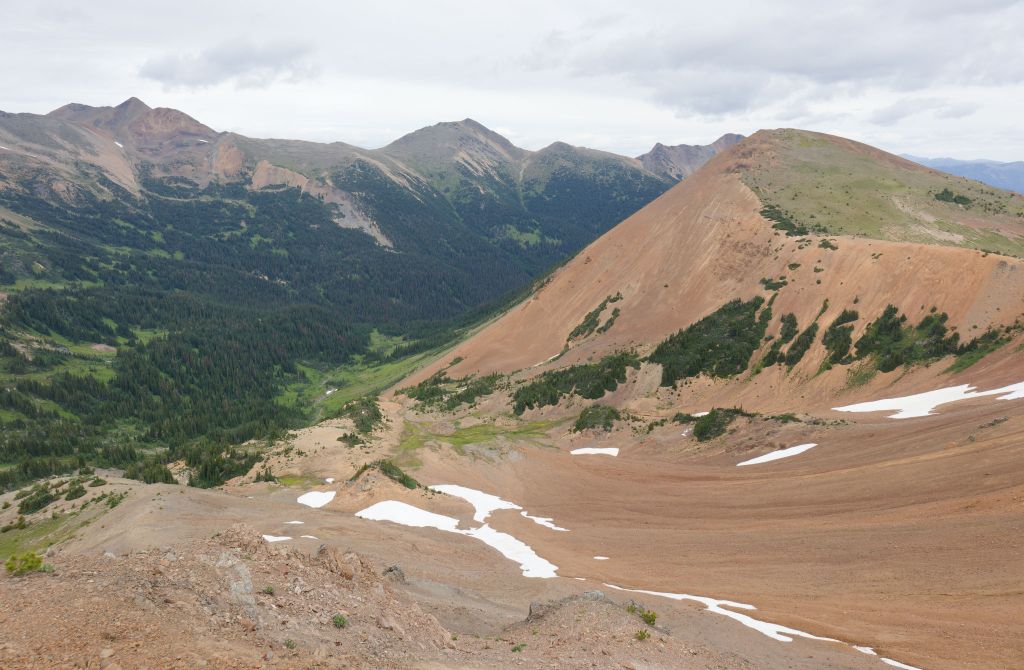
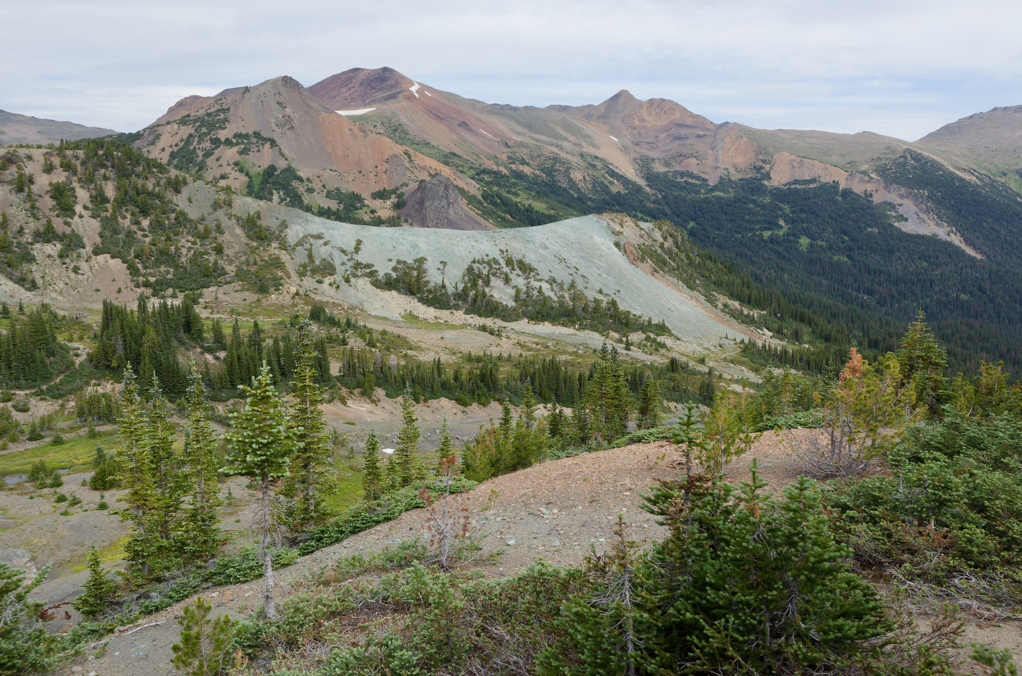
Moving on after lunch, we walked up a small gully or valley that looked to have been excavated by mining and topped out on the ridge at the head of the North Cinnabar drainage, joining the path we’d hiked back in 2018. Here, we had a decision to make: do we descend into the meadows (only to climb up to the shoulder of the ridge again) or do we continue along the ridge and traverse the south rim of the basin? It wasn’t a hard choice. The day was fine and we were loving being up high with the limitless views offered by our ridge hiking.

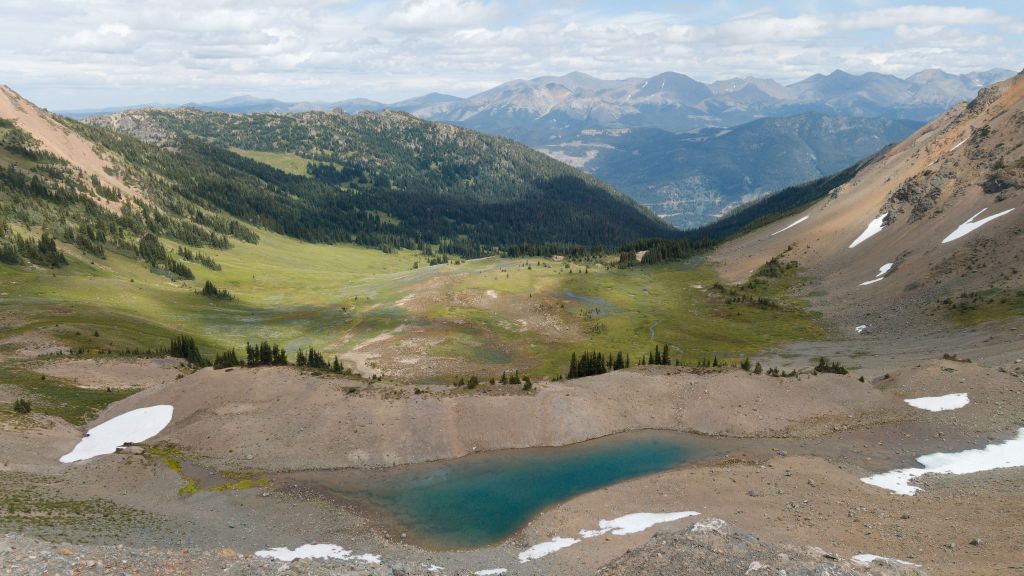
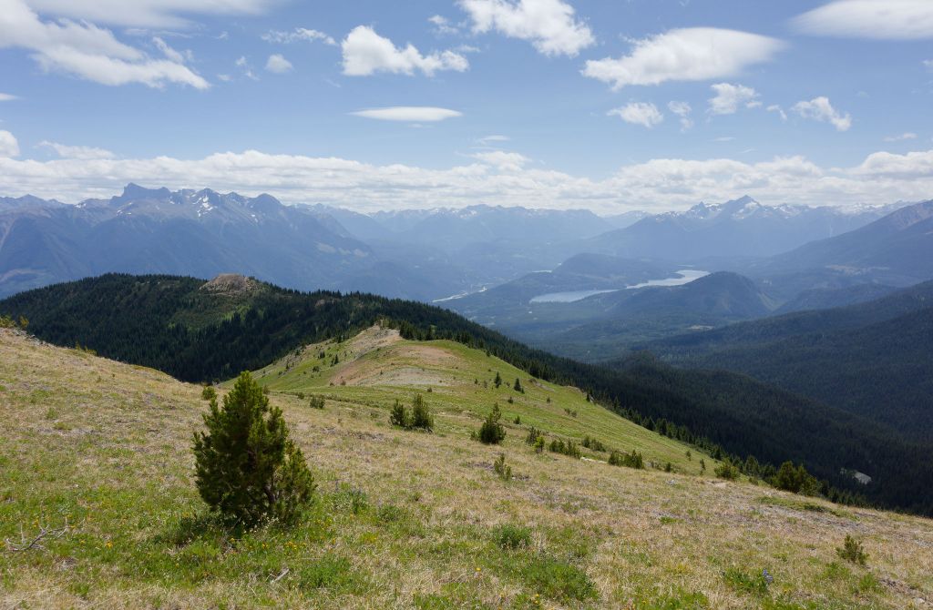

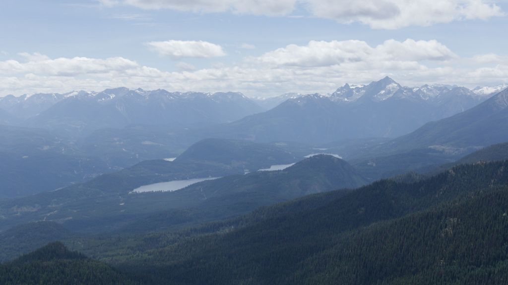
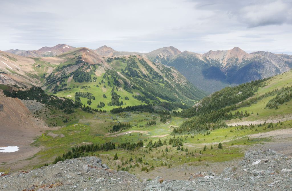
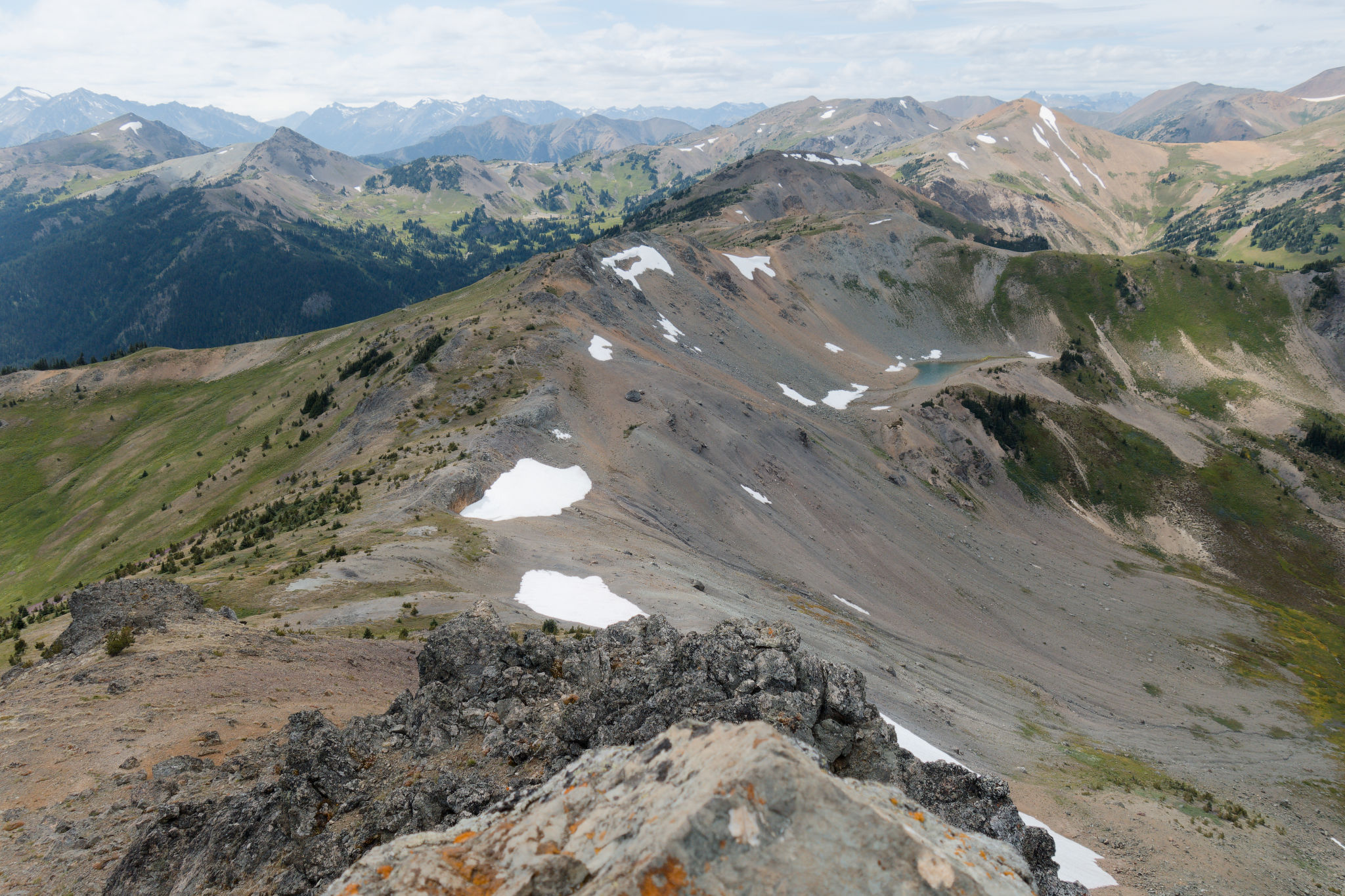
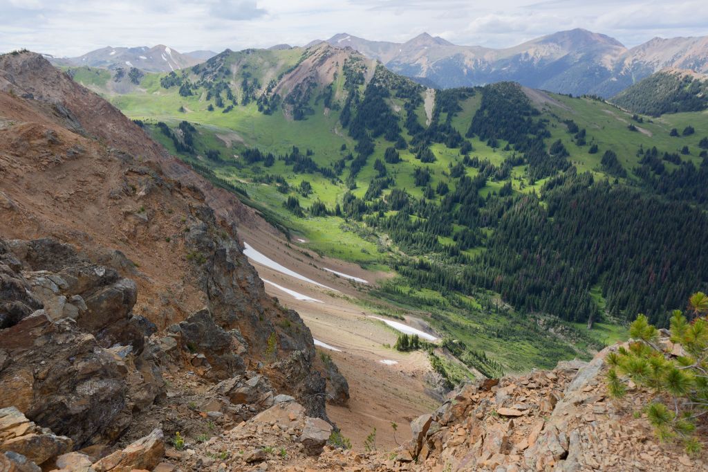
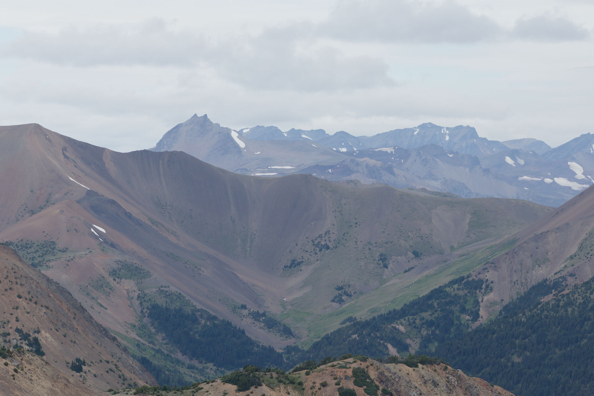
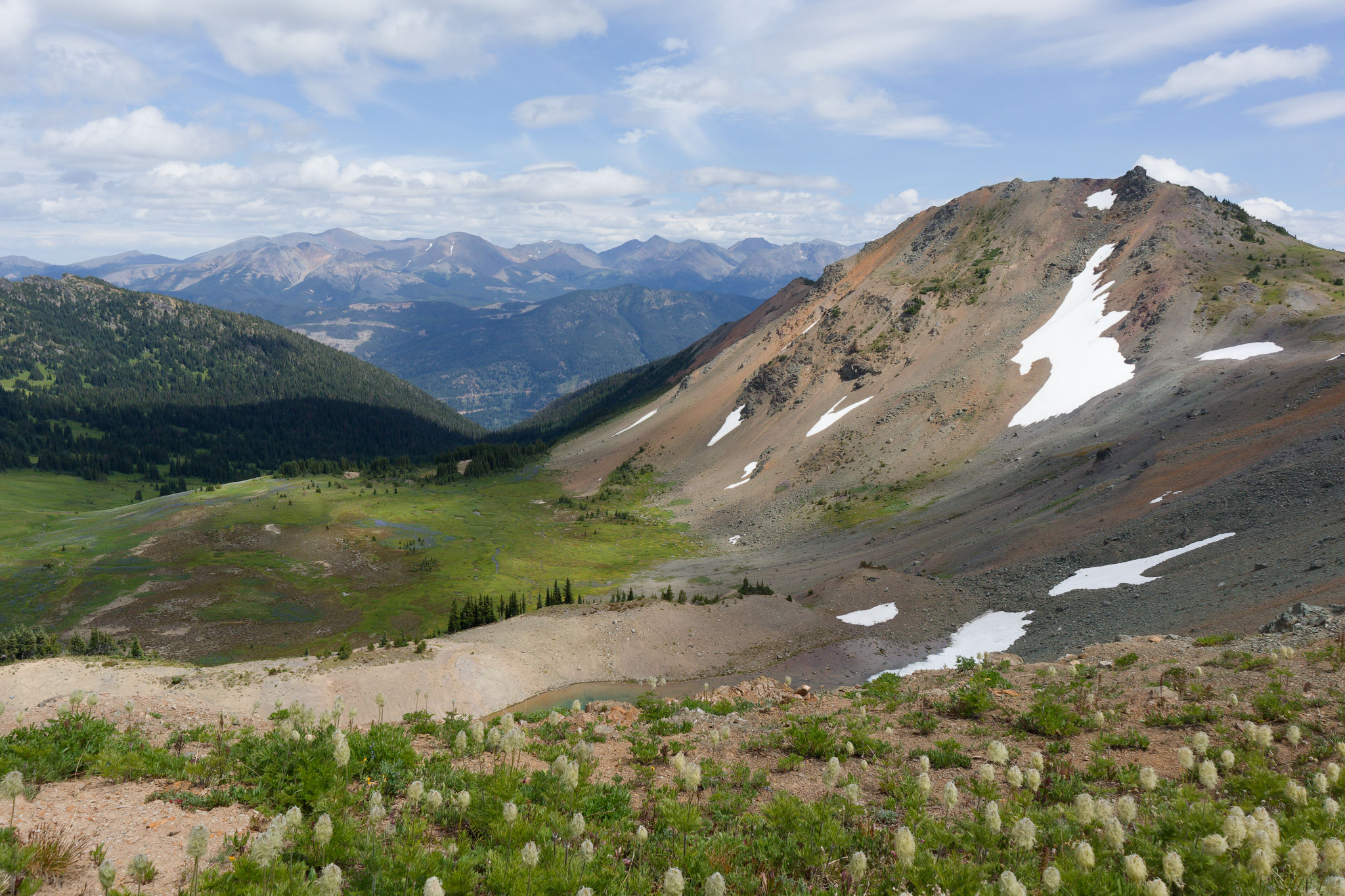
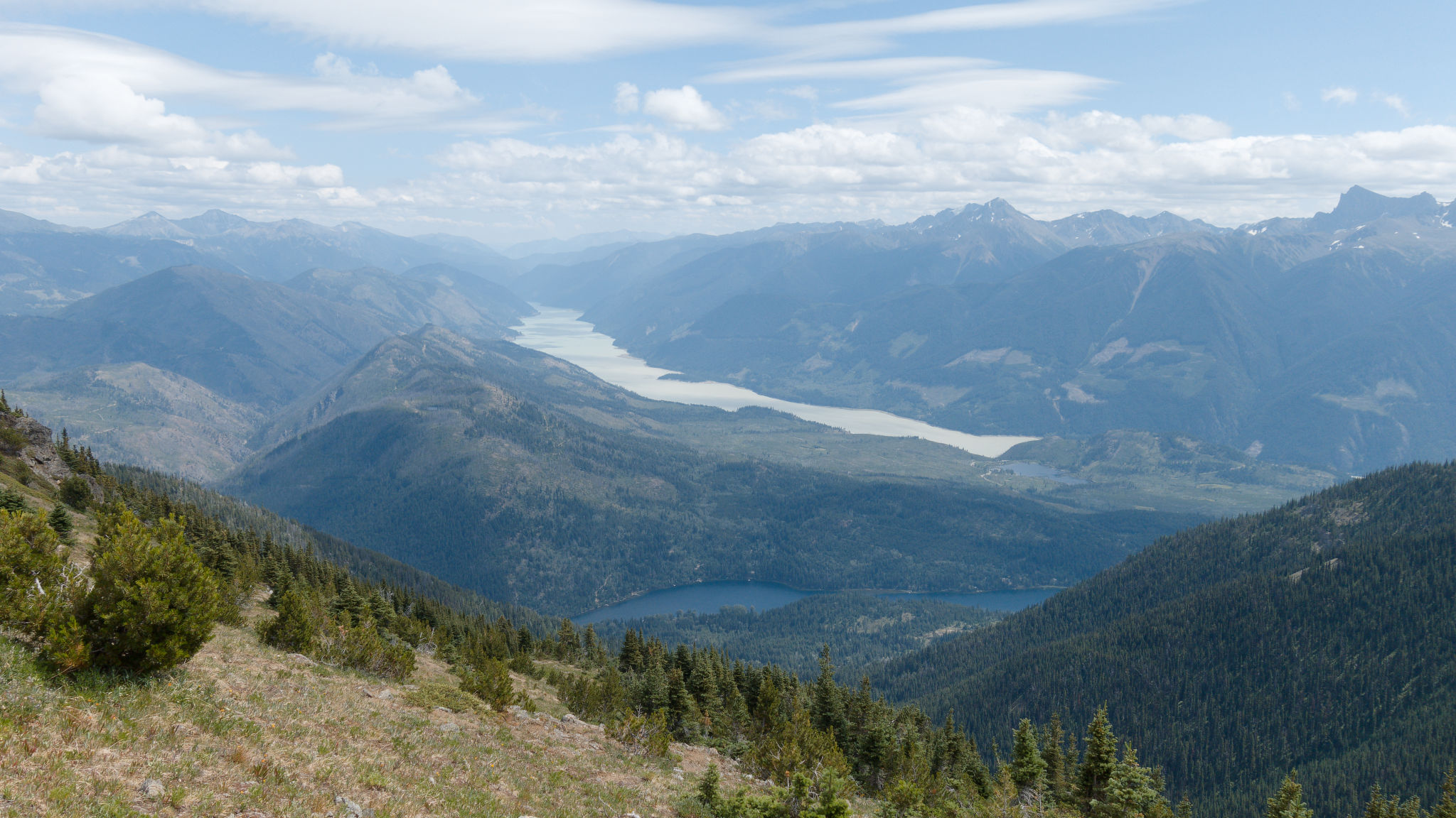
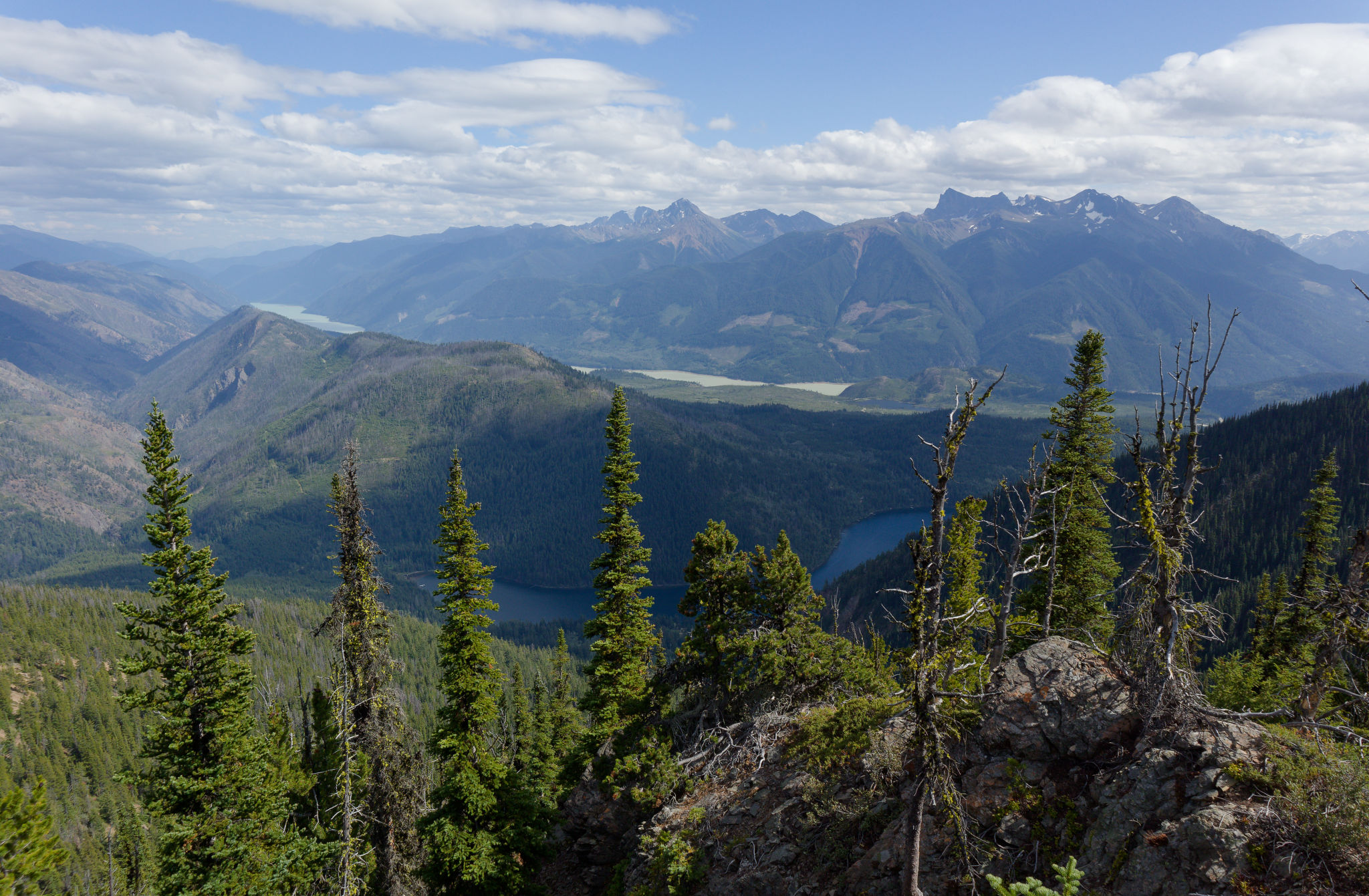
Despite the easy decision, part of me would have loved to walked through the meadows down in the valley again, and to create our own GPS track of the path we lost on our first day in the South Chilcotins. I consoled myself with the stunning views down into the valley and across to Gun Lake and the mountains beyond in the opposite direction. We followed the easy trail past the old mining track on which we descended into the Pearson Creek valley in 2018 and began traversing the south-facing meadows. These expansive verdant meadows stretched down to the treeline far below and were such a surprising contrast to the craggy, ice-plucked north face of this part of the ridge. The turquoise Carpenter Lake came into view, dotted with wonderful cloud shadows. Lenticular clouds graced the skies to the east, testament to the high wind that had been our ever-present companion since reaching Deer Pass.
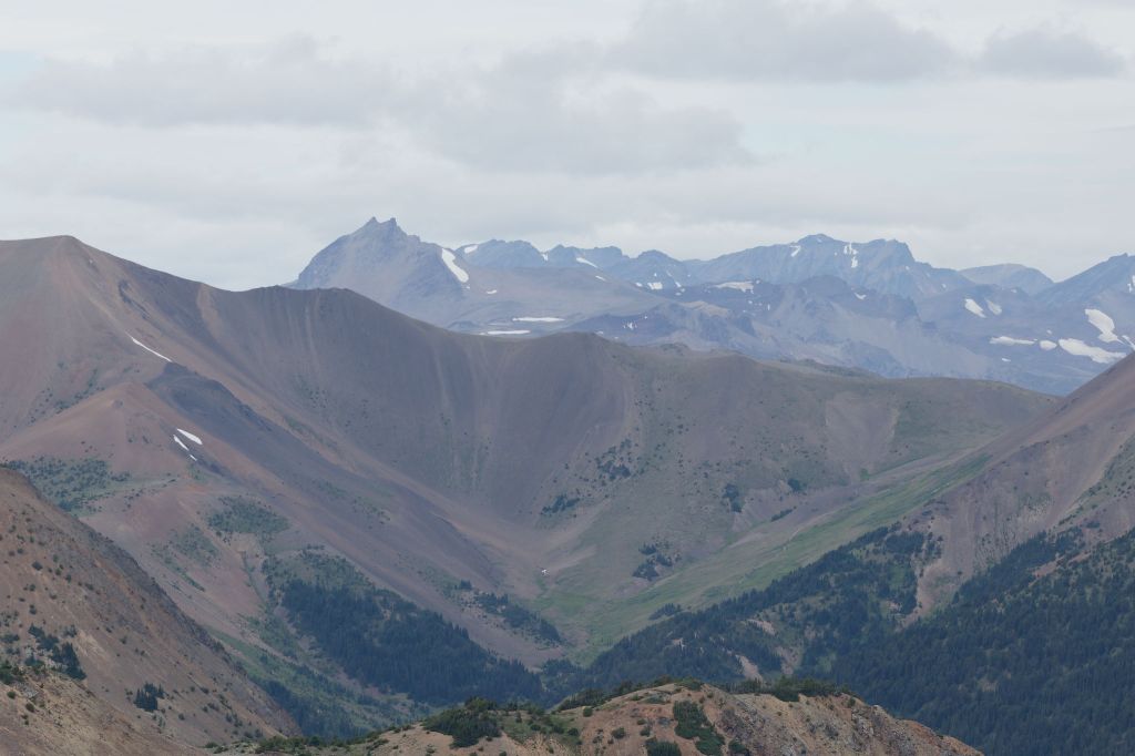
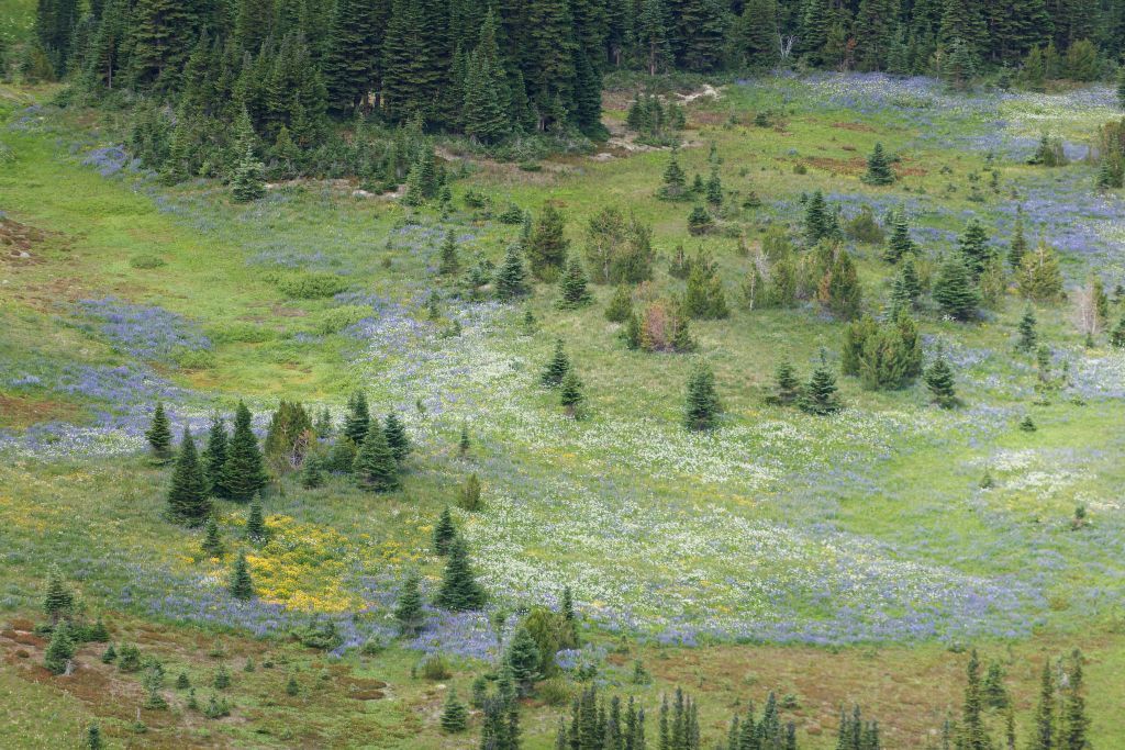
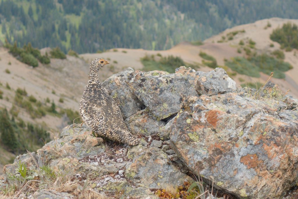
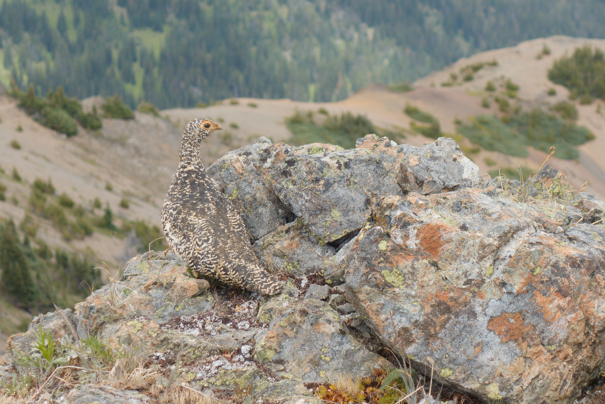
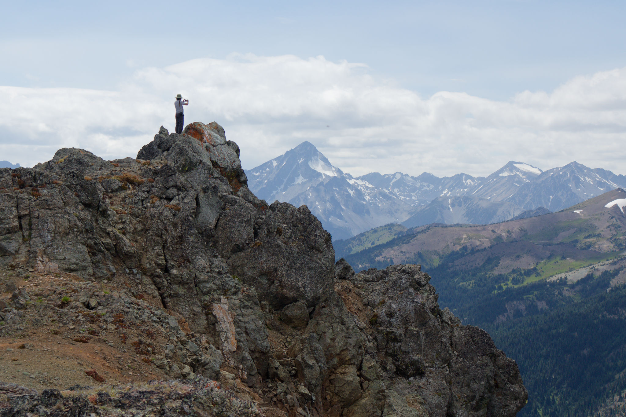
We followed a well-defined trail across the meadows, climbing up towards – though not directly on to – the ridge, gradually skirting the high point to meet the ridge line further round. Now we got a different view down into the North Cinnabar valley! We scrambled up to the small, airy summit of the ridge on our left to take in the wonderful 360-degree views, startling a female ptarmigan and her five exceptionally-well camouflaged chicks. We took a couple of photos in the direction of the chicks, and even with the ability to zoom in, it was hard to find them in the pictures! We lingered on the top to savour the prospect before us, knowing that it would be our last summit of the trip, and only reluctantly picked our way back to our packs to continue our journey..


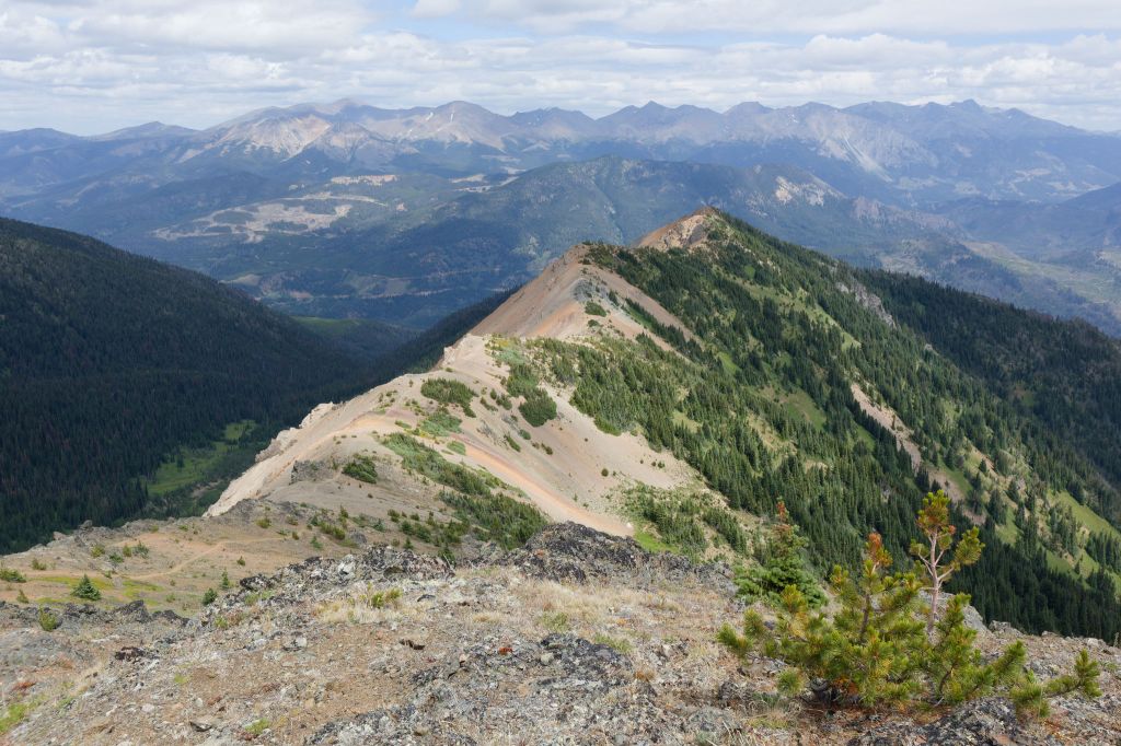
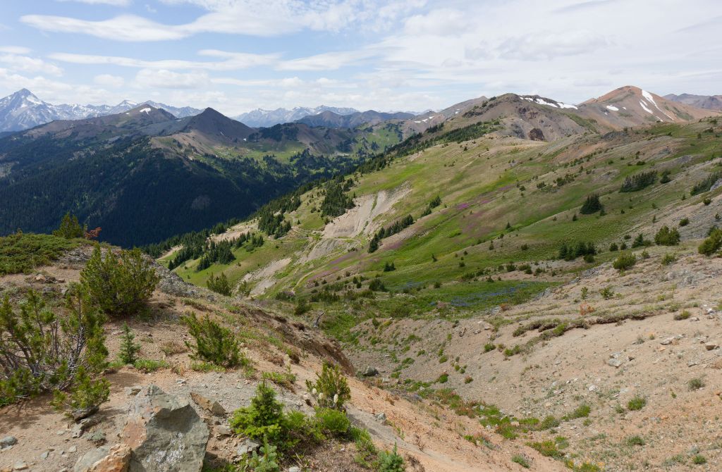
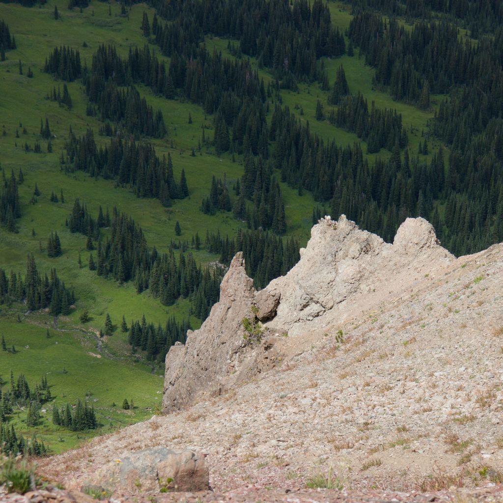
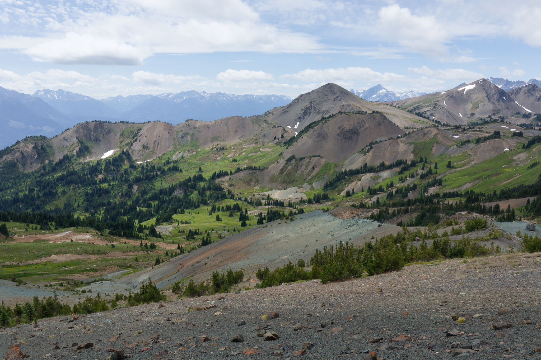
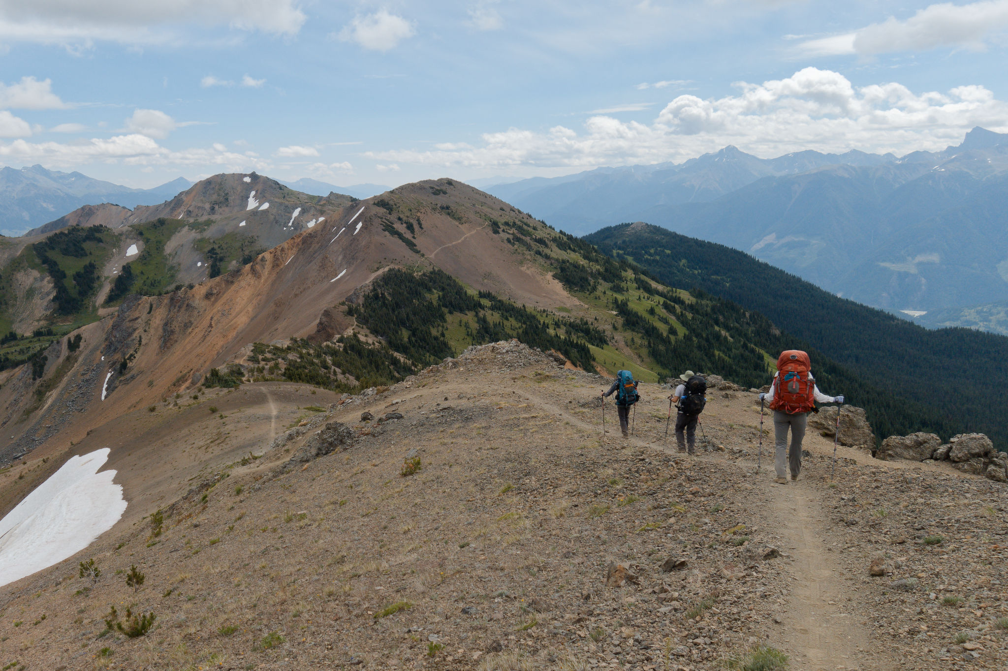
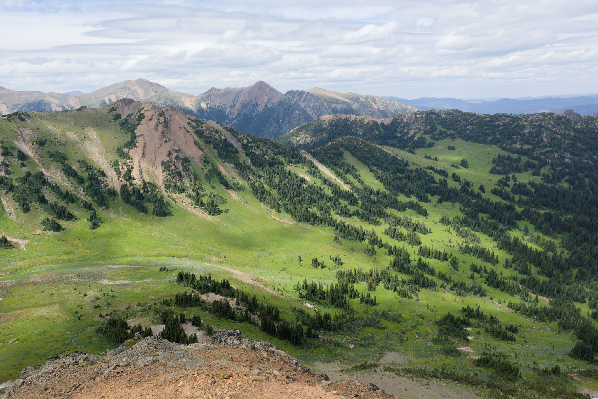
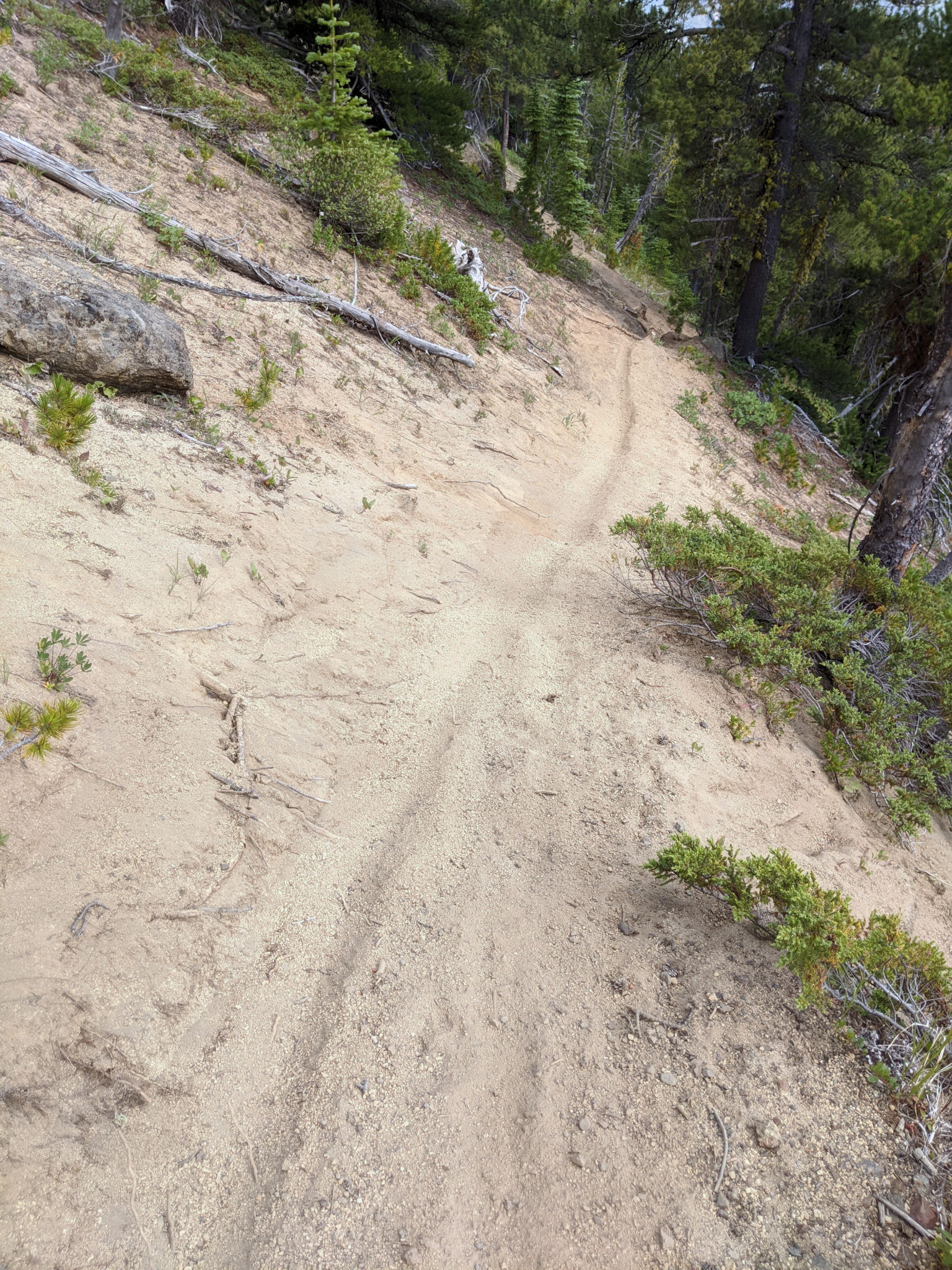
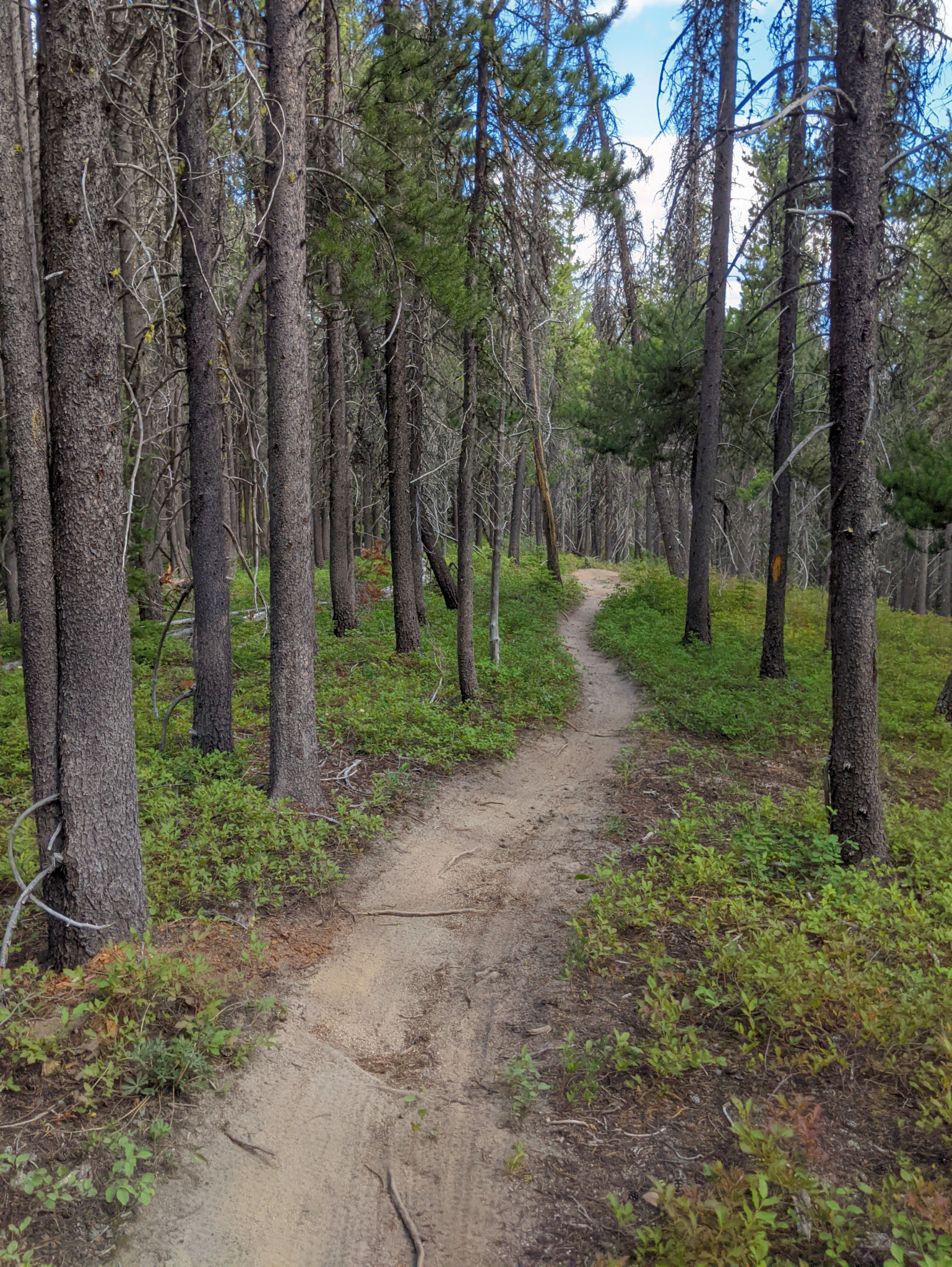
The ridge ahead of us looked fun though, with bands of different coloured rocks for us to walk over. However, the initial descent really wasn’t fun (and was a portent of things to come), with the sandy, furrowed trail having no switchbacks as the mountain bikers had simply ridden the direct line downhill. Ugh. Thankfully it soon levelled off on the main part of the ridge and we enjoyed some more of that wonderful ridge hiking that is so common here. The ground was easy to walk on, the views on either side a treat for our eyes, and we followed the trail up and over small outcrops, sometimes at the very edge of the rocky slope where a mis-step would have been – shall we say – unpleasant, and sometimes through dense groves of small pines and firs.
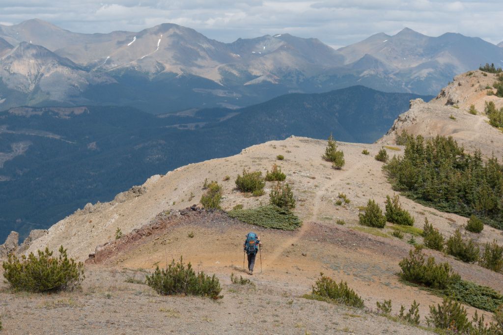

We paused at a point where the trail began descending more steeply to take in the views one last time and grab a snack. Then the real downhill began. I don’t think I’m exaggerating when I say it was probably the worst hiking of the whole trip. As earlier, the trail followed the steepest gradient straight down the slope with no switchbacks to make travel easier. I guess the mountain bikers don’t really care – at this point it’s downhill to the end. The ground was treacherously loose and we were forced to zig-zag over the meadows in a bid to not end up slipping and sliding. It was really awful. Alas, since this trail is not in the provincial park, it was forged informally by successive mountain bikers. I found it a little ironic that it was so bad, given how much effort the mountain biking community puts in to creating quality trails.
But we could not savour the irony and it did nothing for our knees, so we had no choice but to suffer. We all exclaimed at a merciful reprieve in the gradient, although it was far too short, and we were soon back to the gruelling descent, each step needing the utmost concentration and careful foot placement. We came to some flowery meadows where I hoped the trail might moderate but – alas – it continued straight down. If the Romans had mountain bikes, then this would have been one of their tracks. It seemed like such a shame to end such a wonderful hike with such a terrible experience, and I couldn’t believe that even the mountain bikers found it enjoyable. The braiding suggested that they didn’t, and it was clear that this trail was only ever used as a descent route. (I later spoke with someone who’d biked that trail and said it was horrific, so I feel somewhat vindicated.)
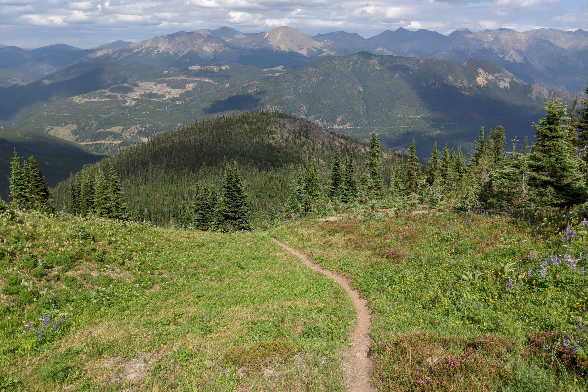


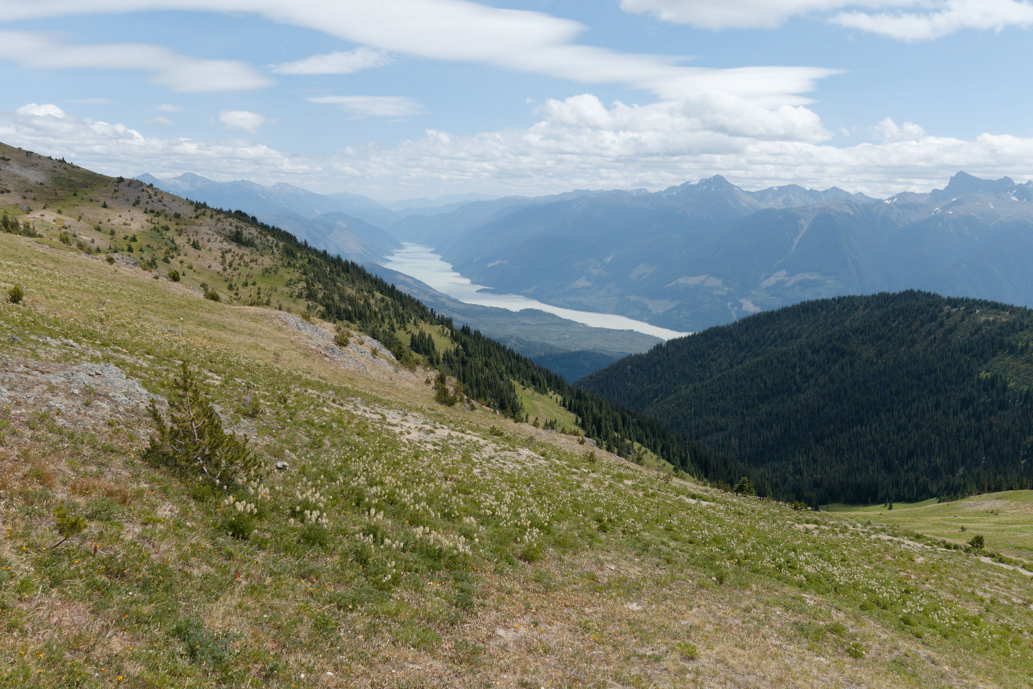
As the mountainside became more densely forested, it was hard to walk anywhere but the trail and we didn’t want to trample the surrounding flowers, dozens and dozens of aromatic lupines. To our great relief, the trail finally levelled off in the forest, punctuated by flower-filled pocket meadows – paintbrush, lupines, and even some pink monkey flower. It was a real Jekyll and Hyde experience with the awful descent yielding to the most wonderful relaxing hiking. Within a few minutes we reached a junction, left where we had descended into the North Cinnabar valley in 2018, right to continue our descent on our initial climb on that trip. We paused at a viewpoint where we could look down onto Tyaughton Lake. Down being the operative word: it was a little disheartening to realize how much elevation we still had to lose.
And so we returned to the trail, disturbing a grouse (which, for once, did not scare us) and sending its chick into a nearby tree in a blur of downy wings. A pair of mountain bikers passed us with their poor dog in tow, which looked overheated and exhausted, the owner(s) seemingly oblivious to its needs and more intent on their own enjoyment ripping down the trail. The trail began descending more steeply again, which we remembered being a hard-won, never-ending climb in 2018. But we also remembered how nice the forest was – sometimes dense, moist forest, sometimes dry, sandy forest – which distracted us a little on the steep, switchbacking descent.
It was with a blessed relief that we eventually came to the end of the switchbacks and dropped our packs for a rest, feasting on some of the plentiful blueberries lining the trail. The afternoon sun was warm, and we noticed how much warmer the air was now that we had descended. We were also cheered by the fact that we knew we were only a couple of kilometres from the trailhead.

And so we shouldered our packs for the last time. Thankfully the trail was now much nicer to hike and we made good time, even allowing for stops to sample the blueberries and huckleberries. The forest was now much more open, more like the interior Douglas fir forest with lots of low-lying bushes including the aforementioned blueberry and huckleberry, but also soapberry which, knowing it to be a favourite of bears, prompted us to make some noise to alert any furry feasters that we were not looking for any trouble and just wanted to be done hiking!
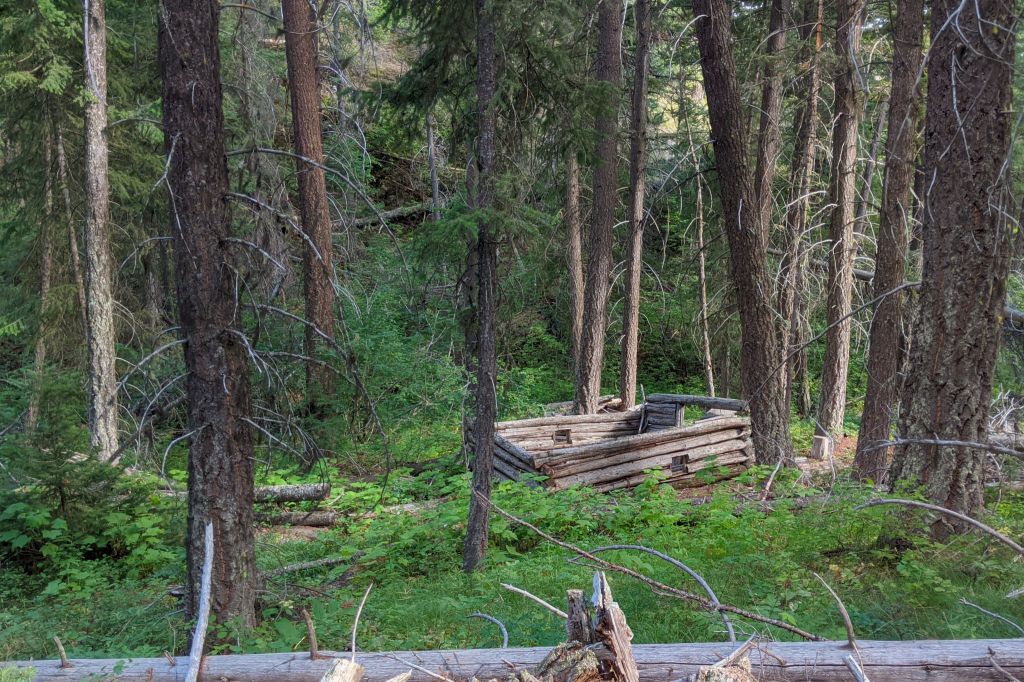
I was trying to recognize landmarks along the way to gauge how far we had left, but was taken by surprise at the sight of an old prospector’s cabin a few metres off the trail. I had no memory of seeing this in 2018! It was too far away and guarded by too many fallen trees to explore so we kept going. But now I did know where we were and – to be honest – eagerly anticipated the final section that would lead us to the road.
And there it was: the forest opened up and we joined the old ATV track, full of paintbrush, meeting the road within another minute or so. Woohoo! We had made it! Well, to the road anyway. We still had 2.5 km to get to the car, but we discussed our options and somehow came up with the idea that I should walk down to pick up the car and drive back to collect everyone else. Maria volunteered to keep me company, and we dropped our packs in the small pullout where we had parked in 2018 and bade a momentary farewell to Stephen and Colleen.
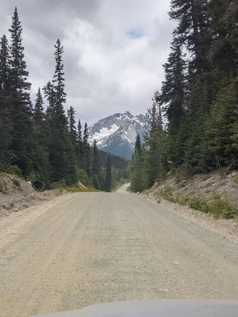
Well, it was a long old walk down that road. Even after we turned off onto the access road we still had another 1.7 km to go. Remember when I said that I suspected this would feel like a long road to walk down? I was right. It felt never-ending and we were so very glad to finally reach the car. It was intact, which was good. Next – would it start? Thankfully, yes! And so we began that strange sensation of moving faster than we can walk without expending any effort, driving back up the long hill to the road. We felt so relieved and elated at completing this epic trek across the mountain range, and were so happy to be driving rather than hiking.
Until we came to the gate at the end of the road. This gate was open when we walked down and now it was closed. No, no way – this cannot be happening. WTF? We could not believe our eyes. We’d passed a car on its way out and exchanged waves with the driver. Who would close a gate knowing that people were on their way in to collect their car? I hit the gate in frustration and then noticed something. The gate was closed, but the chain was not locked, only looped over the gatepost. Phew! Thank goodness for that! All our anger and frustration melted away in an instant and we drove through, closing it behind us again.
In the blink of an eye we were back with Colleen and Stephen to load our packs into the car. A couple of mountain bikers warned us of a bear on the trail, and although I would have liked to have seen a bear, we let them know we had just finished and were on our way home. We turned around and headed back down to the Gun Creek campground, hoping to find camping. As we got nearer, we ended up behind another car, which – to our horror – also turned into the campground. With our fingers crossed that they were not looking for a site, we followed them in and – thankfully – they drove out again, leaving us to claim the one remaining site in the campground. It wasn’t ideal, but it was good enough for us.
As we set up our tents, our neighbours warned us that this was a deer thoroughfare so we figured we’d pitch our tents as far to one side as possible to leave a passage if they needed it. (They didn’t: we saw no deer, and I suspect the deer would just use any unoccupied site to walk through.) But that was for later. Now, the most important thing was to sit down and crack open a very well-earned beer. Oh that tasted so good! Colleen and Stephen went down to the creek to freshen up, and we switched places as they returned. Now we could contemplate some food, and only once we were fed did we bother setting up our tents, just as darkness fell. The night was mild, warm even, and we sat out awhile, relaxing and unwinding and reflecting on the past 8 days. Even the bugs left us alone.
We had done it. Another successful trip into the South Chilcotin mountains where we had walked almost 68 km from one side of the provincial park to the other (with another 20 km in side-trips) and climbed half the height of Mount Everest. It was a trip with many epic moments, along with a good number of challenges; challenges we hoped we would learn from for our future trips. We celebrated a hike well-hiked and crawled into our tents.
I sat up a while longer to finish writing up my notes by headlamp, the night still pleasantly warm and the creek far enough away to provide a pleasing background; not too loud, not too urgent. As I finished, my eyes began to close and with that usual trip-end mix of sadness and relief, it was time to zip myself into my sleeping bag for one last time.
Epilogue: Day 9, 25 Jul 2021
Driving home, good food, and reflecting on a fantastic week
I’m lying here in the tent, the sun just peeking above the mountains, listening to the sounds of this warm Sunday morning: chickadees, ravens, a nuthatch, and the distant creek. It was warm enough overnight to leave the fly tied back allowing the faintest of cooling breezes to flow through the tent. I had got up at 3:30 am to visit the outhouse (luxury!?), a clear sky full of stars, the just-past full moon illuminating the campground, bright enough that I did not need my headlamp, and still warm enough for me to be comfortable in just a t-shirt. On my way back to the tent I startled a toad.
Reflecting on the past week, I realized that, in 8 nights, we only put the tent away damp once, which was the day we left Deer Pass after the snow showers. I thought that was quite remarkable. When it came time to stir, our pack-up was easy and relaxed, and we were on the road by 9 am. The drive back to Pemberton on the Hurley FSR was quiet, at least until Railroad Pass where we counted 43 cars at the Semaphore Lakes trailhead! Forty-three?! We thought that the 24 we’d counted a week ago was high. I fear for that area; it’s definitely being loved to death. Our descent into the valley saw us pass many more vehicles on their way up, undoubtedly to Semaphore Lakes. We arrived at Mile One as they opened and we enjoyed their superb burgers and quaffed another well-earned beer, toasting our spectacular week in the backcountry. All that ridge hiking was just stunning, despite the wind, despite the sometimes difficult terrain, despite the long climbs. Truly spectacular and I’d do (most of) it again in a heartbeat.

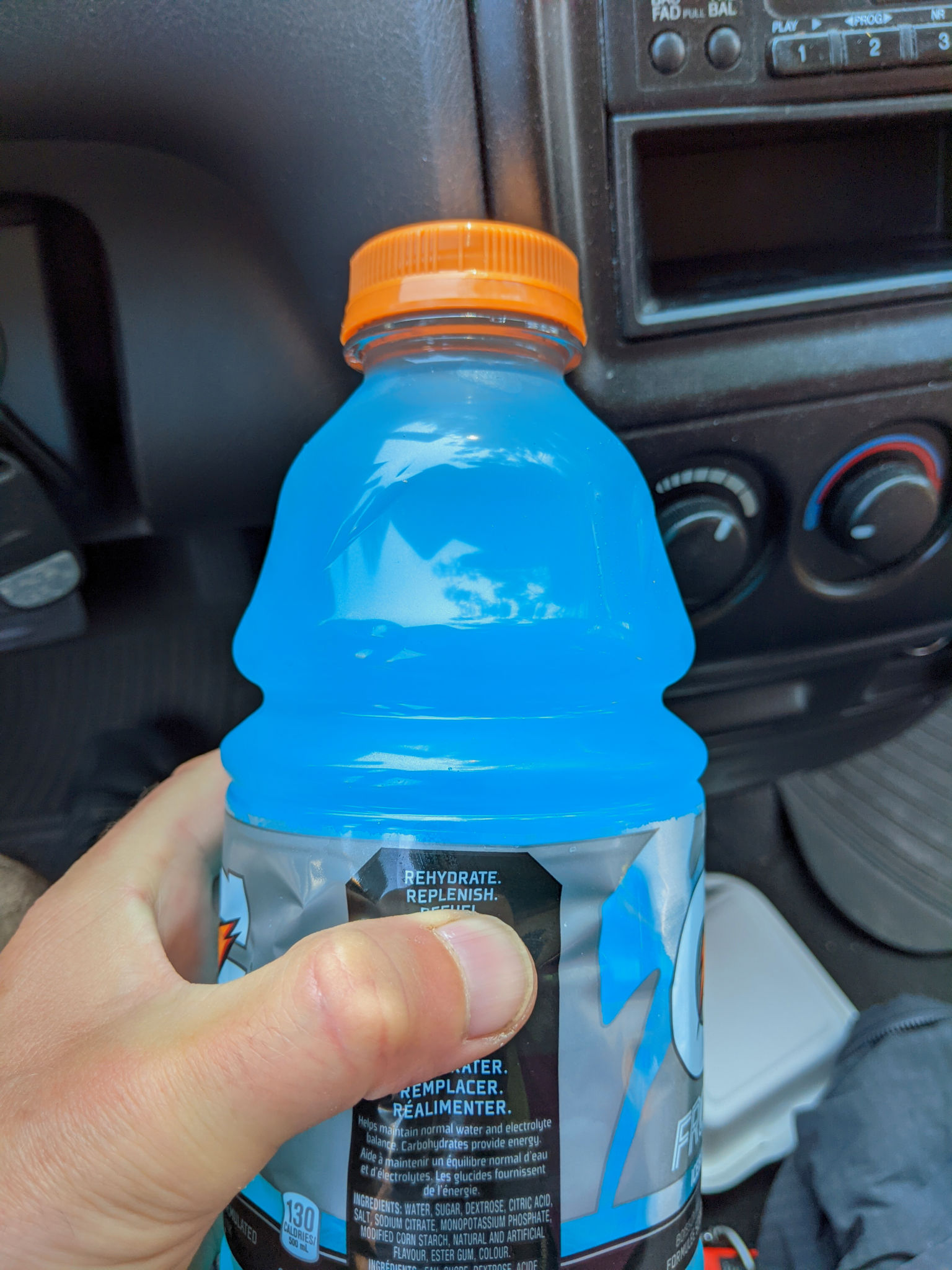
Then it was back down the Sea to Sky highway with a bottle of Lorna Lake-coloured gatorade to cool us off. The drive was – thankfully – pretty quiet for a Sunday. Back in Vancouver, we dropped off first Colleen and then Stephen. As the group shrank, the reality of the trip ending sank in a little deeper. Seeking to prolong it just a bit more, we called in for ice cream on our way home. All too soon we were pulling into the underground parking where we unloaded the car, took our grubby gear upstairs, and dumped it all on the balcony. We’ll sort it out later. For now, it’s time for a shower!
Eight days in the backcountry. I could really get used to that.


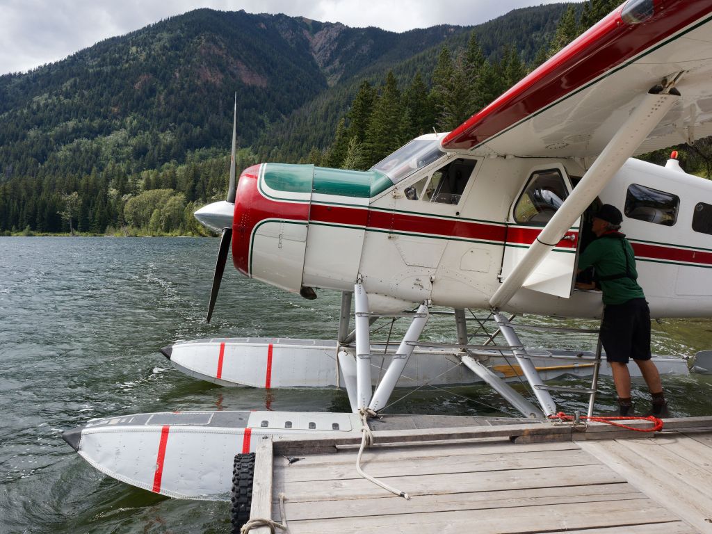
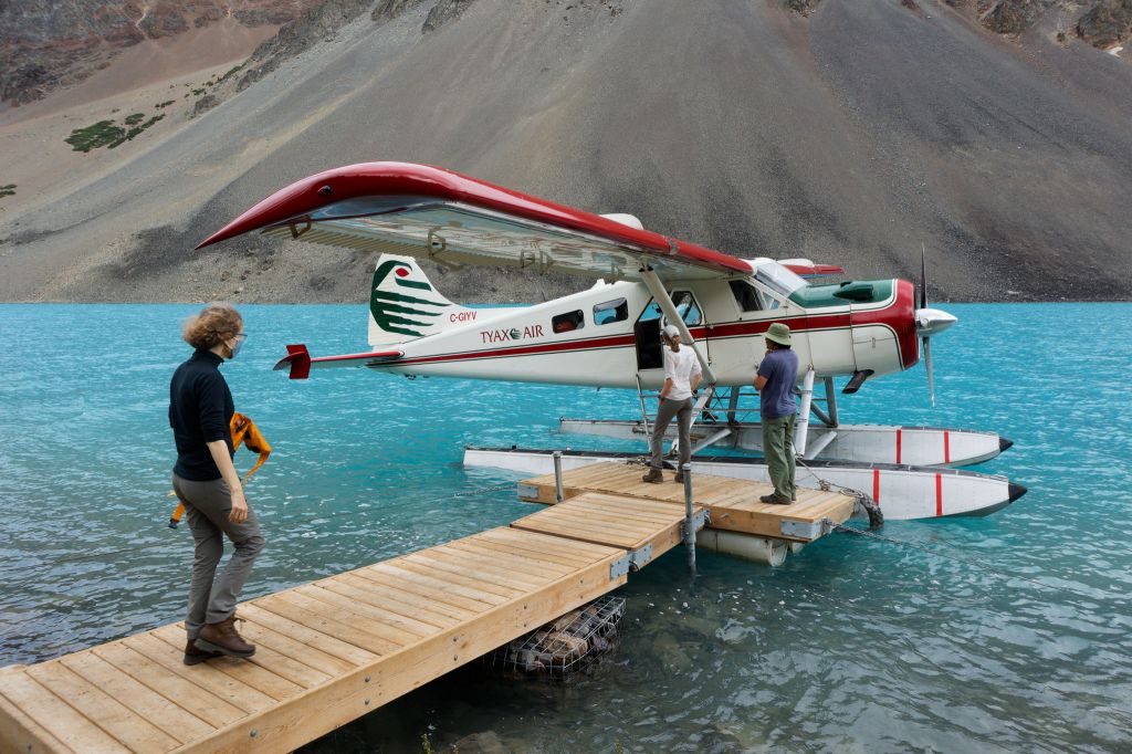
Postscript – the sad demise of the floatplane, C-GIYV
It was with great sadness that we learned of the crash in July 2022 that destroyed the plane we had flown in to the fantastic blue Lorna Lake; the red-and-white de Havilland Beaver with callsign C-GIYV. Thankfully there were no fatalities, although it meant that the trip we had planned – to visit Lorna Lake again only a few weeks later – had to be re-jigged to accommodate a helicopter drop-off and pick-up at a different location. It all worked out well for us (mostly – not everyone enjoys the quirks of helicopter flight) and, possibly, led to an even better trip. (We spoke with another friend who had flown out on that plane a few days earlier and had wondered about the sudden absence of floatplane traffic.)
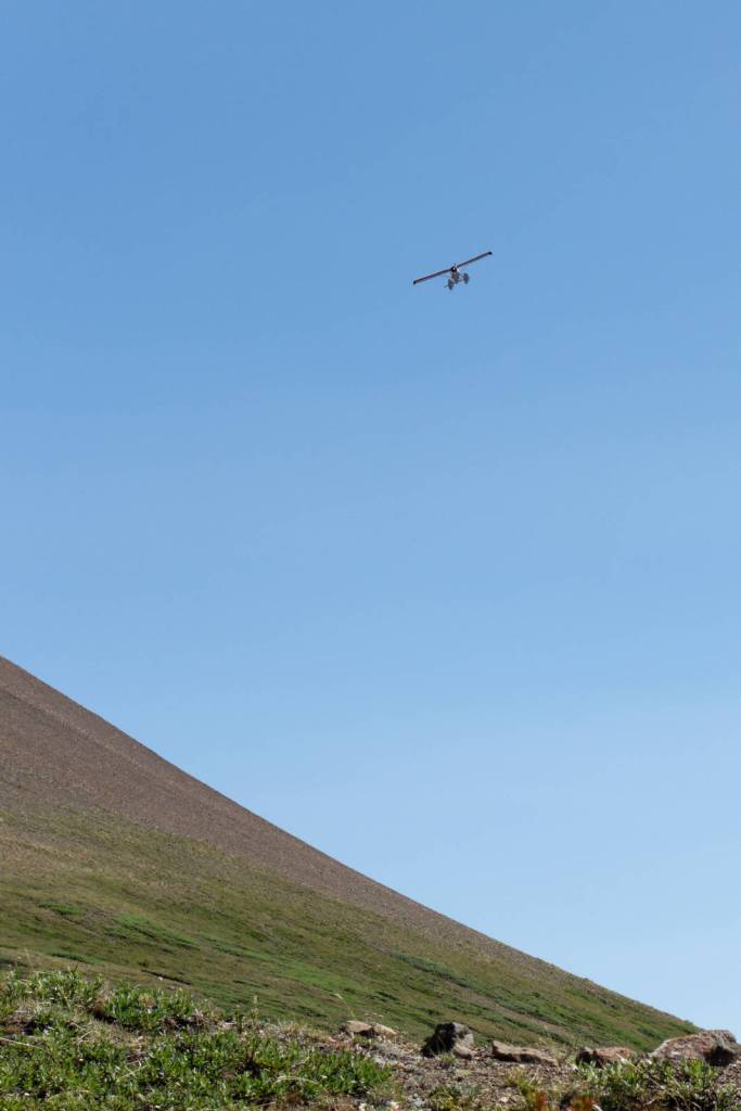
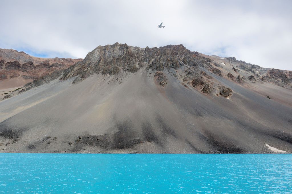
As we skirted Elbow Pass – the site of the crash – on the fourth day of that trip, we kept our eyes open for any signs of the wreckage, but it turned out to be further east of where we were hiking. Not that we really needed to see it, but part of me wanted to see the terrain for myself and attempt to comprehend what happened.
I recently discovered the official report of the crash by the Transportation Safety Board and eagerly read it to understand what had happened. The report does not place blame but lists likely contributory factors of flying in relatively featureless terrain in poor weather (which made it difficult to judge ground speed and height) coupled with the presence of commercial pressure to drop off paying customers. I feel bad for that pilot, especially as it looks like they were relatively new to flying in these mountains, and I really hope everyone involved made a full recovery (the report does not follow up on that). The report is available online here:
https://www.tsb.gc.ca/eng/enquetes-investigations/aviation/2022/A22P0057/A22P0057.html
I’d hate to think I’d contributed to such an incident by seeming too eager to fly even if the weather was bad, so my takeaway is to never give the impression that the flight must proceed at all costs. Maybe that’s easier done for multi-day trips though, where a delay of a day might not significantly affect the trip, compared with a day-trip where the let-down would be greater. Still – and this is easy to say from the comfort of home – safety should always come first.