
From Tyaughton Lake to Lorna Lake (flight): 48 km, +1480 m, -520 m, 26 min
The week had been full of the usual pre-trip nerves about being ready on time, packing enough food, having the right gear, and – most importantly – whether it would all fit into our packs. Friday night saw us doing the final pack-up, and after an all-too-short night’s sleep, we were up the next morning and getting ready to leave. Stephen arrived at 8:15 on the dot, and we were soon heading downtown to pick up Colleen from the Harbour Air terminal. We watched her plane land in the harbour, and nervousness finally gave way to anticipation and excitement as we stowed her gear and began our journey up the Sea to Sky highway.
Howe Sound glowed a wonderful milky glacial green, even under the heavy clouds. The summit of the Chief was enshrouded as we entered Squamish where we were greeted by heavy rain showers. As we drove through more showers I wondered if the cloud base would be too low for us to fly. We passed through Whistler, where we had our first bear sighting of the trip: a black bear on the other side of a concrete barrier, head down feasting on the greenery. Finally, the clouds parted as we descended into Pemberton where, to my relief, we could see the mountain tops once again.
We arrived in time for an early lunch at Mile One – our favourite eatery – before getting back on the road. As we neared the turnoff to the Lillooet forest service road (FSR) we saw a black shape at the roadside ahead of us. Our bear suspicions were confirmed when a car driving towards us startled it into the undergrowth, its profile unmistakable. Crossing the Lillooet River we could see how much lower it was compared with a few weeks earlier, the foliage by the water still coated in fine grey silt. The Lillooet FSR proved to be in good condition, and even the Hurley FSR wasn’t bad, just bumpy on some of the switchbacks and steeper sections. Thankfully the car showed no signs of overheating like it had when we drove up to hike the Semaphore Lakes trail in late June. Speaking of which, as we neared Railroad Pass we noted a few cars parked on the road near the Tenquille Lake access and then were staggered to count 24 at the trailhead for Semaphore Lakes. Twenty-four?? On a Saturday lunchtime? Yikes…
Once over the pass, the descent was easy, just the usual bumpiness. We paused on the bridge at the waterfall next to the road for a moment before completing the drive into Gold Bridge. Fireweed grew in abundance at the roadside, a striking difference to previous years when all we saw was paintbrush. We called in briefly at the Gun Creek campground to check it out and to stretch our legs for a moment, and were greeted by Saskatoon bushes laden with ripe berries that we hoovered up by the handful; our last real food for a week, it was like eating jam right off the bush. Delicious!
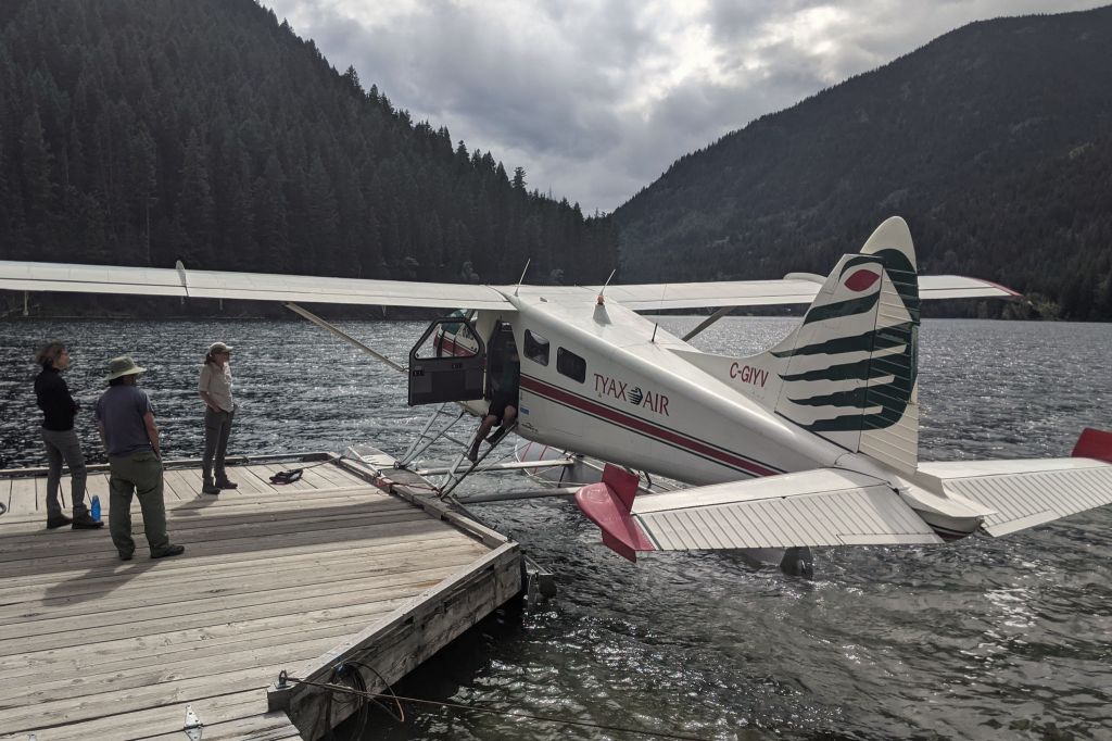
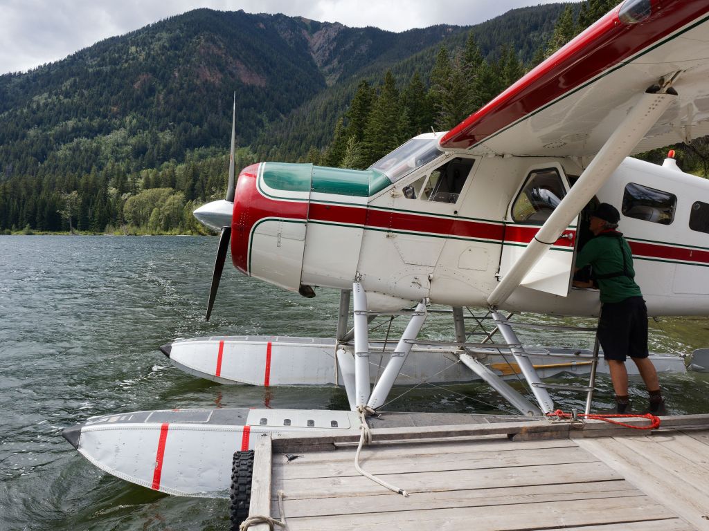
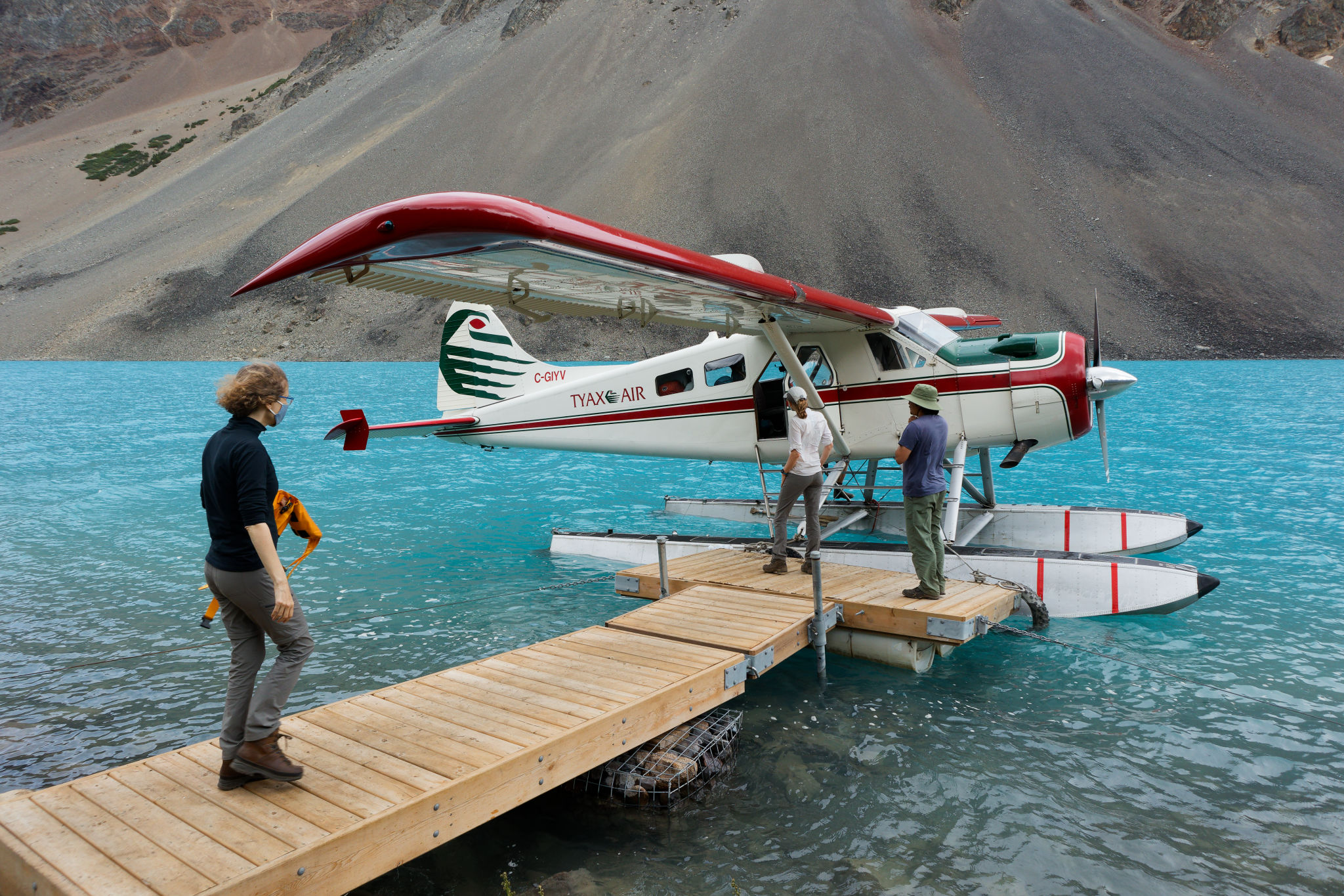
Back on the road, we soon reached the turnoff to Tyax Adventures and drove down the long single-track road to check in a little after 3 pm. (It occurred to me that this would feel like a long road to walk at the end of the trip in a week’s time…) I dropped off our gear at the dock and parked the car, while the others sorted out their packs and the pilot did his pre-flight checks. By 3:20 pm the plane was loaded and we clambered in to our seats. Somehow I got the co-pilot’s seat (score!) with Maria sitting behind me, Colleen to her left, and Stephen behind Colleen. The pilot went over the safety briefing and we strapped on our lifejacket pouches. Then it was time to taxi to warm up the engine, going around in a big circle on the lake. The wind was blowing strong and the trees were leaning in its wake, which made me a little nervous about the take off and flight. Despite the strong wind, the take-off was surprisingly smooth, and short. It felt like we were in the air only seconds after the pilot opened the throttle.
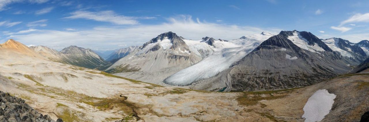
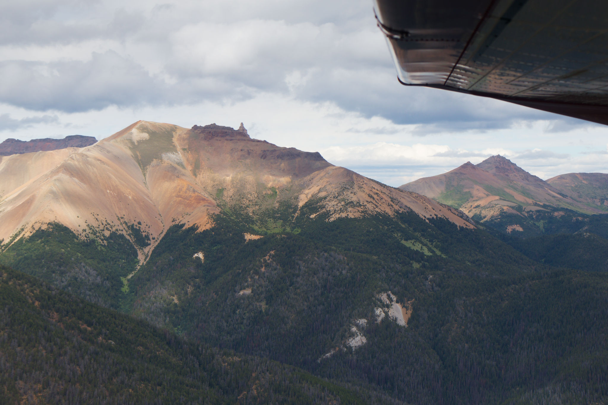
Climbing away from Tyaughton Lake, we could see all the properties lining its shore, the ground gradually receding as we gained height. Our flight took us over old logging operations, so clearly delineated from the unlogged forest, and past the steep slopes of the nearby mountains, scored with deep ravines where creeks had carved through the soft rock and layers of sediment. The plane jumped and yawed a few times as it was caught in pockets of turbulent air, a few moments of stomach-clenching drops adding to the excitement. But, by and large, the flight was smooth, and we looked out to watch the forest – I love seeing trees from above, they have such interesting shapes – and admire the colourful mountain scenery so typical of the South Chilcotins.
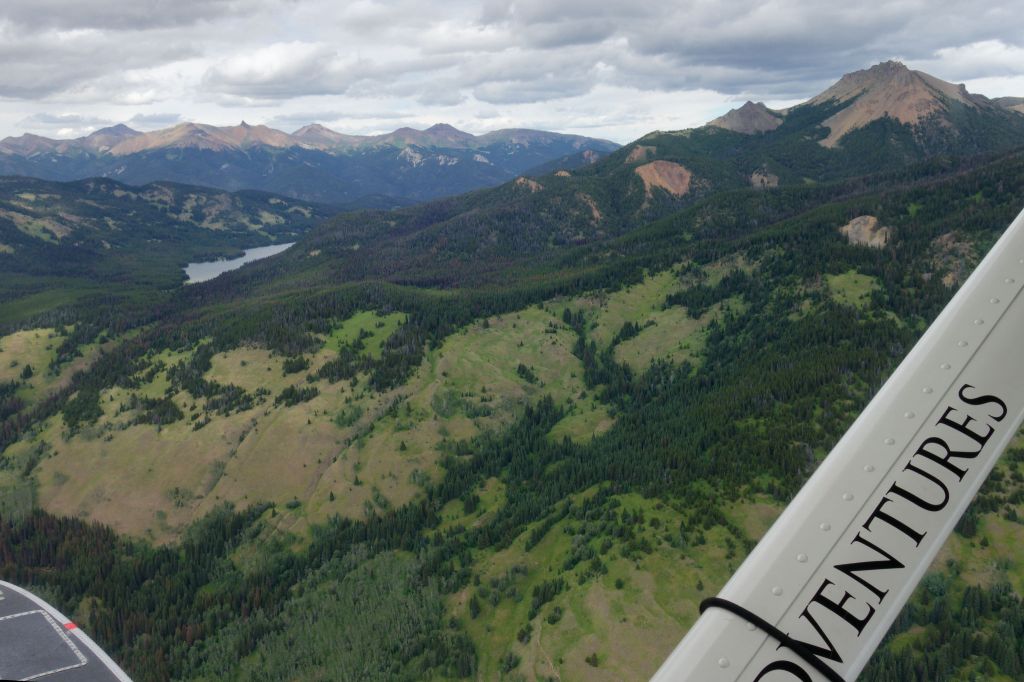
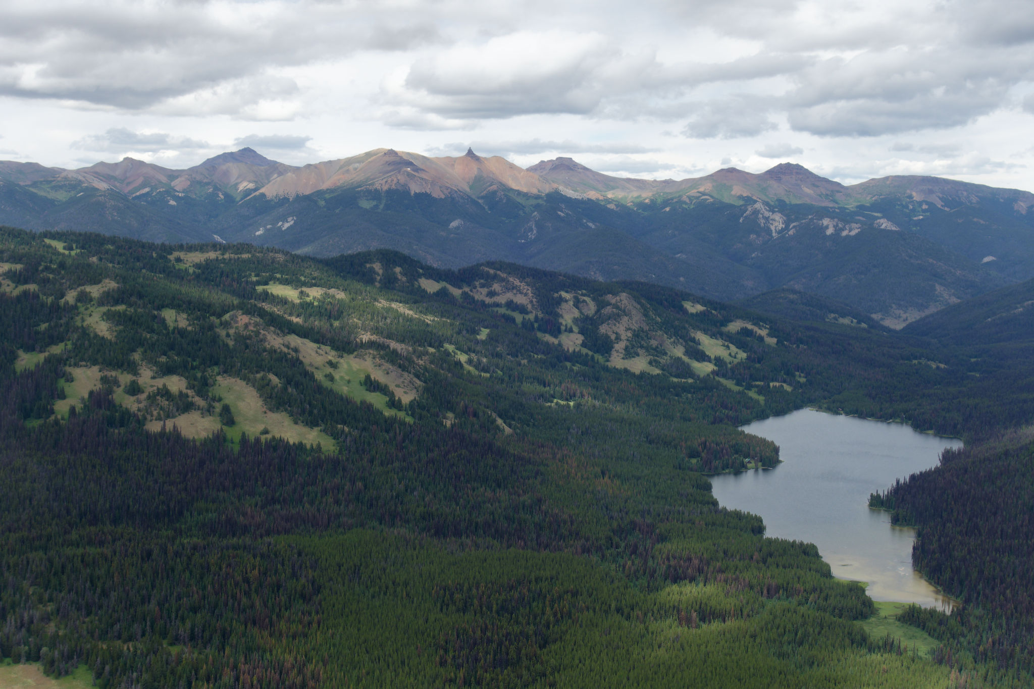

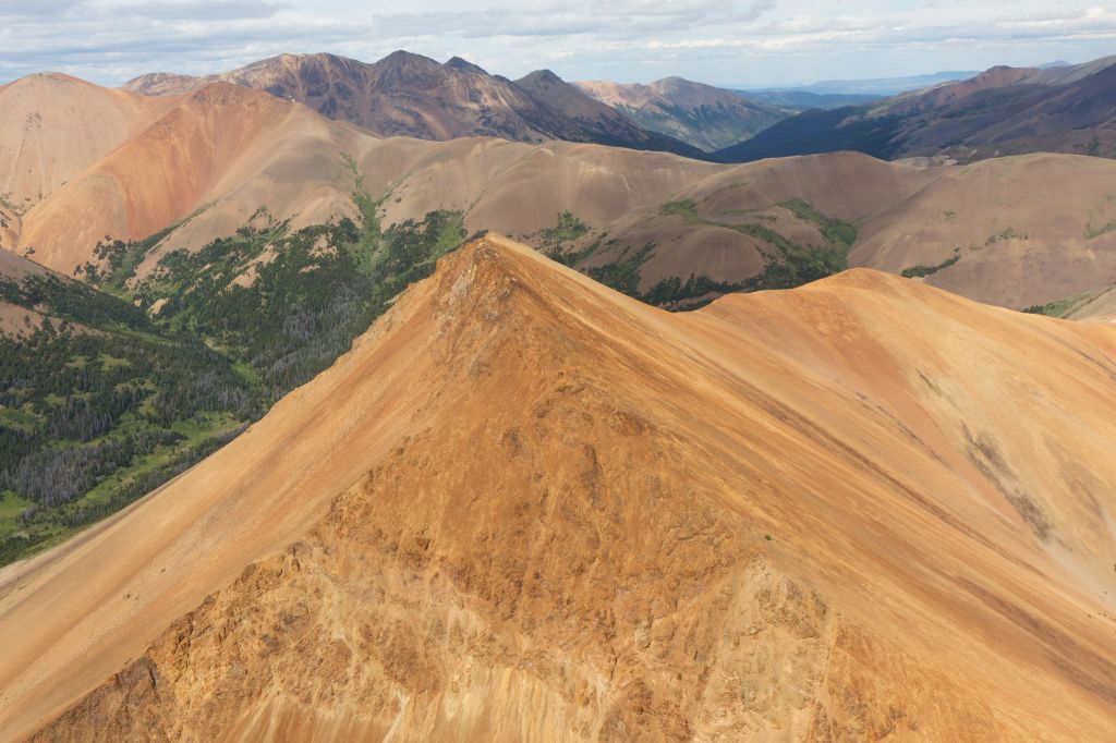
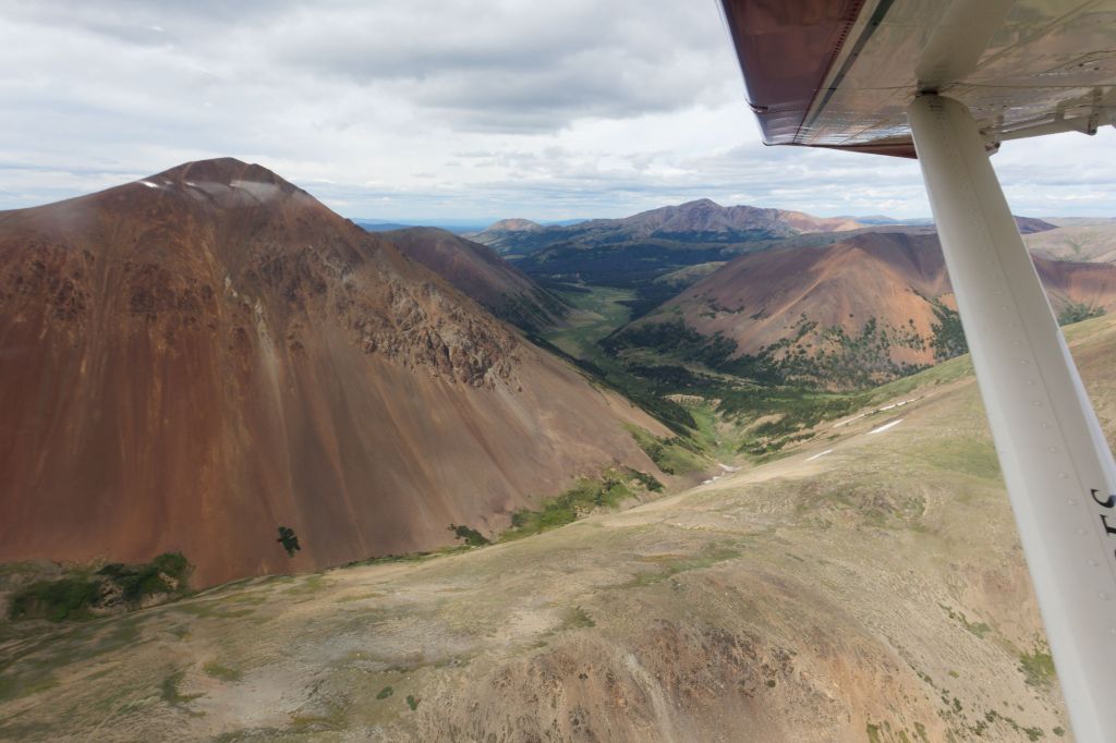
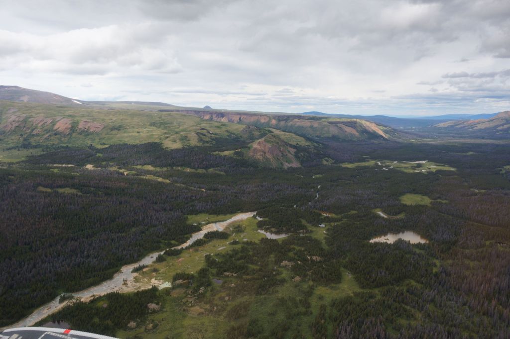
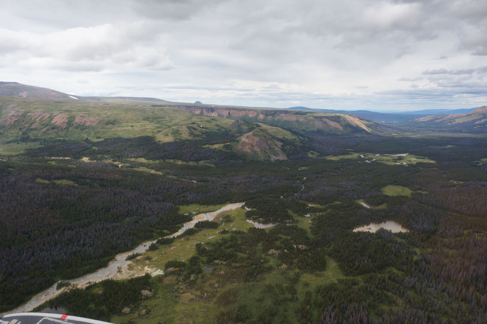
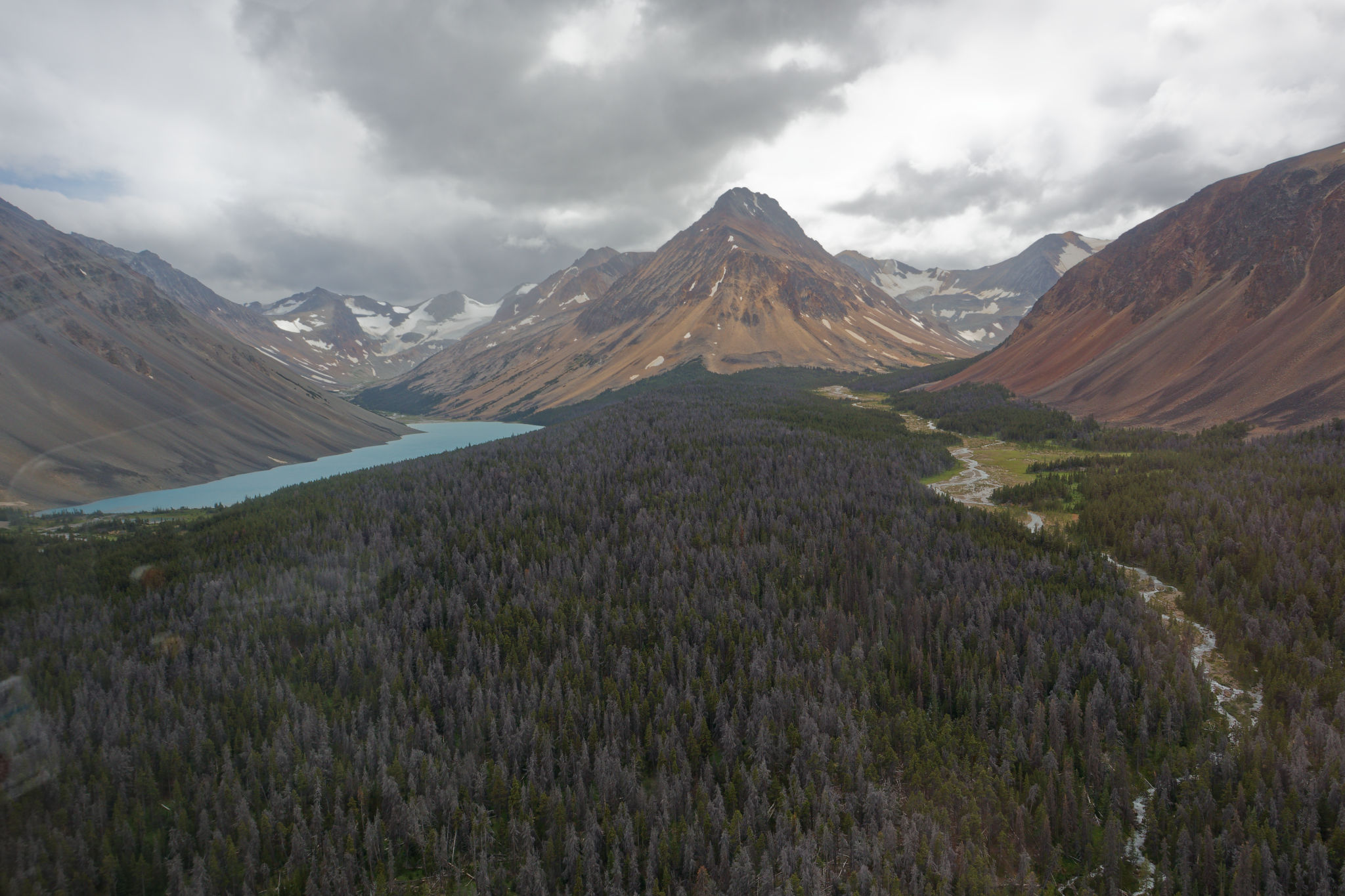
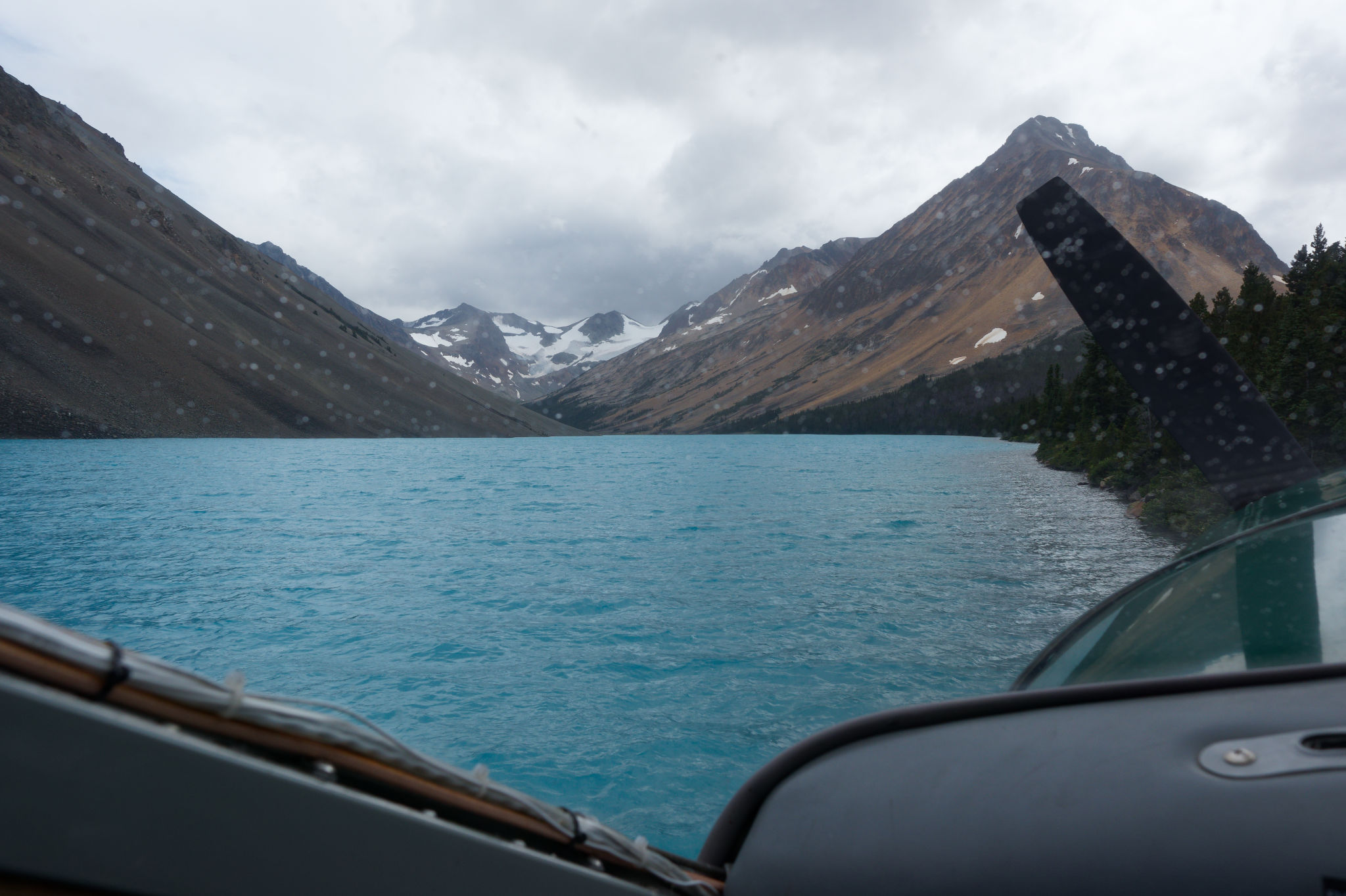
We flew along Gun Creek before turning northwards over patches of grassland, undoubtedly near the Cowboy Camp where we were planning to camp on our sixth night. Passing Spruce Lake we turned west to follow Tyaughton Creek. Here we could see many familiar peaks from last year’s trip including Fortress Ridge, Castle Peak, and Mount Cunningham. Sheba Ridge was now on our left but – alas – both Maria and I were on the wrong side of the plane to get a good look, and caught only fleeting glimpses of its sheer north-facing slopes. Soon we flew through Elbow Pass. the ruddy rocks glowing in the afternoon sun, and banked left to follow the Big Creek valley south towards Lorna Lake. Now I understood why Big Creek was given its name – the valley was broad and it was amazing how quickly the mountains yielded to the gentler plateau to the north. We’d seen that transition last year and surprised me again to realize we were at the very northern limit of these mountains.
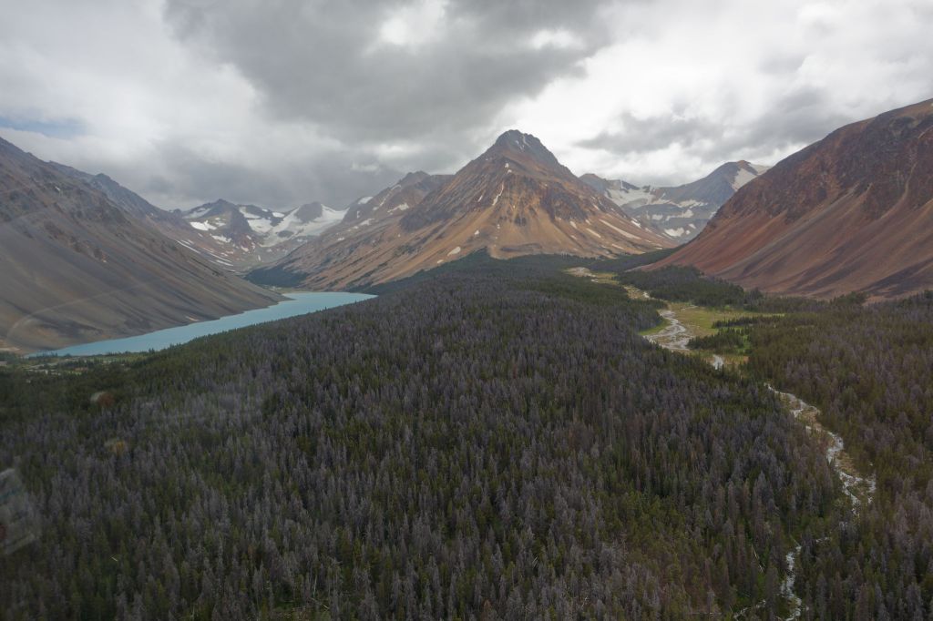
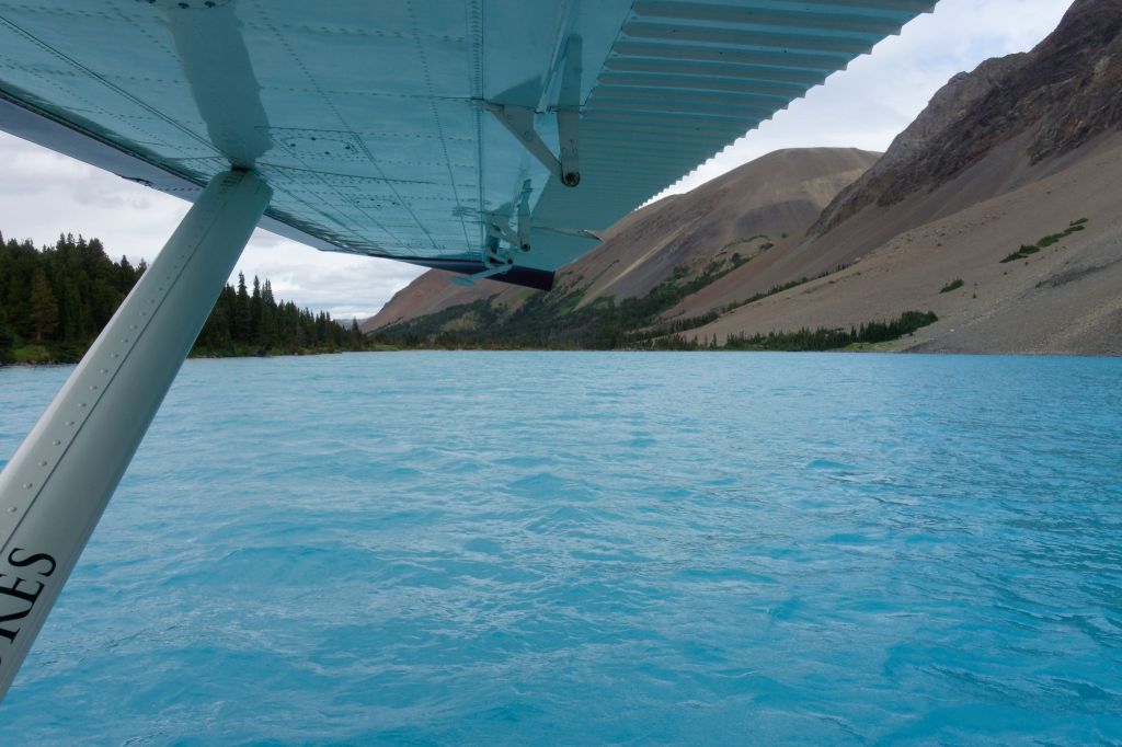
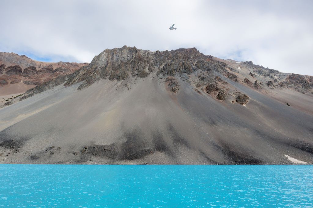
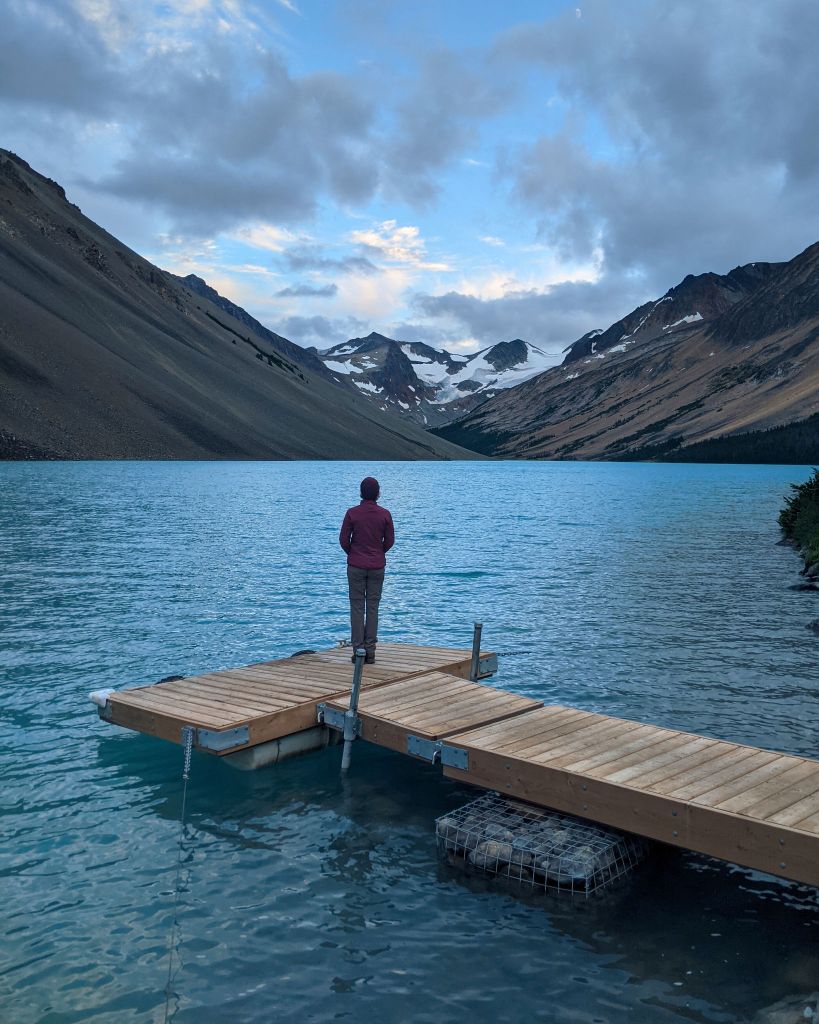
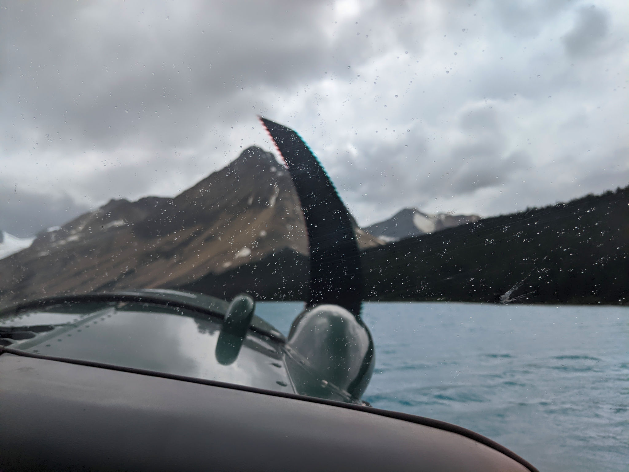
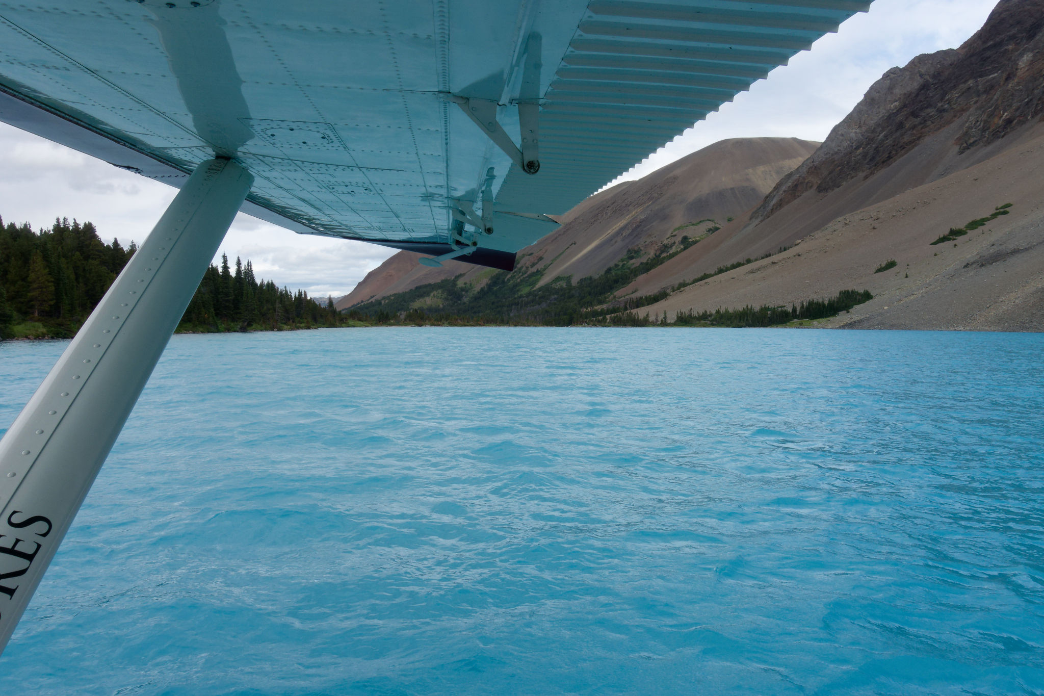
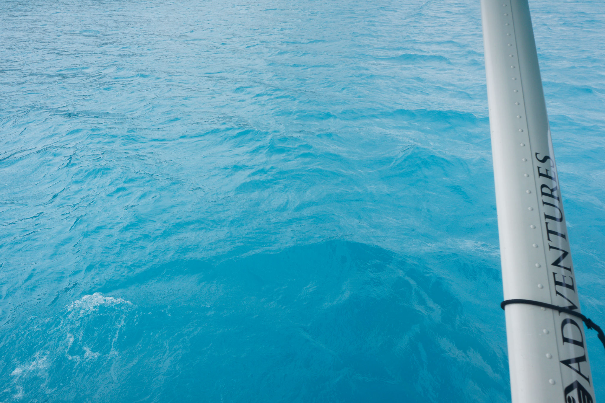
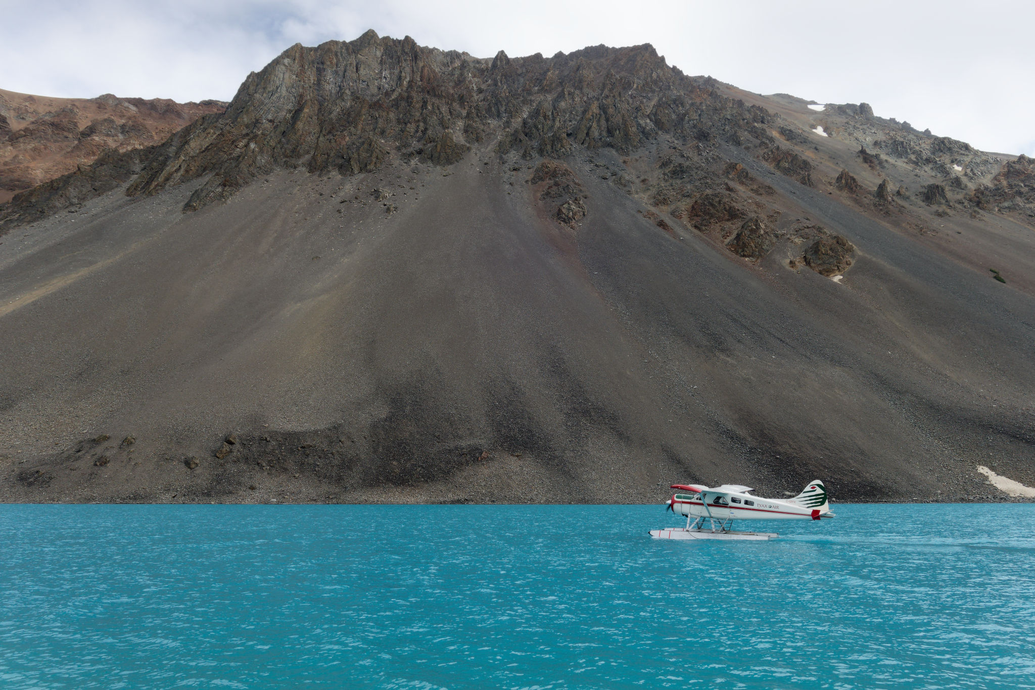
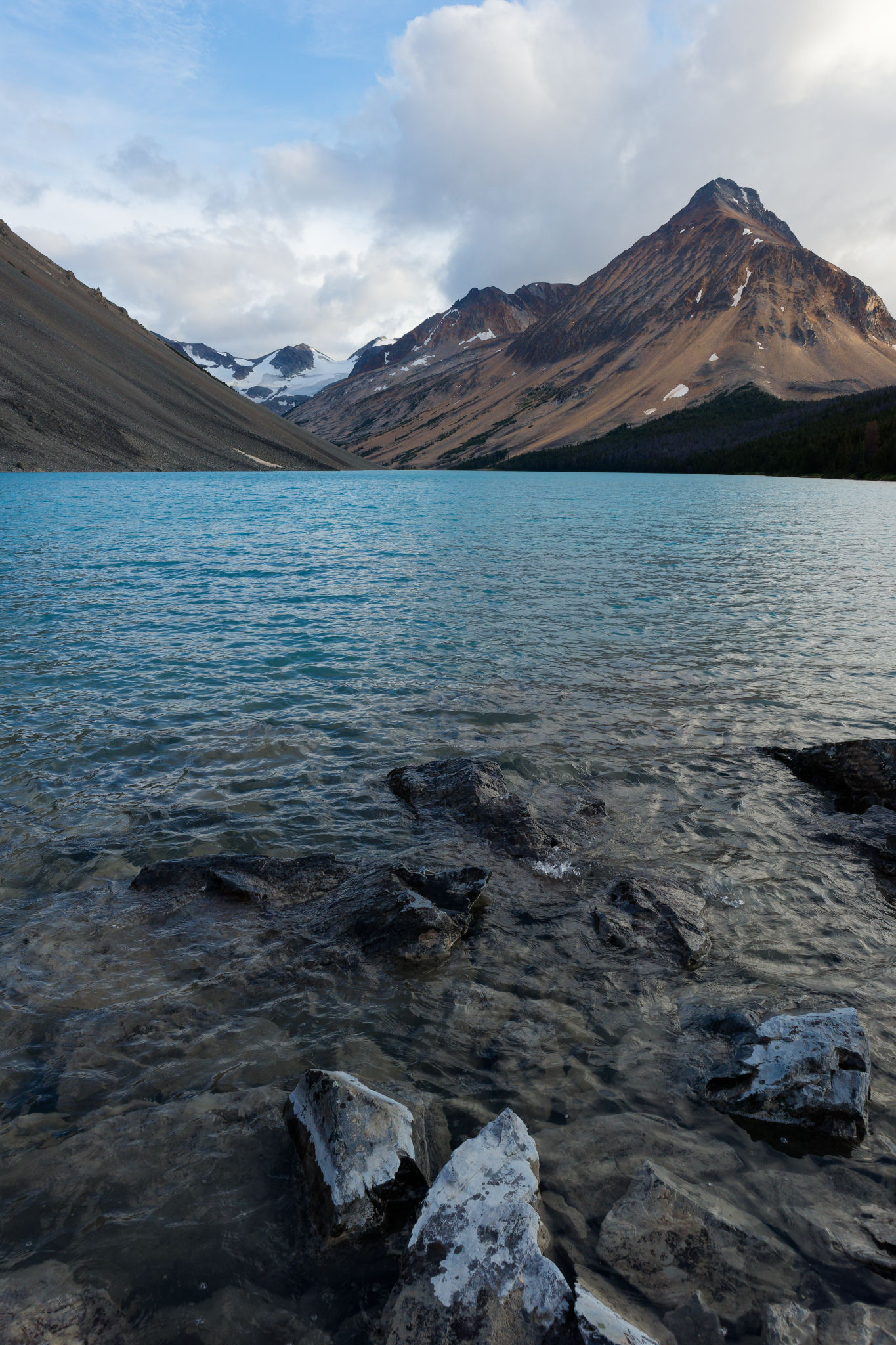
Suddenly there it was ahead of us: Lorna Lake, glowing an icy blue and nestled between two high ridges. The plane descended along the creek, the ground beginning to rush past before we were over the water where the intensity of its colour became all the more apparent. Looking out of the window, it felt like I was gazing into a blue void, it was impossible to judge distance or depth. The floats touched down, kicking up some white spray that brought me out of my defocused trance. The pilot quipped that this was where blue Gatorade came from and in that moment I could believe it.
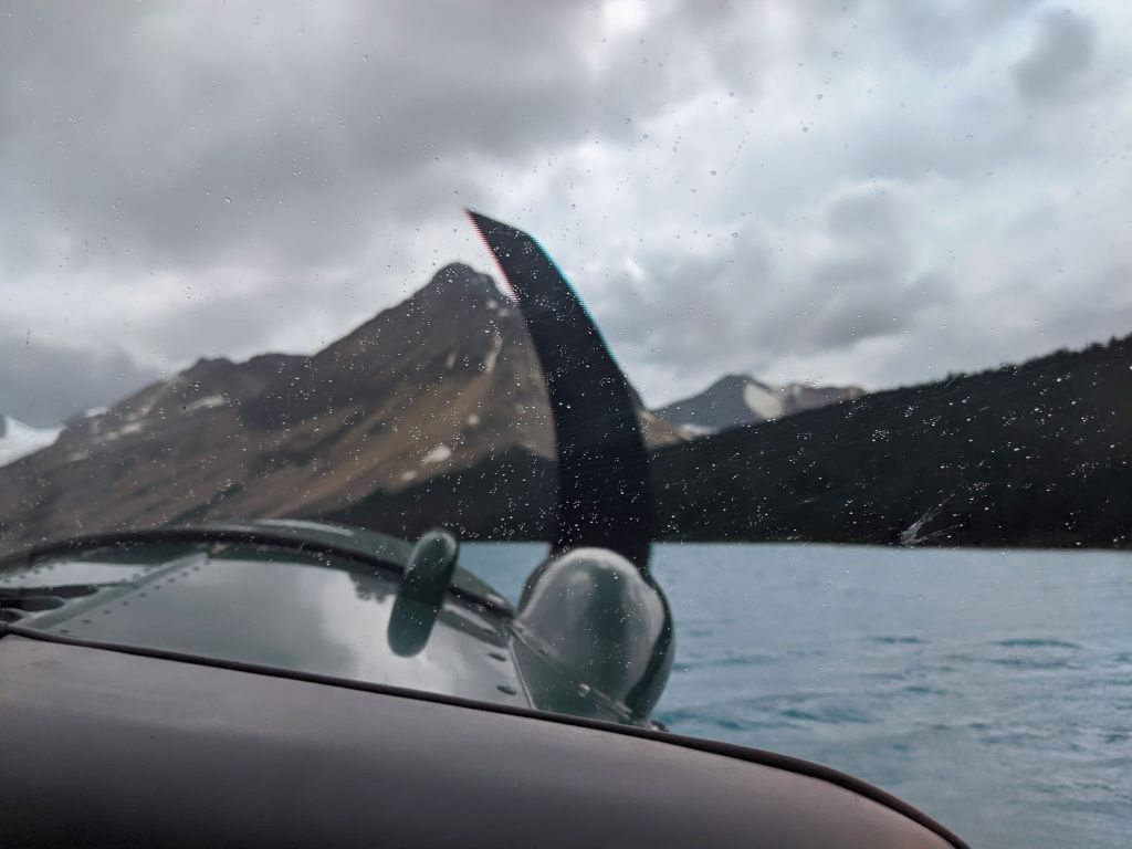


The landing was as smooth – if not smoother – than the take off. The pilot cut the engine and we drifted to the small dock at the lake shore where he stepped out over the floats and picked up a rope to tie the plane to the cleats, allowing us to climb out safely. A few raindrops had dotted the windshield of the aircraft as we descended and I wondered if it was just spray, but as we disembarked, I felt the lightest of rain cooling my arms and legs.
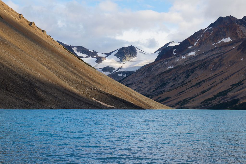
Speaking of cool, stepping out of the plane was a bit of a shock: the air was cold! In my mind I was expecting it to feel warm and summery, but no – we were quickly reminded of the fact we were now high in the mountains. Checking later I realized we were at nearly 2000 m, so no wonder it felt chilly! The stiff southerly breeze didn’t help, blowing over the glacier at the head of the valley and along the glacial lake. But we were here at this remote, magical spot, so far removed from the city where we’d started the day.
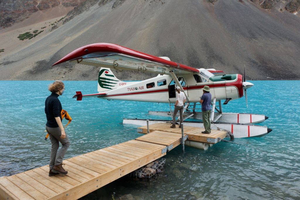


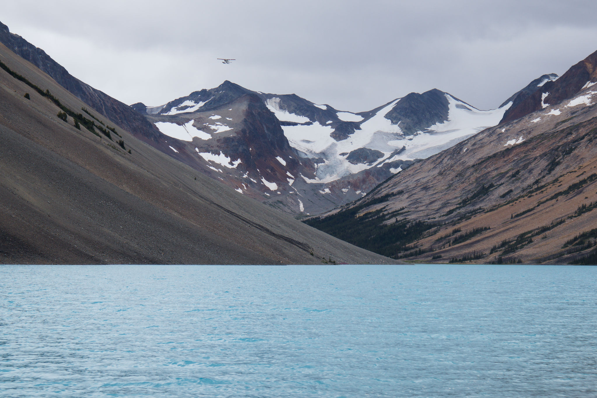
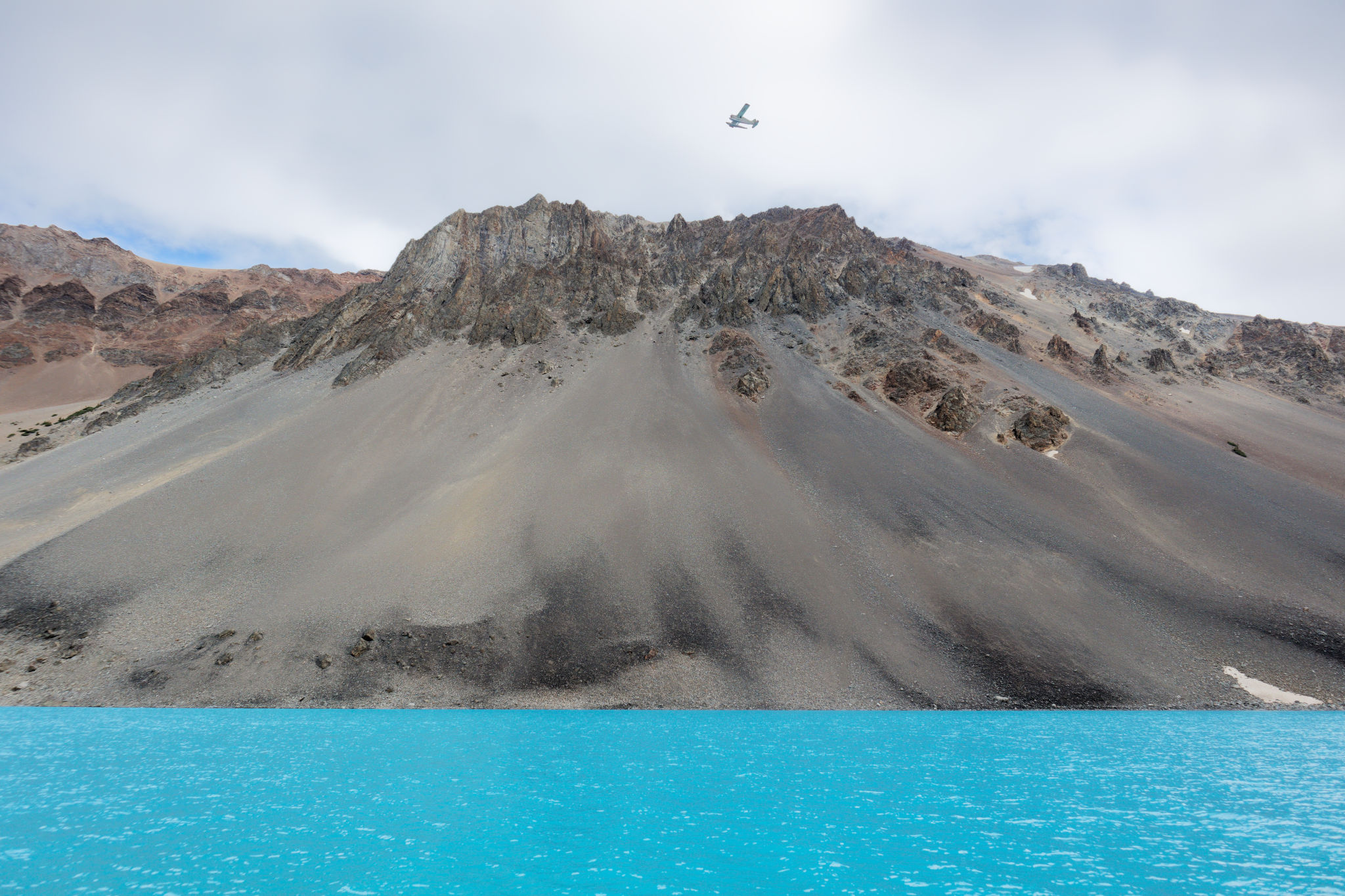
With all our gear unloaded, we stood and watched our transport depart and I felt that same sensation that I’d had at the start of the Nootka Trail: this was it, we had no choice but to walk back. That time was only 37 km; this time we had at least twice that. As the sound of the plane receded into silence we spent a few moments taking in where we were before picking up our backpacks and walking up the slope towards the campground, spurred on by the appearance of a few hungry mosquitoes.
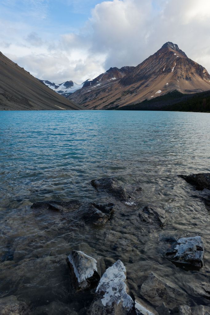
I was pleasantly surprised to find that the campground had numerous well-defined flat areas for pitching tents. Alas they were all spoken for as a group of four was already there, having been dropped off a day or two earlier. We stopped to chat with them before walking a bit further to find our own spots among the trees. While far from perfect, and too close to the trail really, they would at least minimize damage to the surrounding flowers. With our tents set up, we took our food bags to the north end of the lake where we found the Instagram camping spots (which was also the cover photo for our map), a pair of open sandy patches right on the lake shore. No doubt they were picturesque spots but with the strong, cold wind we were more than happy to be camped in the shelter of the trees.
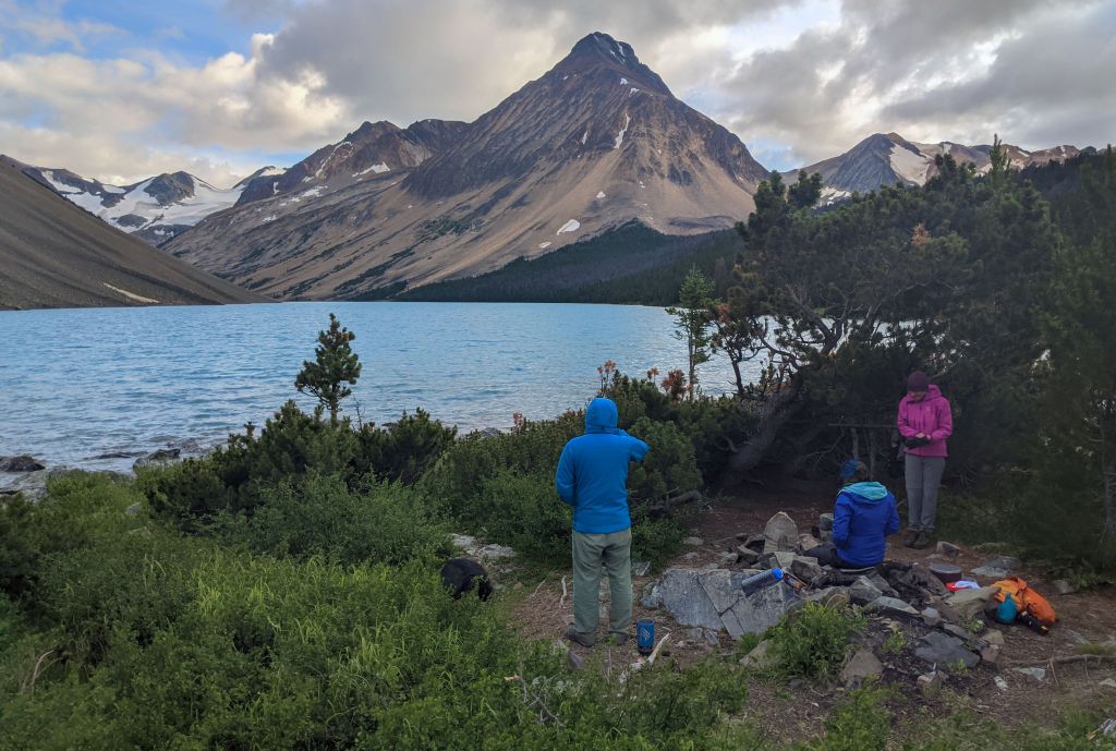
We wiled away the rest of the afternoon chatting about the trip, poring over the map, and absorbing our surroundings. The cold wind soon had us seeking shelter behind a small patch of pines and we quickly decided we needed hot food and drinks: by this point I was actually starting to shiver. We watched the evening descend, the lowering sun lighting up the colourful slopes and the glacier at the head of the valley. The first-quarter moon rose over the ridge to the east, and the wind died down, which, of course, was the cue for the mosquitoes to reappear. We lasted until just after 8 pm before the chill and the bugs forced us back to our tents. We stowed our food in the cache and chatted with the other four hikers for a while before taking one last look at the lake and finally crawling inside to the warmth and comfort of the tent.
It was so, so peaceful. After we’d done fidgeting and zipping ourselves into our sleeping bags we just lay there and listened to the quiet, punctuated only by the wind in the tree tops. The song of a distant hermit thrush caught my ear from time to time and it instantly transported me back to last year’s trip, listening to a handful of those birds singing their delightful song around us. As I lay there trying to catch my breath, I found myself reflecting on the altitude and how I was caught out by the fact we had travelled from sea level to just below 2000 m over the day without any acclimatizing in between. I knew I would get used to it soon, but it still took me by surprise.
But now there was nothing for us to do but rest after a long day. To sleep!


I thoroughly enjoyed reading this post, as I’ve done multiple trips in the South Chilcotins and this sentence really it hit my memories and heart: “It was so, so peaceful.” Gosh I love love love this area, Big Creek PP really stole my heart, and when I think of BC this is one area that is so quintessentially BC to me. Thanks for taking me back for a few minutes. Blue Gatorade indeed! 🙂
Thank you Chloe! We’ve also fallen in love with this area – Lorna Lake is just so stunning – and can’t wait to return! Alas it won’t be possible this year… Anyhow, there’s more to come over the next few weeks as I finish writing up this trip 🙂 And then there’s our 2022 trip to start, which was pretty much entirely within Big Creek PP!
Hard if not impossible to fall in love with the area, besides the chaotic weather at times! I look forward to the rest of this series and 2022’s trip! Good on ya for documenting past trips, something I’m terrible at, it’s always a “winter” project that never happens. I agree, this year with the burns I’m not sure if we will do a trip in the area, but I itch very much to get back to the Dil-Dil plateau and Vic Lake.
The plateau and Vic Lake were on our radar for our 2022 trip, though we changed plans along the way, but it’s an area we’d love to visit. Plus I’m intrigued by the idea of summiting a 3000-m peak!