
Opinion
A very nice little hike, especially at this time of year when it’s quiet. A pretty lake, interesting geology, gorgeous open, mossy forest, and a couple of great viewpoints make this a little gem of a trip, especially as it only needs a couple of hours.
Fact
The trailhead is easily accessible by low-clearance two-wheel-drive vehicles. The road has only one steep and ridiculously bumpy section but it’s not difficult. Getting to the trailhead means turning off onto the Cheakamus Lake road and then turning right almost immediately to cross the river on a one-lane bridge. Follow this gravel road for a couple of km (2.3 km) to reach the small parking for Logger’s Lake.
Many of the trails in this area are shared by mountain bikers, but it’s not clear if they’re allowed on the Crater Rim trail itself.
The trail is easy to find and follow but beware of side-trails. It was a bit slippery in places, especially on the descent. We encountered some flooding on the old logging road portion towards the end that would get your feet wet if you were in runners.
Lots of fungi out and some nice fall colour here and there.
Distance: 4.5 km
Elevation gain: 280 m (total)
Story
We knew we had to get out in the fine weather today after last weekend’s deluge and high winds, coupled with tomorrow’s rainy forecast. I’m not sure what our original timeline was supposed to be but it’s safe to say that it quickly became history as we lounged around at home for the morning! I knew the hike was short and wouldn’t require much time, plus I knew how long it would take to get there having driven up to Function Junction a couple of weeks back. I figured that as long as we left around mid-day then we’d be fine. Sure enough, at 12:20 pm we were pulling out of our apartment building.
Traffic through the city was slow (as to be expected) but we were soon clear and on the highway. We contacted Jen to see if she was interested in getting out for a couple of hours and she was more than happy to do that, so we picked her up in Britannia Beach (after grabbing a drink from Galileo – finally!) and motored on up the Sea-to-Sky highway.
We turned off at Cheakamus Crossing/Function Junction and after a minor false start (the satellite imagery is still way out of date compared with the actual road layout) we soon found ourselves on the right road. It didn’t take us long to get to the trailhead, although I couldn’t remember how obvious it was and we stopped long enough for me to check the GPS.
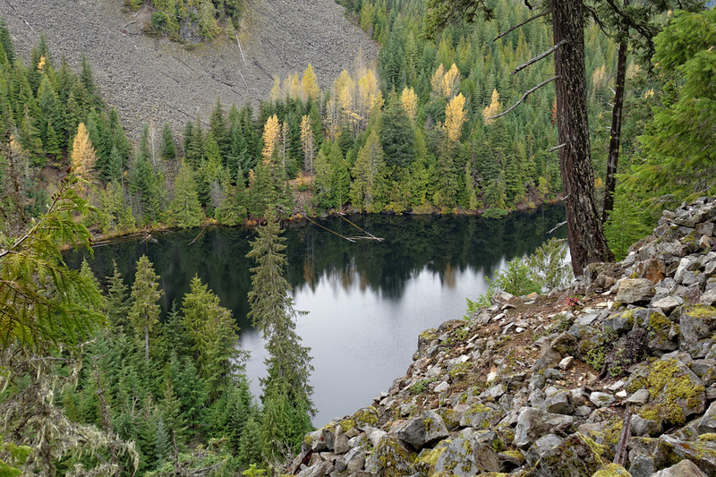
At the decidedly late time of 3:30 pm, we were under way! We crossed the road and plodded up the gravelly old road, passing under some impressive end-on columnar basalts. I attempted a photograph or two but they didn’t turn out. It wasn’t long before we reached the turnoff by Logger’s Lake and we left the old road to duck into some lovely Douglas fir forest.
The trail began to climb up away from the lake and onto the rim that gives this hike its name. More striking columnar basalts, this time tilted over at about 45 degrees defined the lake-side slope. They weren’t easy to photograph but I had to try. The trick was to get clear of the trees without slipping down onto the boulder field below!

We continued upwards, and I – of course – stopped here and there to get fungi photographs. Thanks to the slope being in my favour it was much easier to lean in with the camera. The forest here was lovely and a delight to walk through – unlogged thanks to its inaccessible location with a wonderful carpet of moss. As the trail levelled off the view opened up to our left (north) and we could see across and up the Cheakamus River valley. The boundary between old- and second-growth forest was so easy to see. This valley is a mix of demonstration/study patches that I guess is set up to see what makes trees grow back fastest to enable a second round of logging. Sorry – harvesting.
The trail carried on around the rim, turning to the west as we gained more elevation. This was my favourite section of the trail. It was even better than the earlier section with mosses completely covering the forest floor. The trees weren’t large, but they were decorated in lichens and so nicely spaced that the forest felt welcoming and light.
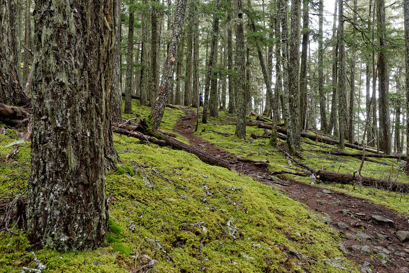
We continued to gain elevation, albeit gently. The greens were pleasing and relaxing to our eyes, and a variety of moss-covered rocks and fungi distracted us from the perpetual climb. It’s funny how when out on on easy hike, even a gently uphill feels like a lot of effort. If I’m on a hike where I expect to spend a lot of time gaining elevation, then I seem to get into the right mindset and plug away. But on a gentler amble it feels like too much effort! Purely psychological!
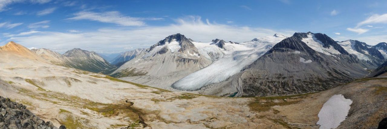
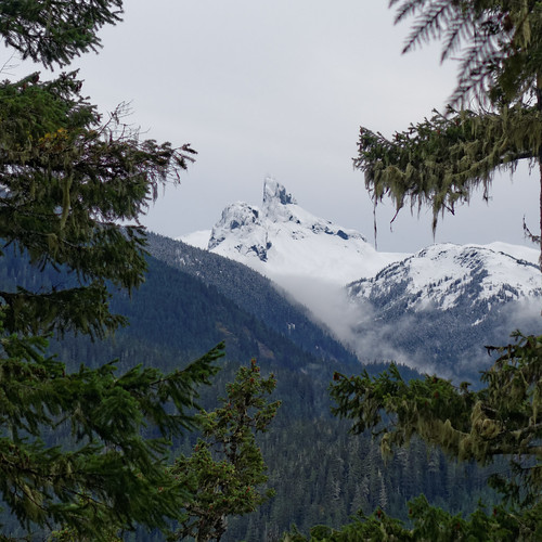
Eventually the uphill gave way to a section of flat and almost immediately started to go downhill. An opening on our left gave us a perfect picture-window view of Black Tusk, freshly bedecked in its winter coat of snow. We paused here for a breather and to top up on water. And to admire the view of course!
Our descent continued and we soon came to another viewpoint, this time looking west over to the Brandywine area. Like its volcanic sibling that we’d been admiring a few minutes earlier, Mt Fee was also beautifully coated in fresh snow. The cottonwood trees in the valley glowed gold, marking the watercourses and wetter areas in the valley. One group of trees looked like a reversed question mark, or perhaps a number 9, or even a “G” if written a certain way.
Down and down we went, losing elevation so much quicker than we had gained it, occasionally slipping on the dirt or wet rocks. We wondered whether it would have been better to do the hike in reverse to get the elevation gain out of the way – something to consider next time. I looked at the GPS track when we got home and we didn’t imagine it: this hike has a very asymmetric elevation profile, and we lost much of the elevation in half the distance it took to gain it.
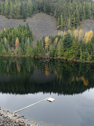
The trail levelled off as we crossed a boulder field inhabited by at least one pika, but then began to climb again for a few hundred metres. Like I said earlier, it felt like unnecessary work! But we soon resumed our descent, following the old logging road. At least here we could walk along together. We splashed our way through a couple of flooded section where water was spilling over the road and soon reached a junction back at the lake. We turned left to skirt the north end of Logger’s Lake – where we stopped briefly to admire the reflections in the perfectly still lake.

We reconnected with our initial path and, in the dimming light, walked the last few hundred metres back to the car. We’d taken about two hours to complete the circuit, two hours very well spent which confirmed our initial reaction from when we first hiked this trail back in 2011. It’s is a great little hike to take in if you’re in Whistler, one we’ll surely continue to repeat.
